Historic Flash Flooding at Havasupai Falls
Havasu Creek’s famous blue, spring-fed water turns brown several times a year from storms or snowmelt. Once a decade, a monsoon storm hits the plateau southwest of the Grand Canyon, triggering a major flash flood.
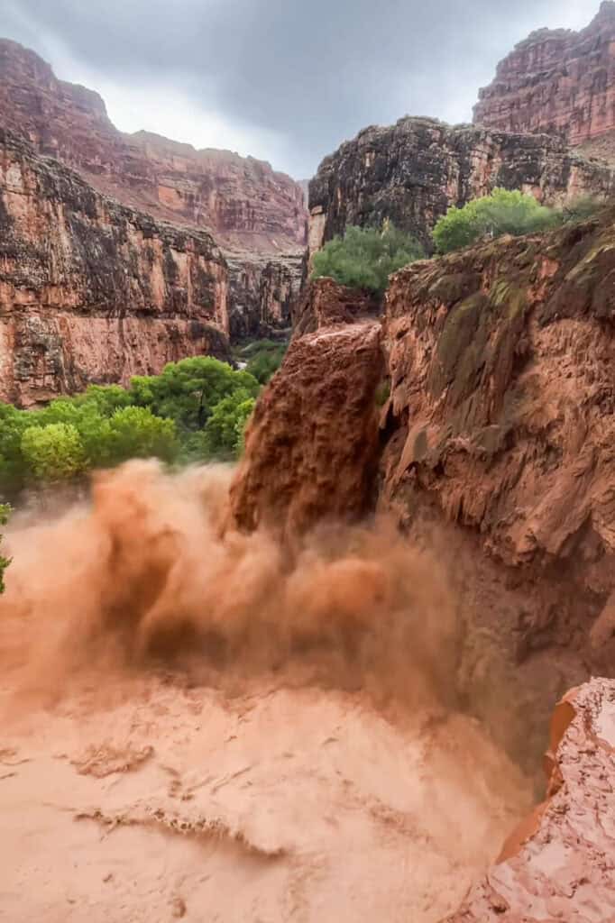
The August 2024 flood at Havasupai Falls will go down as one of the most severe in recent memory.
Headlines from the Flash Flood
- A storm hit midday, August 22, 2024.
- The National Weather Service posted warnings, but there’s no real way to warn people hiking and camping in such a remote location.
- One woman died, after flash flooding swept her down Havasu Creek into the Colorado River.
- More than 100 hikers had to be flown out.
- Arizona’s governor activated the Arizona National Guard to assist with rescues.
- Flash flooding damaged homes and utilities in Supai, plus the campground.
- The trail in the canyon between the hilltop and Supai became impassable for hikers or mules.
- Havasupai Falls closed to tourists for more than a month.
- Havasupai reopened to visitors in October, 2024.
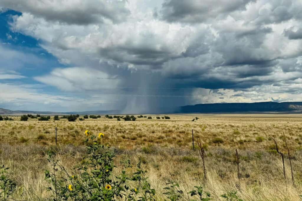
A Monsoon Storm Triggered the Flood
A lot of people picture Arizona as an arid desert, but the region sees an annual shift in the jetstream, which brings monsoon storms up from the south. They can be intense, and trigger floods in all parts of the state between June and September.
The National Weather Service reports: heavy rain fell on August 22nd, 2024, on the plateau above the canyon, triggering the flooding.
Rainfall Totals
The National Weather Service reported these rainfall totals for a 90 minute period:
- Village of Supai: 1-2 inches
- Cataract Canyon: 2-3 inches
The National Weather Service in Flagstaff says rain was falling at three inches per hour at the peak of the storm elsewhere on the plateau which empties into the canyons and Havasu Creek.
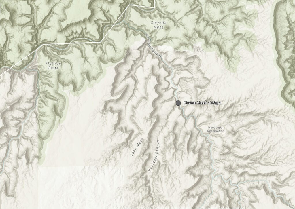
This map from the USGS shows the series of canyons that come down to Supai, eventually flowing north into the Colorador River.
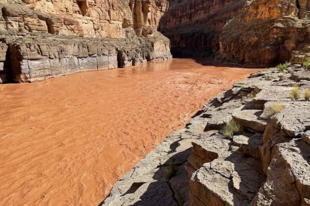
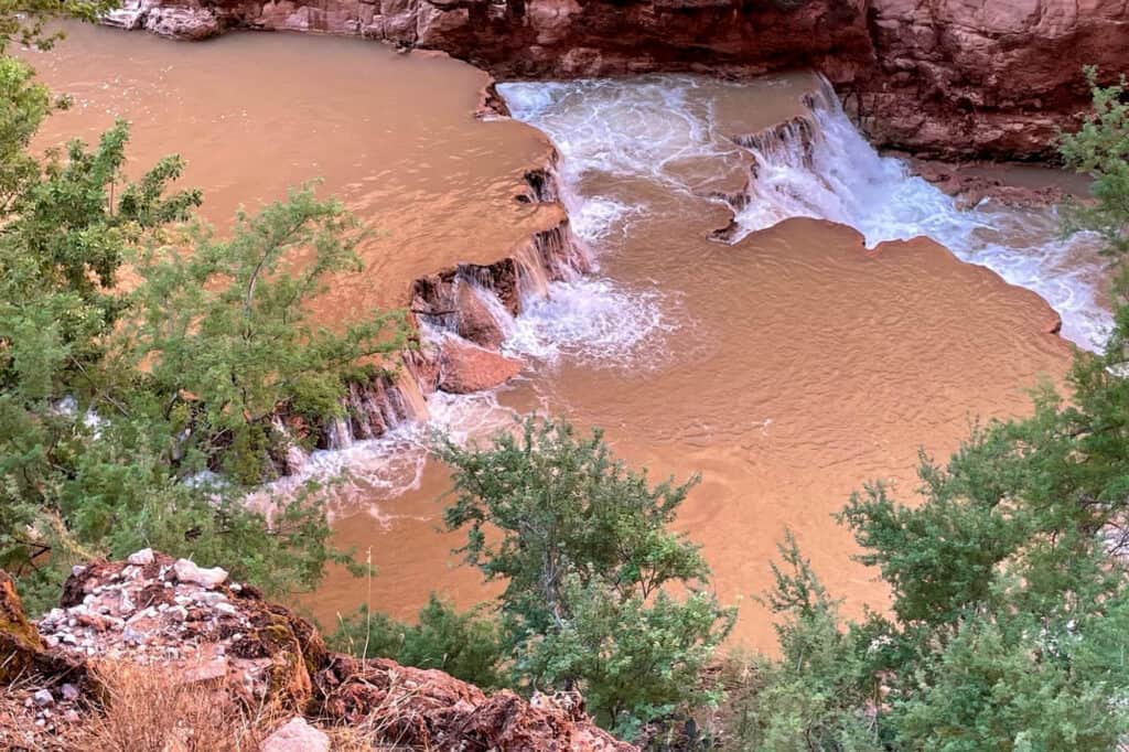
Flooding in Havasu Creek
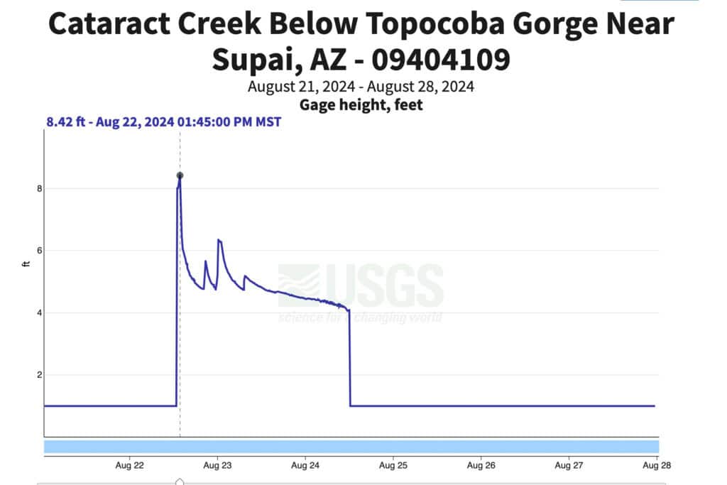
The floodwaters knocked out the water level gauges at two locations in Havasu Creek, so we may never know exactly how high the water got during the flood.
Flood Gauge Readings
This photo of gauge readings shows a blank for the period of time when waters rose.
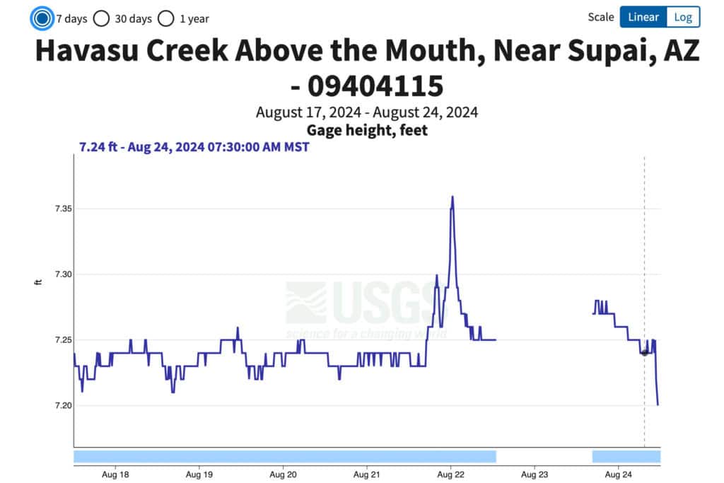
Upstream, the gauge tells a dramatic story. The gauge at Cataract Creek shows a wall of water grew to 7 feet high, in a matter of minutes.
The graph below, from the USGS, shows water levels rose from one foot at 12:45pm to 8 feet by 1:00pm. It diminished, but the creek remained above flood levels for another full day. In narrow parts of the canyon, the water was likely even deeper.
Havasu Creek drains a massive part of Northern Arizona, including a 3,000-square-foot plateau which stretches from Williams, AZ, up to the Grand Canyon.
The National Weather Service says a few of the canyons collected water from the storm, sending all of it down toward Havasu Creek, which is normally beautifully blue and spring-fed.
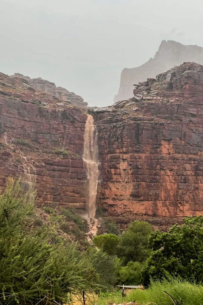
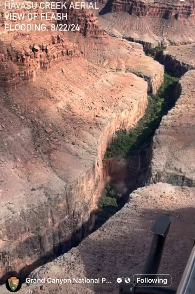
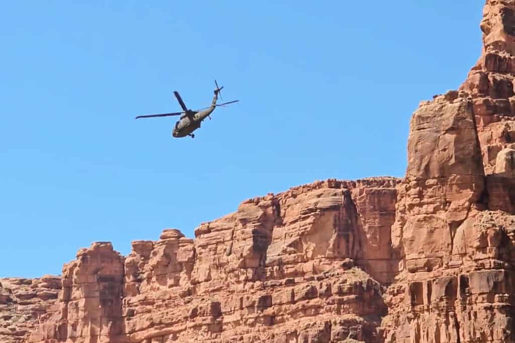
An aerial view from a National Park Service helicopter shows the flood continuing after the sun came back out over the canyon.
A Hiker from Gilbert, AZ, Lost Her Life
Chenoa Nickerson, a 33-year-old wife and mother from Gilbert, AZ, was hiking at Havasupai Falls with her husband. She was last seen August 23rd, around 1:30pm.
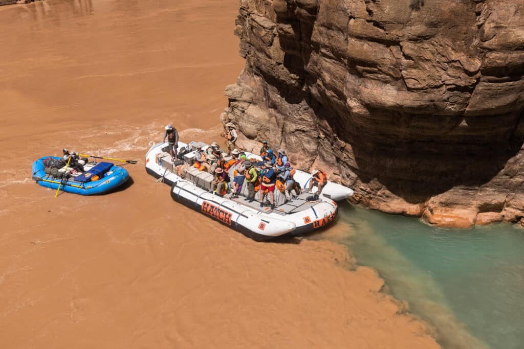
The search and rescue team with the National Park Service launched a massive effort to find her, including an online and social media campaign, in the hopes that a rafting group downstream might have picked her up.
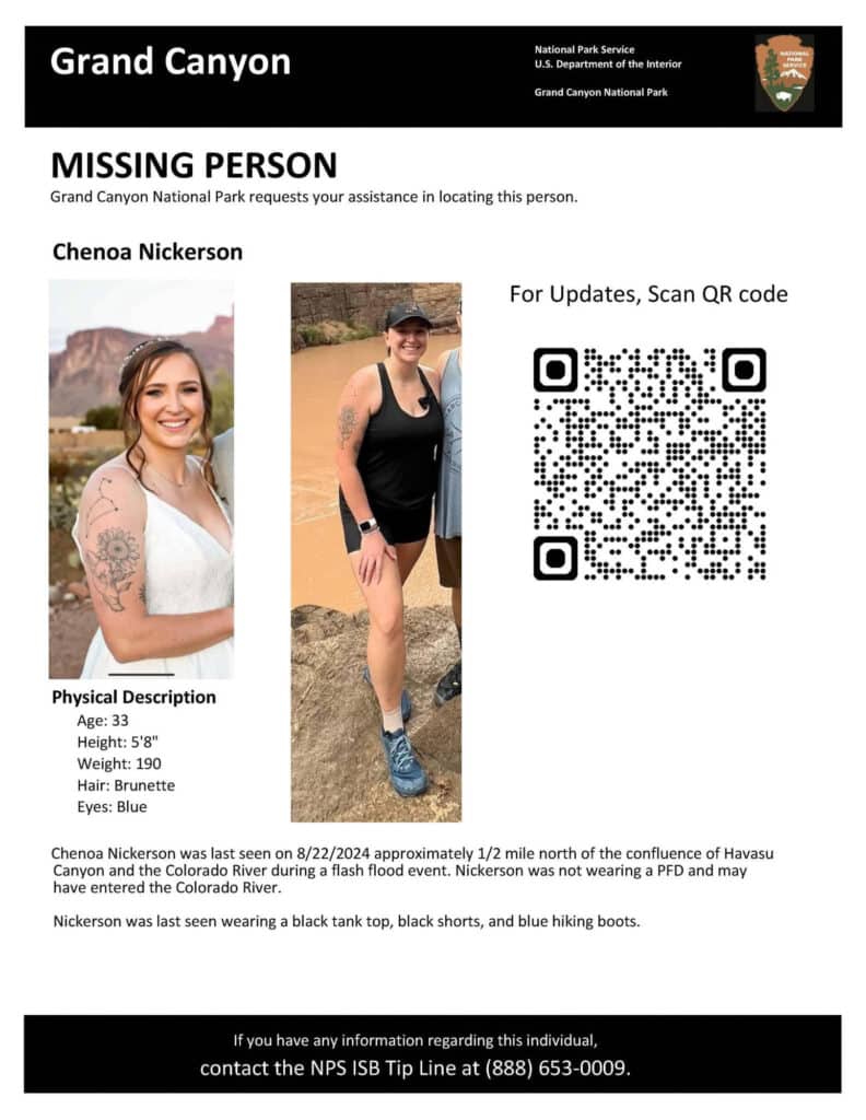
After a 3-day search, her body was discovered by a commercial rafting group in the Colorado River.
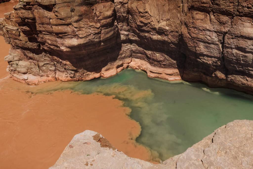
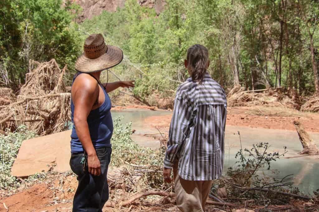
Chenoa and her husband were hiking near the confluence, a popular spot which requires an extra 10-mile hike (each way) beyond the Havasupai Campground. The normally blue water in Havasu Creek meets the dark, muddy water of the Colorado River.
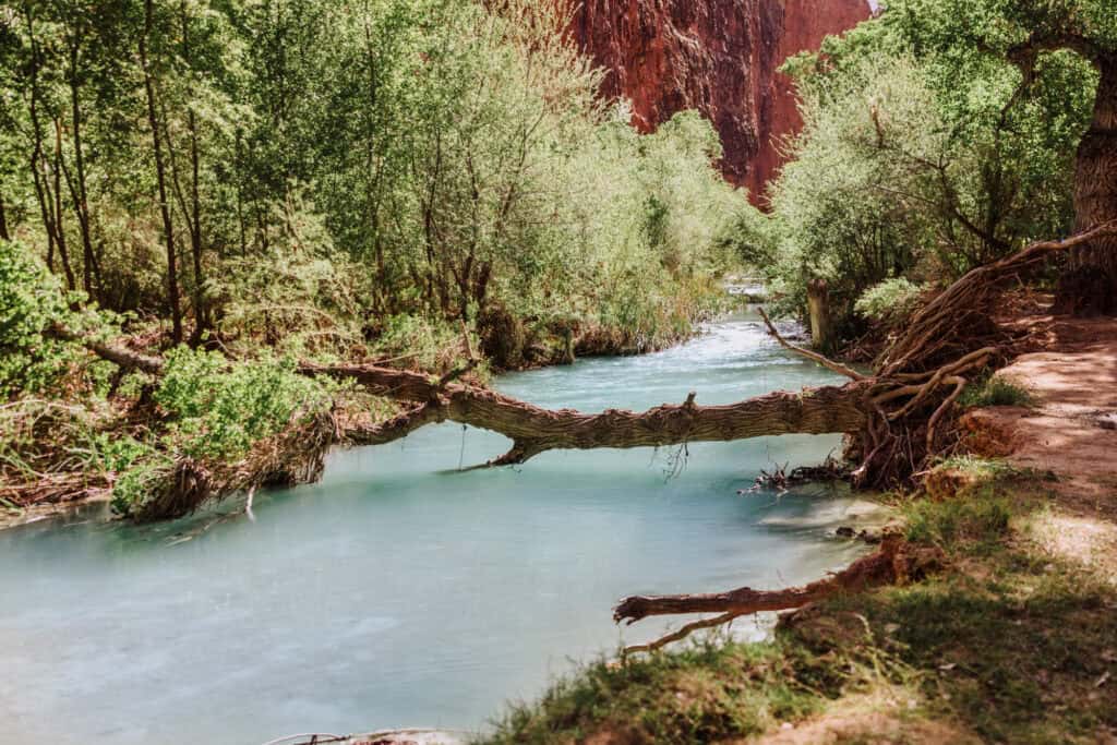
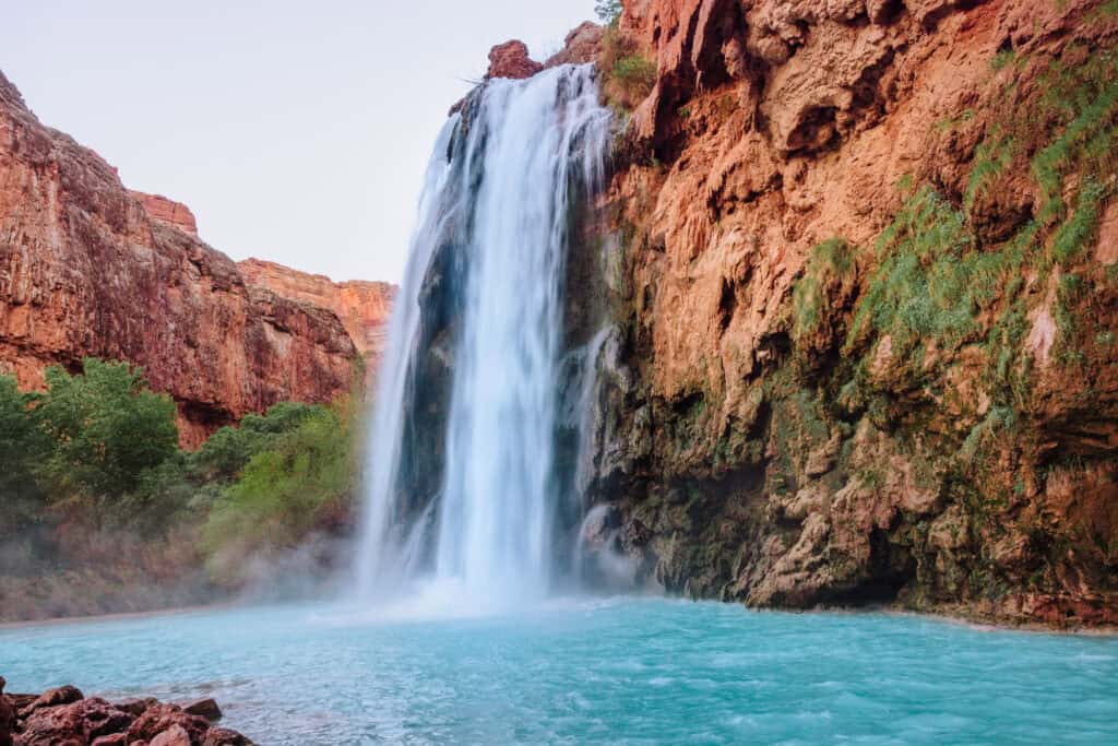
This is what the confluence usually looks like:
Rafters, who often tie up their boats here for a break, helped save her husband’s life. He spent at least one agonizing night hunkered down with them, waiting to be rescued while his wife was still missing.
Chenoa’s family started a fundraiser for the search and rescue teams, who worked night and day to find her.
More on The Confluence
Chenoa was between 100 and 500 yards from the confluence, according to park officials. This is an area known for the normally bright blue water of Havasu Creek flowing through a very narrow canyon.
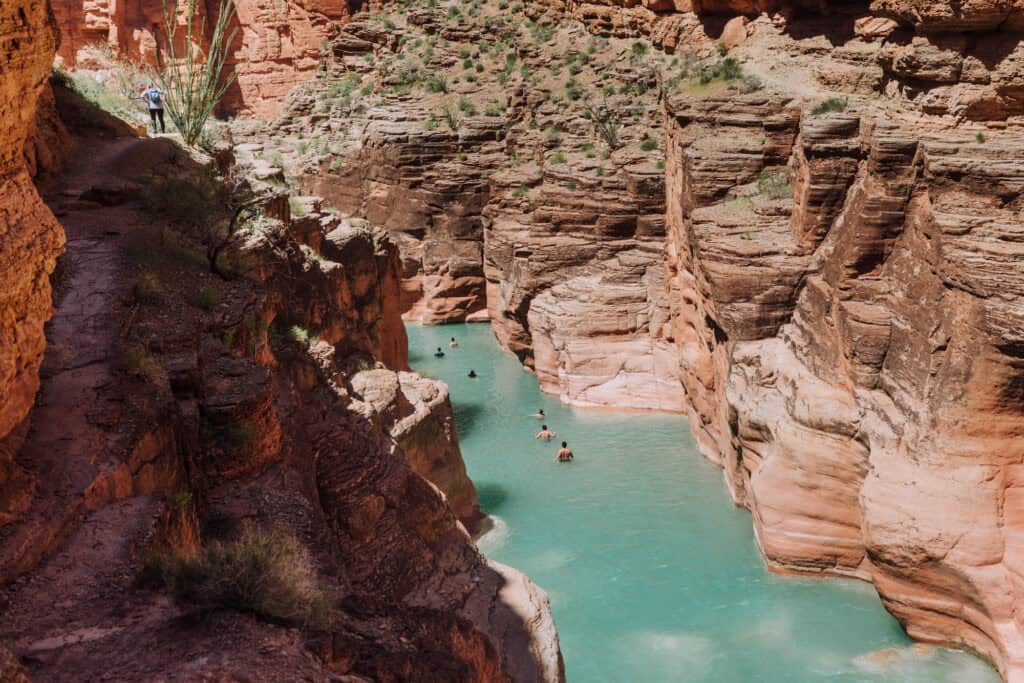
It’s a popular spot for swimming, but the water depth and currents change. Plus, you can see, the canyon walls are steep, without many opportunities to climb up.
At the spot where Havasu Creek meets the Colorado River, you’ll often see commercial tours tie up their rafts to take a break and explore the creek area.
The current can be very strong, even without a flood. On our last visit, we witnessed a 70-year-old man jump out of the raft to cool off in the water, only to find himself unable to get back in.
It took two of us about 20 minutes to climb down, get into the big raft, and figure out a way to lift him up out of the water and back into the raft. The currents here are always a factor, no matter the weather or the season.
Hikers Rescued
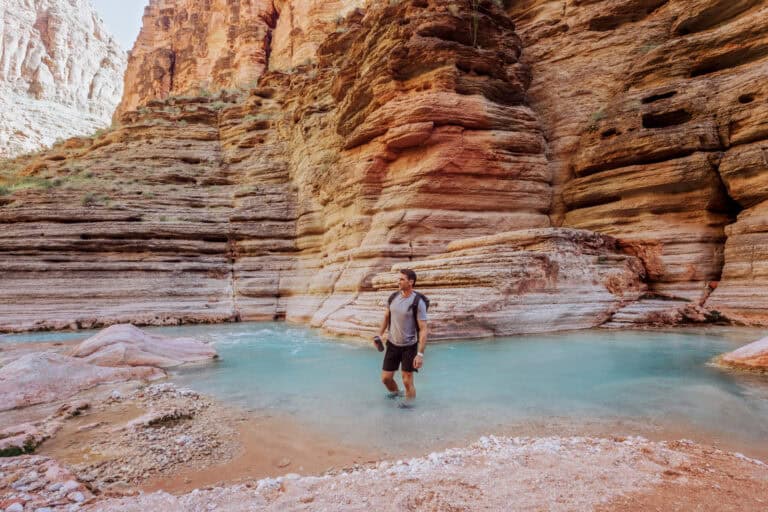
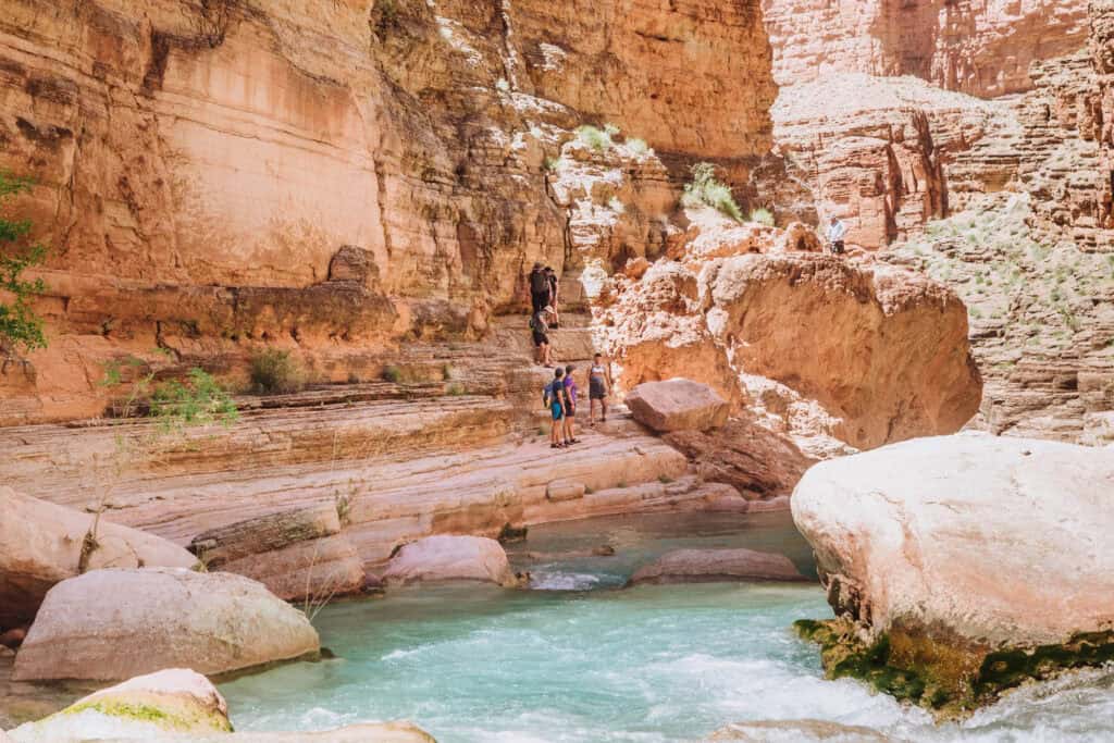
At Havasupai Falls, hikers span across a 12+ mile stretch of Havasu Creek, between the village of Supai and the Confluence with the Colorado River.
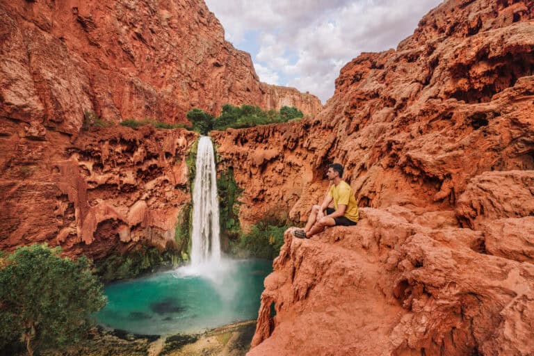
Havasu Falls, which is two miles beyond the village, marks the entrance to the campground. These photos show the difference between a normal day and a flash flood.
The Havasupai campground spreads out along a mile-long stretch of Havasu Creek, which ends at Mooney Falls.
To get to the bottom of Mooney Falls and continue on to Beaver Falls and the Confluence, you have to scale a verticle rock wall. There are stone steps and rickety ladders to help. It’s a part people either love or hate.
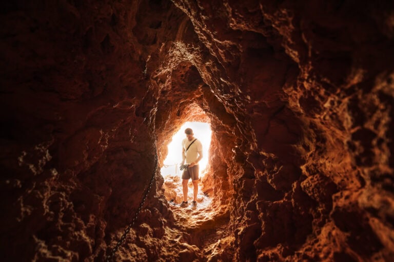
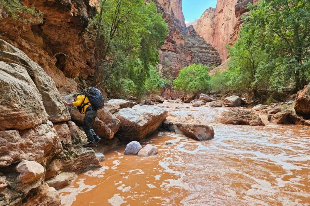
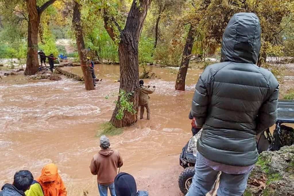
Regardless, during the storm and flood, a lot of hikers were stranded down below the ladder, on their hikes to Beaver Falls and the Confluence. Several others report taking cover on high ground as Havasu Creek rose quickly, or taking shelter in rock caves along the way.
Again, there was no way for them to know a flood was coming. They were likely hiking in the sunshine until it happened since the intense part of the storm first hit miles away.
Hiking down beyond Mooney Falls to Beaver Falls requires a series of creek crossings. The water was too treacherous to attempt those crossings on August 22nd.
Several used the SOS function on their cellphones, which sent their coordinates to dispatchers. A few hunkered down for the night in caves before venturing back at dawn.
Some people who were trapped below were able to hike out and up to the village after the waters receded around 5:00pm, five hours after the flood first hit.
People in the campground reported feeling like they were in a bowl that was filling quickly. They witnessed huge boulders flow through, and soft parts of the canyon walls fall into the water.
The National Guard Activated
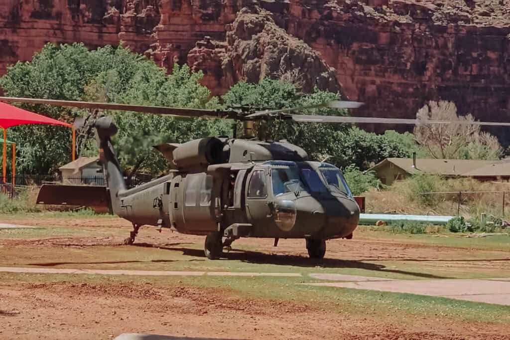
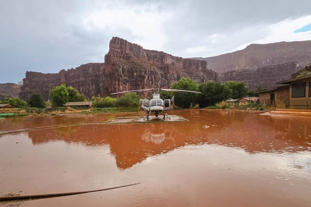
Arizona Governor Katie Hobbs activated the National Guard August 23rd, after it became clear that more people needed help evacuating.
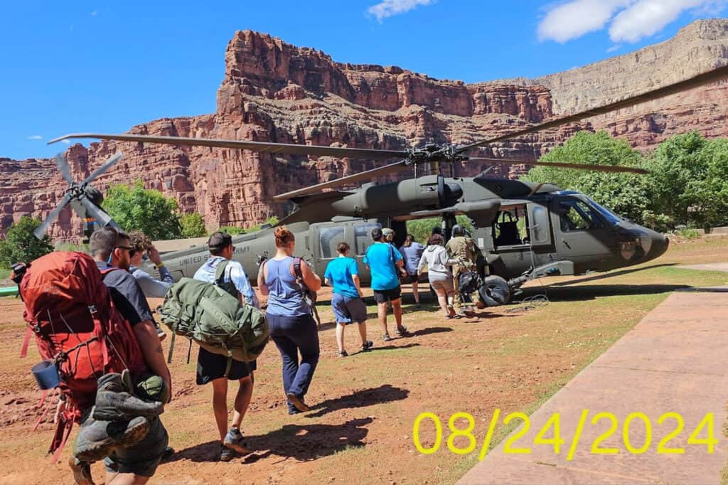
The Guard’s UH-60 Blackhawk helicopter flew rescue missions from Friday through Saturday afternoon, evacuating 104 hikers.
The helicopter also dropped off food and other supplies in the village. The governor later said it was the guard’s largest rescue mission in history.
The private helicopter company chartered by the Havasupai Tribe, AirWest, reportedly continued charging the normal $100 per passenger to fly out. Several witnesses say the chopper also continued its normal duties, even flying inmates out as evacuations were underway.
Damage in Supai
The village of Supai is home to fewer than 500 people these days, living in modest homes along dirt roads and trails. It’s a rural community, with a school, church, healthcare center, cafe, and market. It’s common to see horses and dogs strolling around town. There are no vehicles, other than ATVs.
Several reported “hearing the roar” of the floodwaters coming toward them.
People in town say the students were going to be released early due to the heavy rain and flood warning, but the floodwaters came too quickly. They stranded the kids for a while at the school property until the waters receded.
Several homes were damaged by floodwater, but people in town describe the damage as “not bad.”
The Bridges
The Havasupai Tribe has one relatively new bridge, and one brand new bridge which opened a few weeks before the flood.
While the bridges survived the flood, the creek created new paths around them at the height of the flooding, so they required repairs.
The Havasupai Campground
The campground, which is two miles beyond the village, was wiped out. Hikers describe it as a river. The floodwaters washed away tents, bags, rental car keys, and everything else.
There are a few remarkable stories of wallets being found downstream and reunited with their proper owners.
Hikers trapped below Mooney Falls, who ascended the day after the flood, describe the abandoned campground as “eerie,” with everything tangled in trees or washed away.
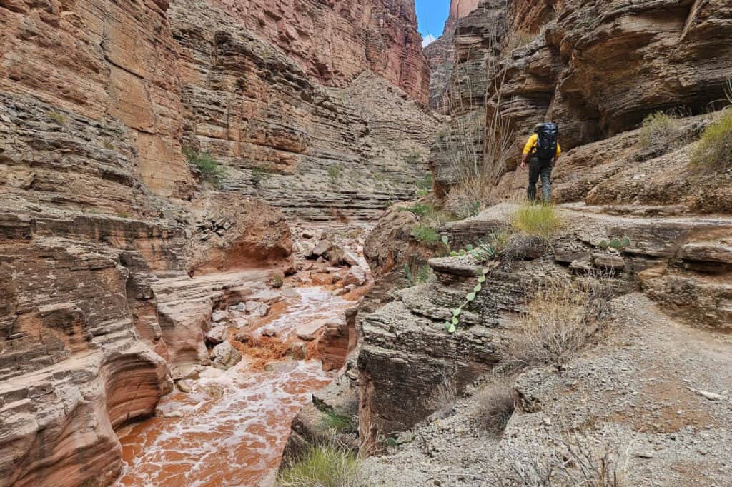
Damage Along the Trail
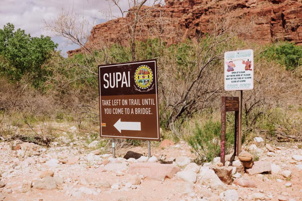
The intense floodwaters that moved through the canyon hikers and mules normally used to get to Supai moved boulders and wrecked an area known as “the ladder.” If you’ve been there, it’s the final stretch between the tall canyon walls and the first “Supai” sign you’ll get to before Havasu Creek.
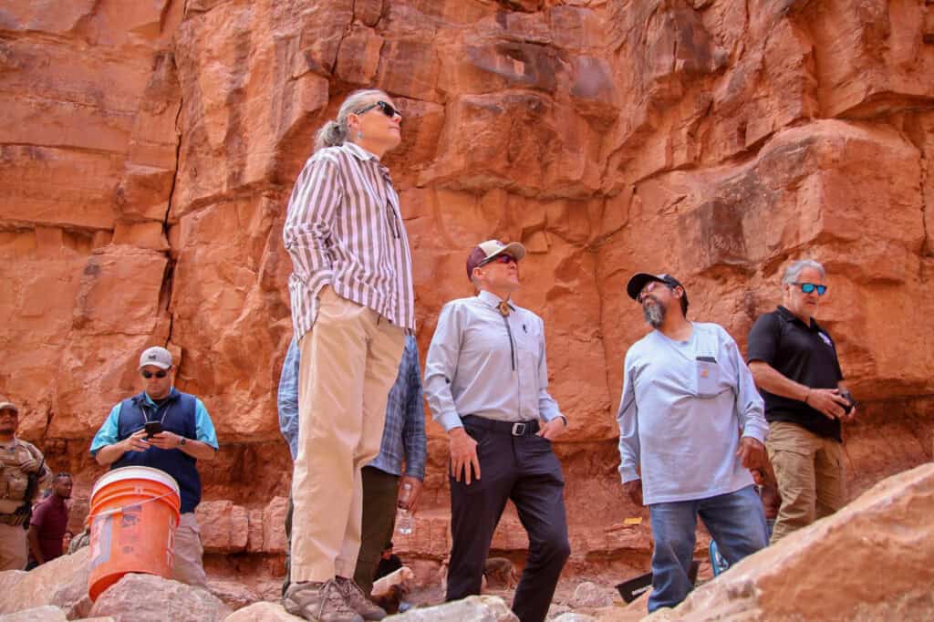
The governor’s office posted a photo of their visit to the damaged trail area, as repairs were underway at the end of August.
With the trail impassable, the mules stopped their deliveries. Mail service for people in the village ground to a halt for several days, before it was eventually flown in by the helicopter company chartered by the Tribe.
Havasupai Falls Closed to Tourists
Understandably, the Havasupai Tribe immediately canceled all upcoming visits. Initially, the closure lasted through the weekend, but as the extent of the damage became clear, the Tribe canceled all tourist visits through September.
After meeting with FEMA, along with Arizona State and Coconino County Emergency Management Services, the Havasupai Tribal Council closed the area to tourists. They put their focus on the health and safety of tribal members, and repairing the damage done.
On the governor’s visit, she promised ongoing state aid.
It seems the Havasupai Falls themselves withstood the floods, though they’ve all likely changed a bit. By the governor’s visit, the water in Havasu Creek had returned to its normal blue, but the creekside paths were gone.
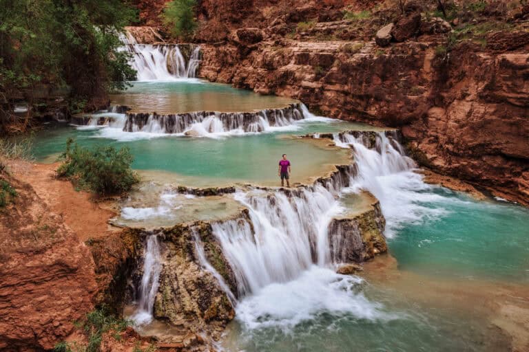
The mineral deposits which have built up over years to create the pools at Beaver Falls held.
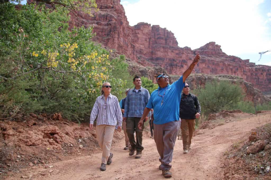
The Flash Flood Warning System at Havasupai Falls
Much of the Grand Canyon is remote, and without cell service. While the signal is improving in the village of Supai, there’s virtually no reliable service between the village and the Hualapai Hilltop, or between the village and the Colorado River.
So the Havasupai Tribe doesn’t have a strong warning system in place for flash floods. Instead, the Tribe basically relies on word of mouth to spread information on watches and warnings.
There’s a ranger cabin down at the Havasupai Campground, along Havasu Creek. The staff is equipped with walkie-talkies and can call for emergency assistance when needed. I’ve witnessed them in action in the middle of the night for smaller emergencies like trapped or sick hikers needing help.
There are also signs indicating “high ground” in the area, where hikers are told to gather during floods.
Still, part of the joy of visiting Havasupai Falls includes hiking down beyond the campground to Mooney Falls, Beaver Falls, and the Confluence with the Colorado River (about 10 extra miles). There is zero chance of a cell signal along the way.
Some hikers have reported limited success using the SOS features on their phones.
Some people opt to bring satellite phones, and I think following the 2024 flash flood, more people will explore that idea.
Other Historic Havasupai Floods
The monsoon season typically brings some flooding to Havasu Creek each year, turning the beautiful blue creek and waterfalls a chocolatey brown. Once every decade (or so) Havasupai is hit with a massive flood, which impacts the town and has changed the course of Havasu Creek.
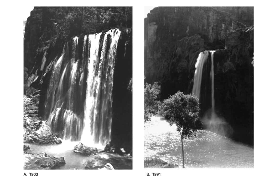
These photos from the National Park Service and a USGS report show how the creek has changed at Havasu Falls over time.
These are the highest floodwater crests recorded along Havasu Creek near Supai in recent history. You can see: most are in the summer months (monsoon season)::
- August 17, 2008: 23.40 feet
- July 31, 2006: 22.00 feet
- October 5, 2010: 20.92 feet
- August 10, 1997: 20.80 feet
- July 16, 2004: 20.28 feet
- February 13, 2005: 19.77 feet
- August 27, 2000: 19.54 feet
- September 8, 2002: 19.46 feet
- July 14, 2001: 18.95 feet
- August 20, 1999: 18.61 feet
- July 19, 2010: 18.30 feet
In August 2008, a significant flood hit the Havasupai Falls area, causing extensive damage to the landscape and infrastructure. It wiped out much of the campground, forcing evacuations and a lengthy closure.
When Havasu Creek floods, it can take a day or several days for the water to clear up.
Are Changes Coming to Havasupai Falls?
While the 2024 flood gained more attention, largely because of social media, these flash floods have been happening for generations at Havasupai Falls.
Again, the National Weather Service in Flagstaff issued multiple warnings, but because of the remote location, there isn’t an easy way to convey those warnings to campers and hikers.
The Havasupai Tribe relies on word of mouth among tribe members and tourists when a warning comes down.
Some have suggested closing to visitors during the summer monsoon season, but that won’t happen. The Havasupai Tribe relies on tourism as a primary source of revenue.
It’s possible a satellite phone and siren system might be setup at the small ranger cabin at the start of the campground. In an emergency, a siren may give people in the campground a heads-up, but many visitors will be out of reach while exploring other parts of the canyon.