Visit Tonto Natural Bridge: The Hikes, Waterfalls, and Viewpoints

Tonto Natural Bridge may be my favorite Arizona State Park. It’s at least in the top 5!
It’s a unique spot, where you can view and hike under what is likely the world’s largest travertine bridge.
The park is great for avid hikers, families with kids, and seniors, because you can choose your own adventure and enjoy this natural wonder from different vantage points.
The hikes at Tonto Natural Bridge are relatively short, but somewhat strenuous.
Key Info on Tonto Natural Bridge
- It’s an Arizona State Park near Payson, AZ.
- The bridge is considered the largest natural travertine span in the world.
- The park is 100 miles from Phoenix.
- There are three main hiking trails.
- There are viewpoints for non-hikers.
- No reservations are needed.
- Payson is also close to the famous Fossil Springs trailhead and other hiking trails.
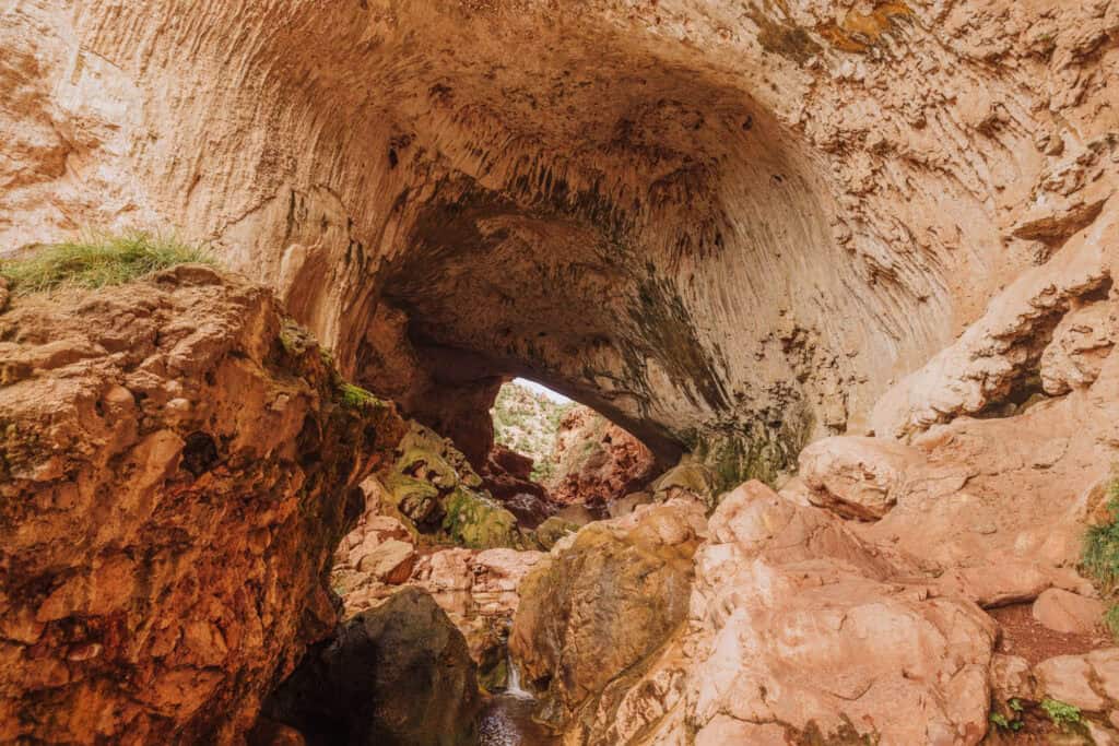
Tonto Natural Bridge: The World’s Largest
The natural travertine bridge formed over thousands of years, as water from Pine Creek seeped through the surrounding limestone. As the water emerged from springs, it deposited layers of travertine. Over time, the creek eroded a tunnel through the travertine, carving out the natural bridge.
- Height of the bridge is 183 feet
- Width of the tunnel is 150 feet
- Length of the tunnel is 393 feet
- Thickness of travertine above the tunnel is 60 feet
Where to Stay in Payson, AZ
Payson is in what’s known as Arizona’s “Rim Country.” Rim refers to the Mogollon Rim, the 200-mile-long edge of the Colorado Plateau.
It’s a decently-sized city, which is home to many restaurants and hotel options. You can plug in your dates to see rates at hotels and VRBOs. This interactive map works best (I think) on a laptop or computer:
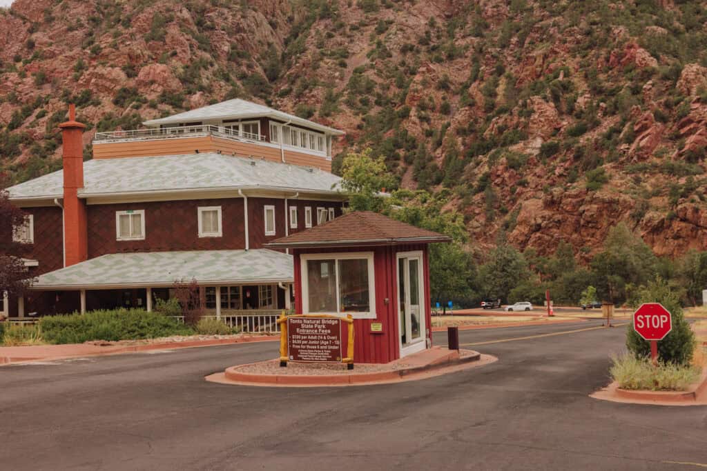
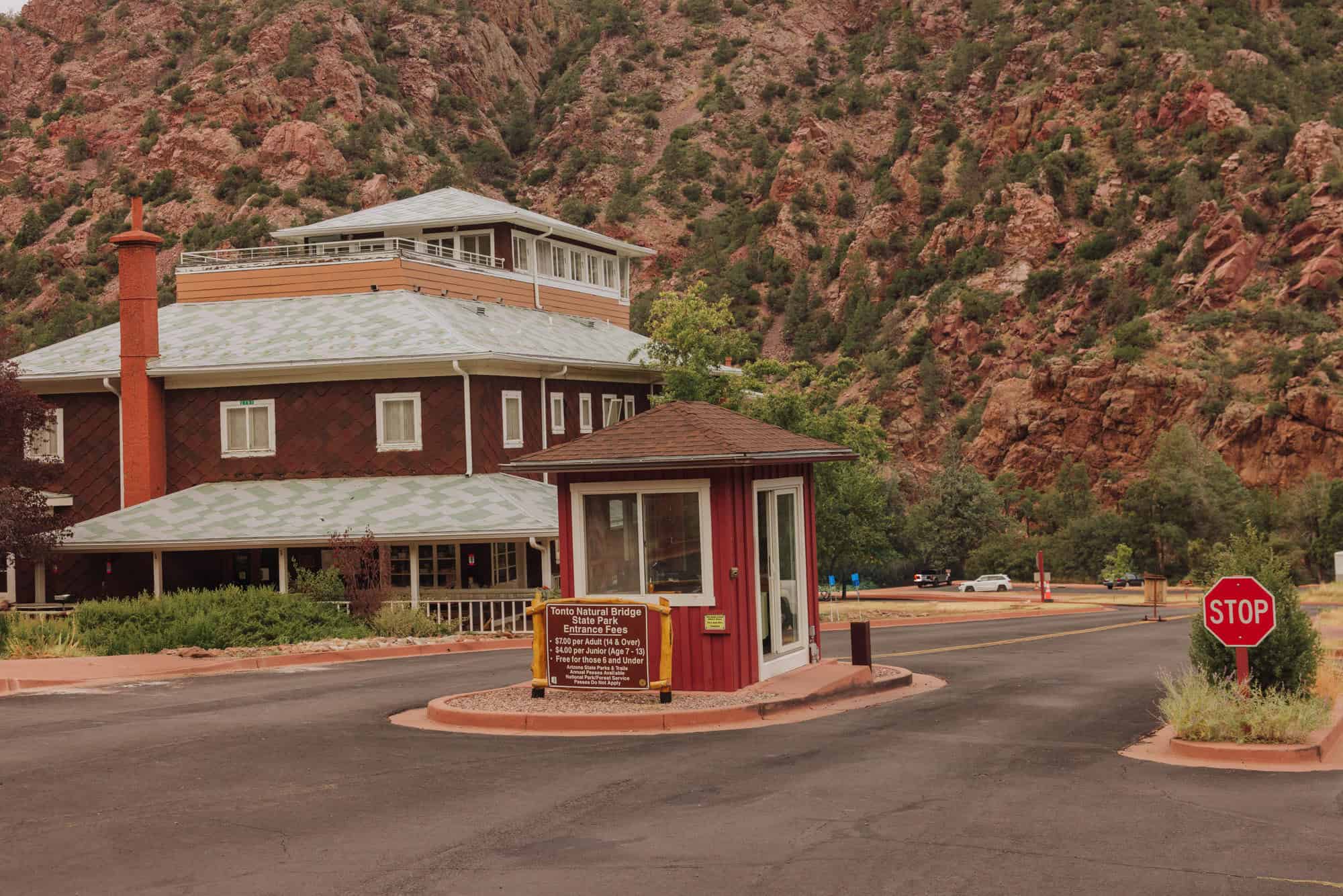
Entrance Fees & Hours
Let’s go over the basics first. The gates don’t open until 9:00am, so if you arrive early, you’ll have to wait in the line of cars which typically forms before opening.
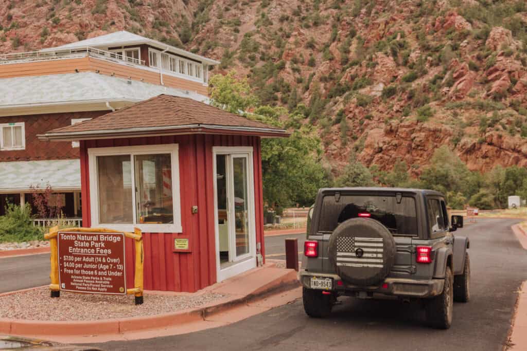
Entrance Fees
- $7 for adults
- $4 for kids
- I’d bring cash, since cell signal is weak.
Hours:
- Daily, 9:00am – 5:00pm
- Last entry is at 4:00pm
- Trails close one hour before the park closes.
Dogs are allowed in Tonto Natural Bridge State Park, but not allowed on the trails.
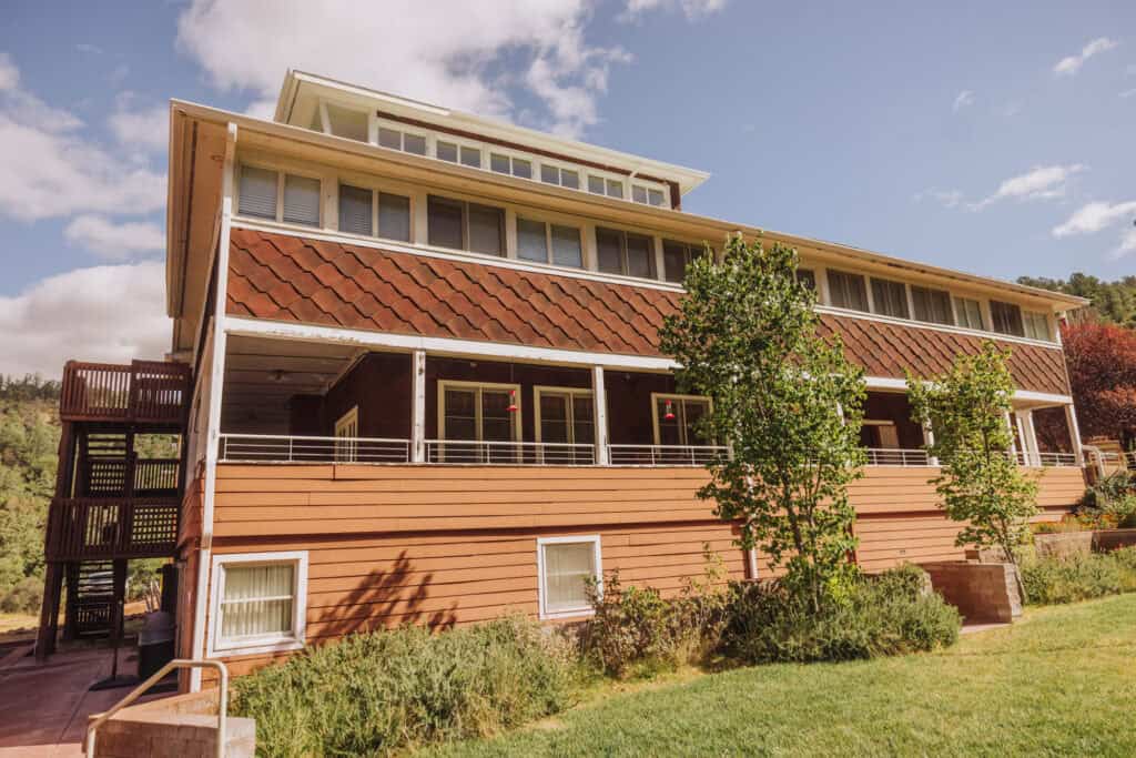
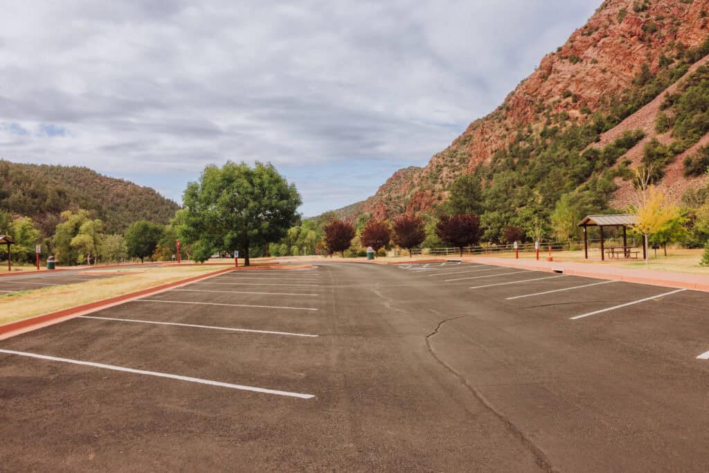
There’s a visitor center and gift shop at the entrance, and several large parking lots.

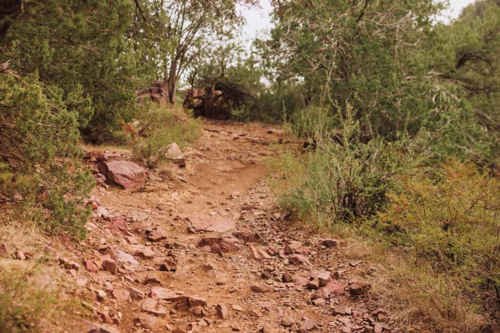
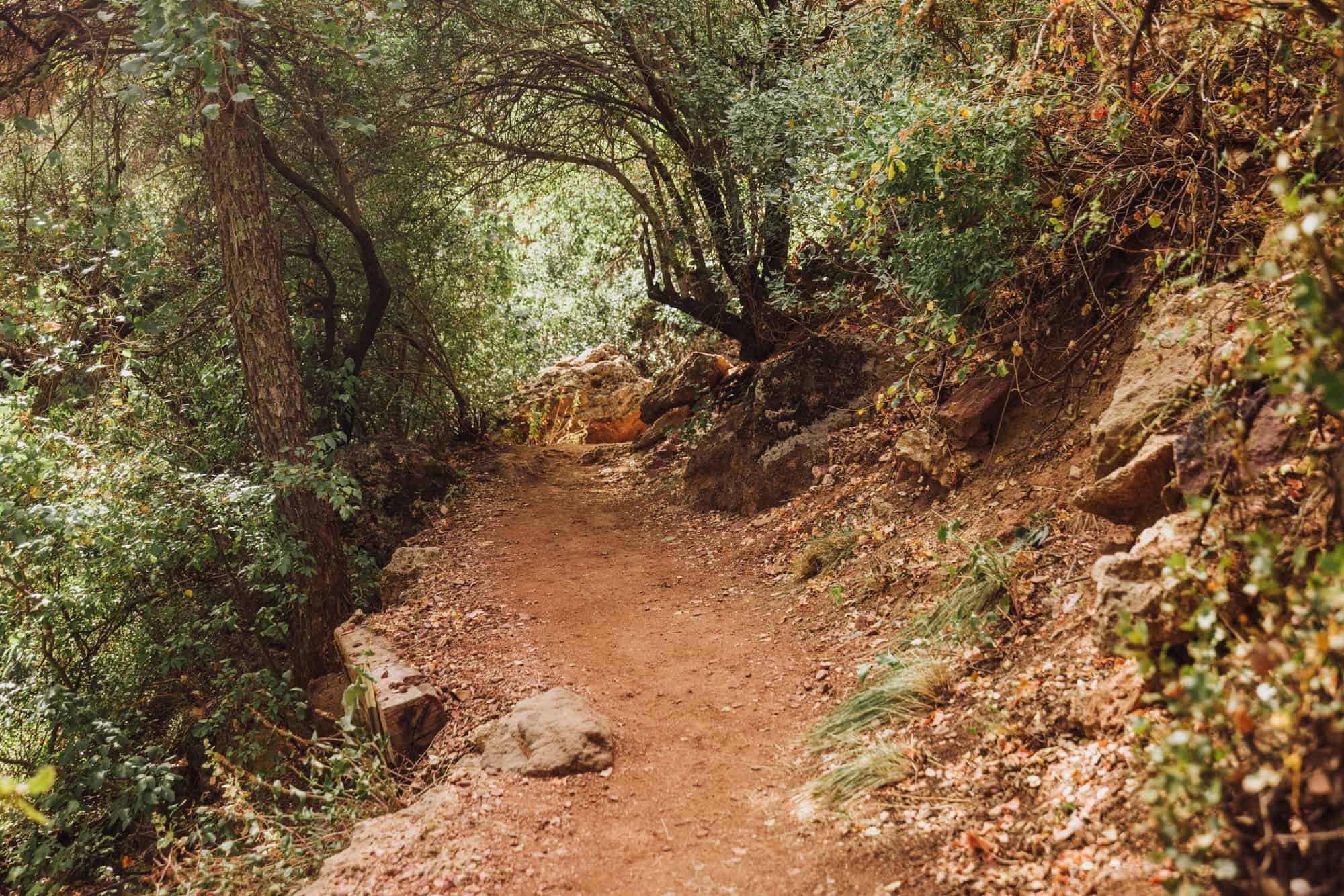
Hiking Trails Under Tonto Natural Bridge
Over the years, the trail that leads under the travertine bridge has closed several times due to bad weather and storm damage. Just keep that in mind as you plan your trip.
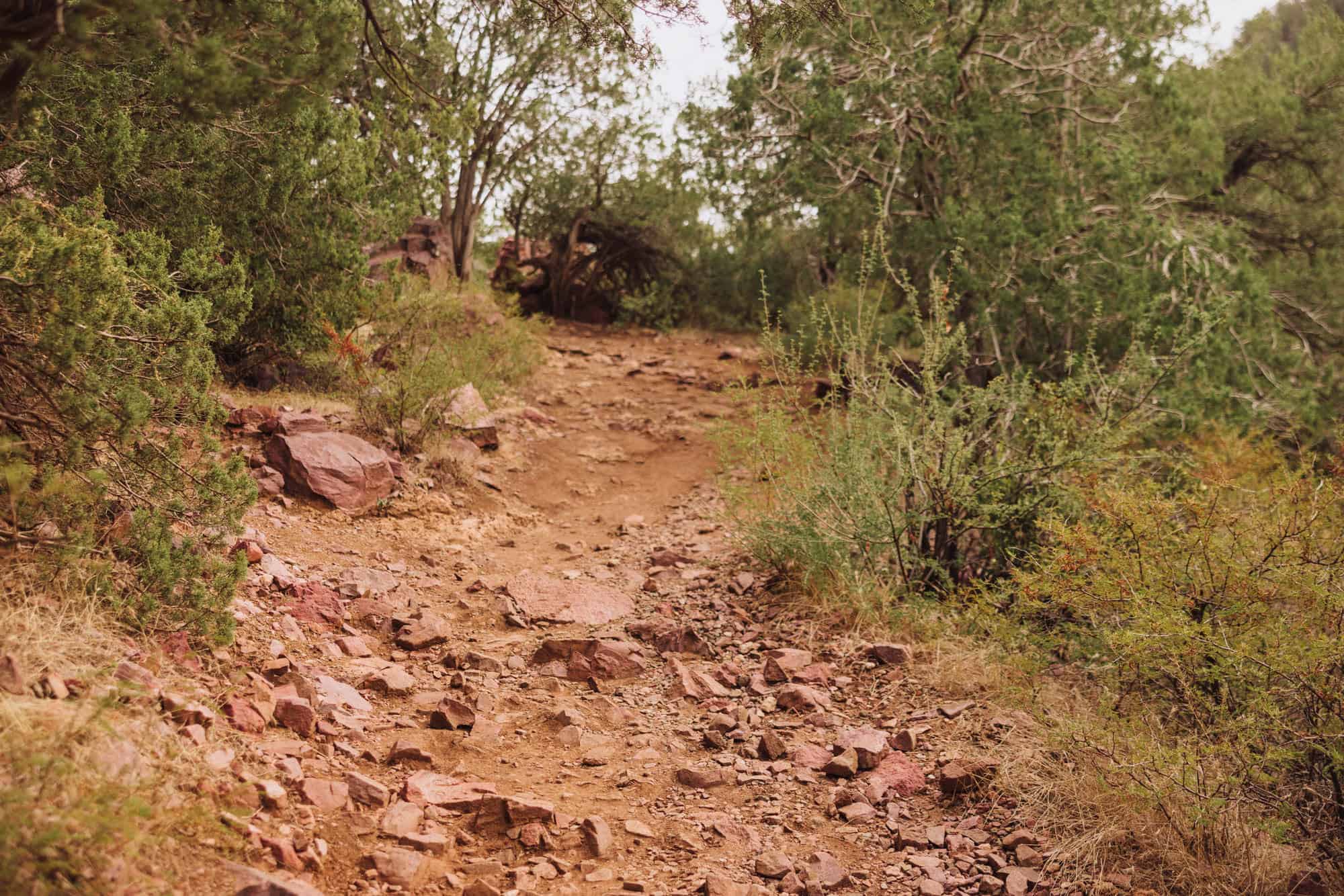
There are several hiking trails, all of which are considered “steep and strenuous” by park rangers. With that said, I’ve seen children do well on all of them.
Most of the trails link to form a loop, which takes you down to the creek and under the bridge. I’d go:
- Down the Gowen Trail…
- Link up to the Pine Creek Trail…
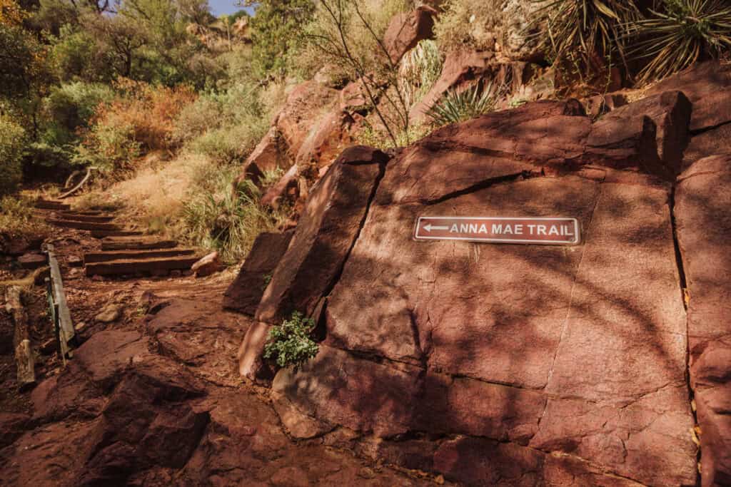
- Which links to the Anna Mae Trail to complete the loop.
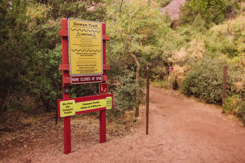
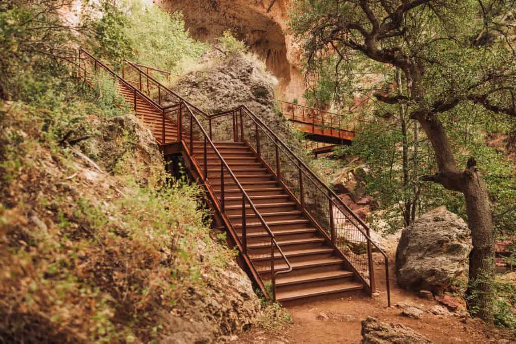
Gowan Trail
- .4 mile long.
- Steep and rough terrain.
- Leads to an observation deck under the Tonto Natural Bridge.
- You can continue from here under the bridge.
Pine Creek Trail
- .5 mile long
- Much of it is along the creek bottom.
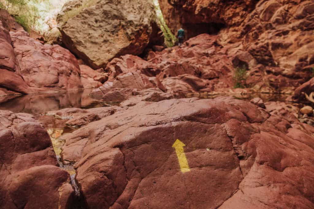
- Arrows will guide you over the boulders.
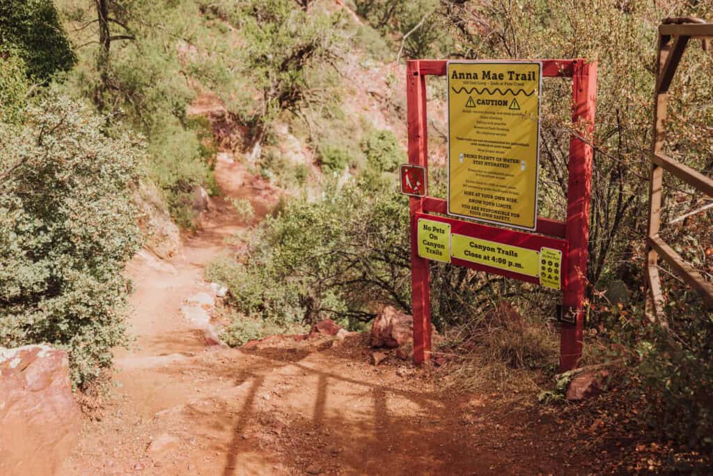
Anna Mae Trail
- 500 feet long.
- Leads you up to the top.
- This is an alternate starting trailhead, too, since you can hike the loop backwards. Follow Anna Mae down to the Pine Creek Trail and under Tonto Natural Bridge.
Photos of the Hike Under Tonto Natural Bridge
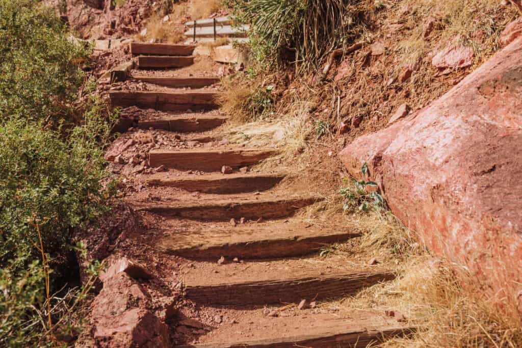
Going down the Gowan Trail is pretty steep. It’s partly wooden steps, and partly rock.
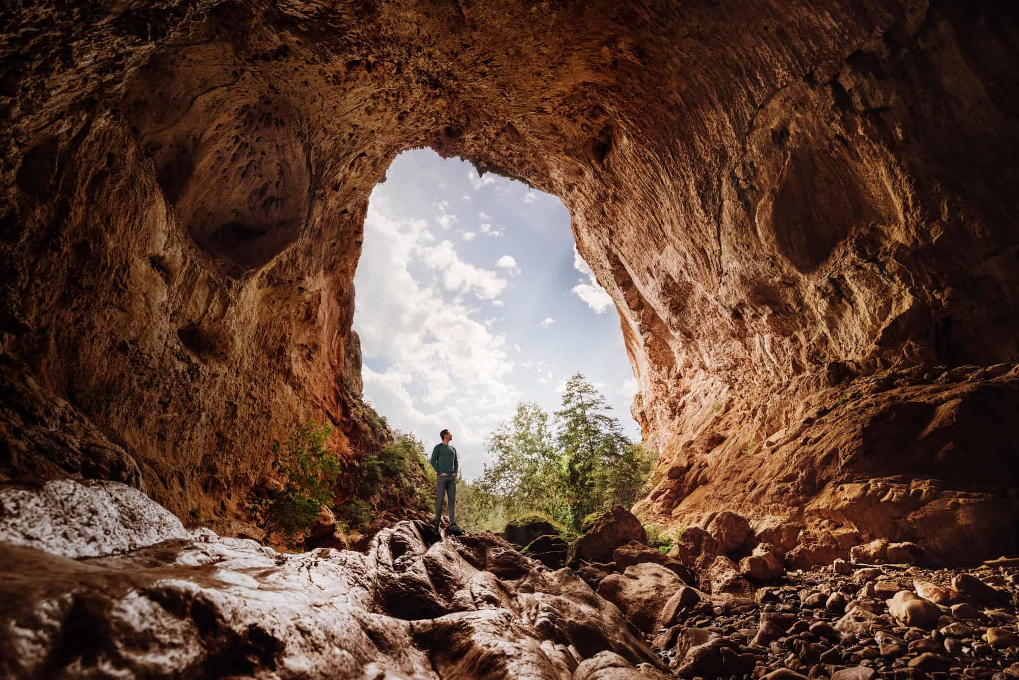
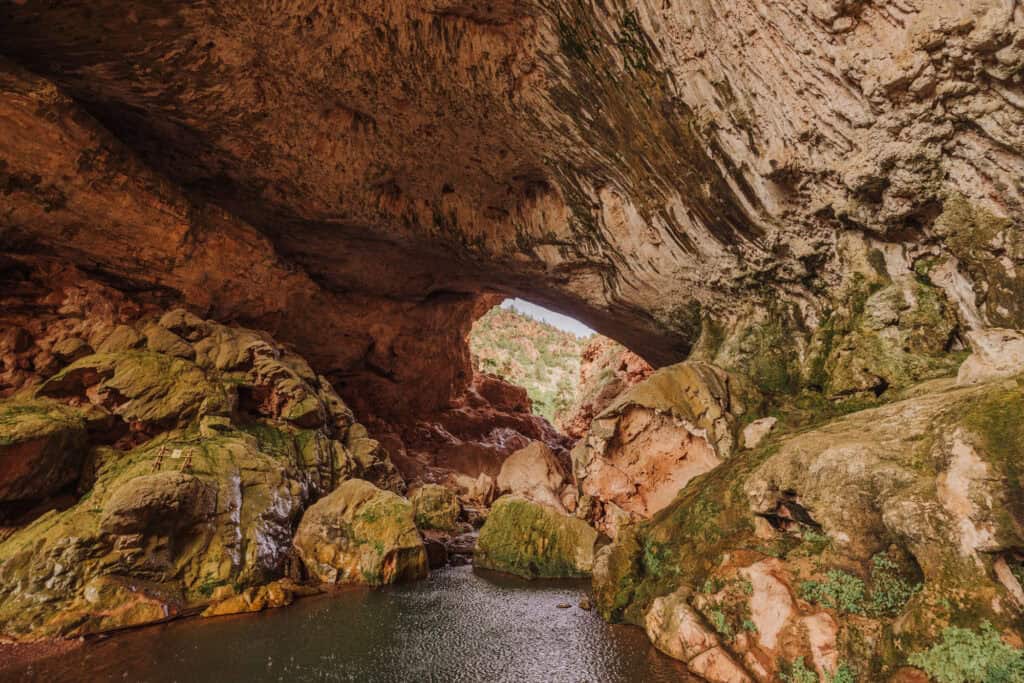
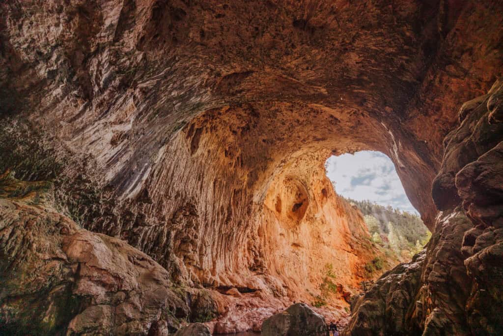
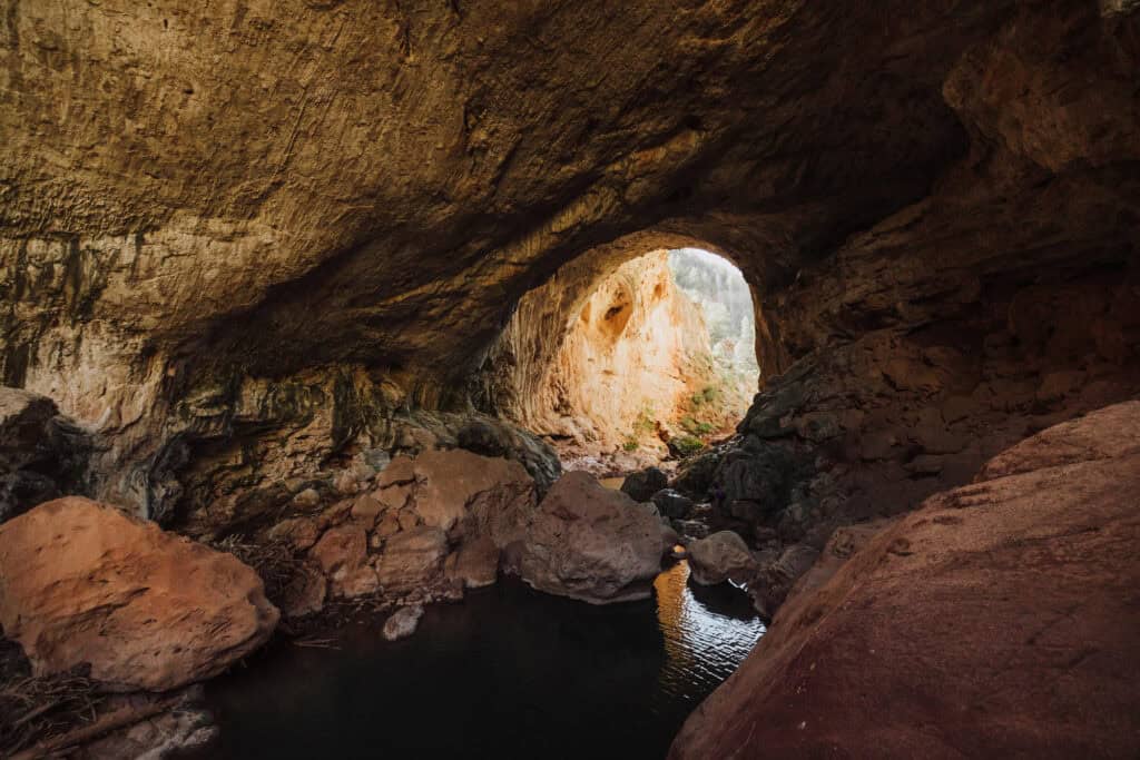
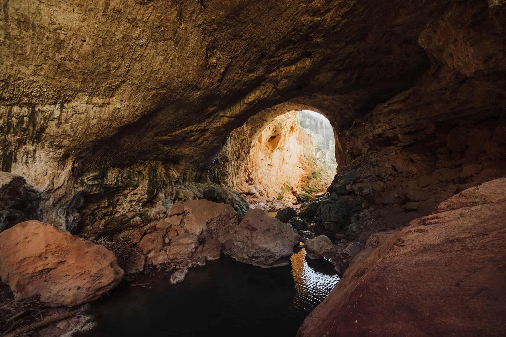
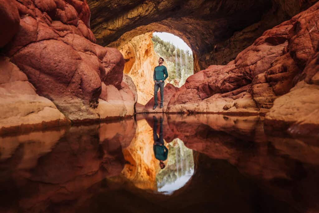
Once you get down to the creek, you’ll be able to see the entire Tonto Natural Bridge from a set of steps that leads up to a large viewing platform.
Here’s the view you’ll get from the creek, looking up at the travertine bridge:
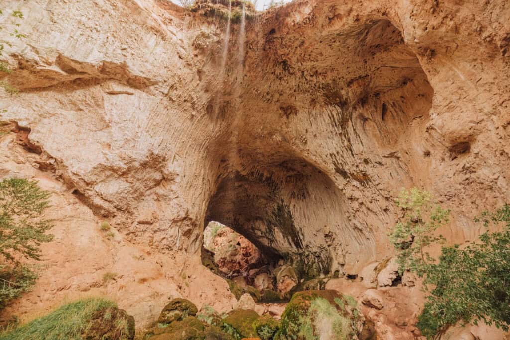
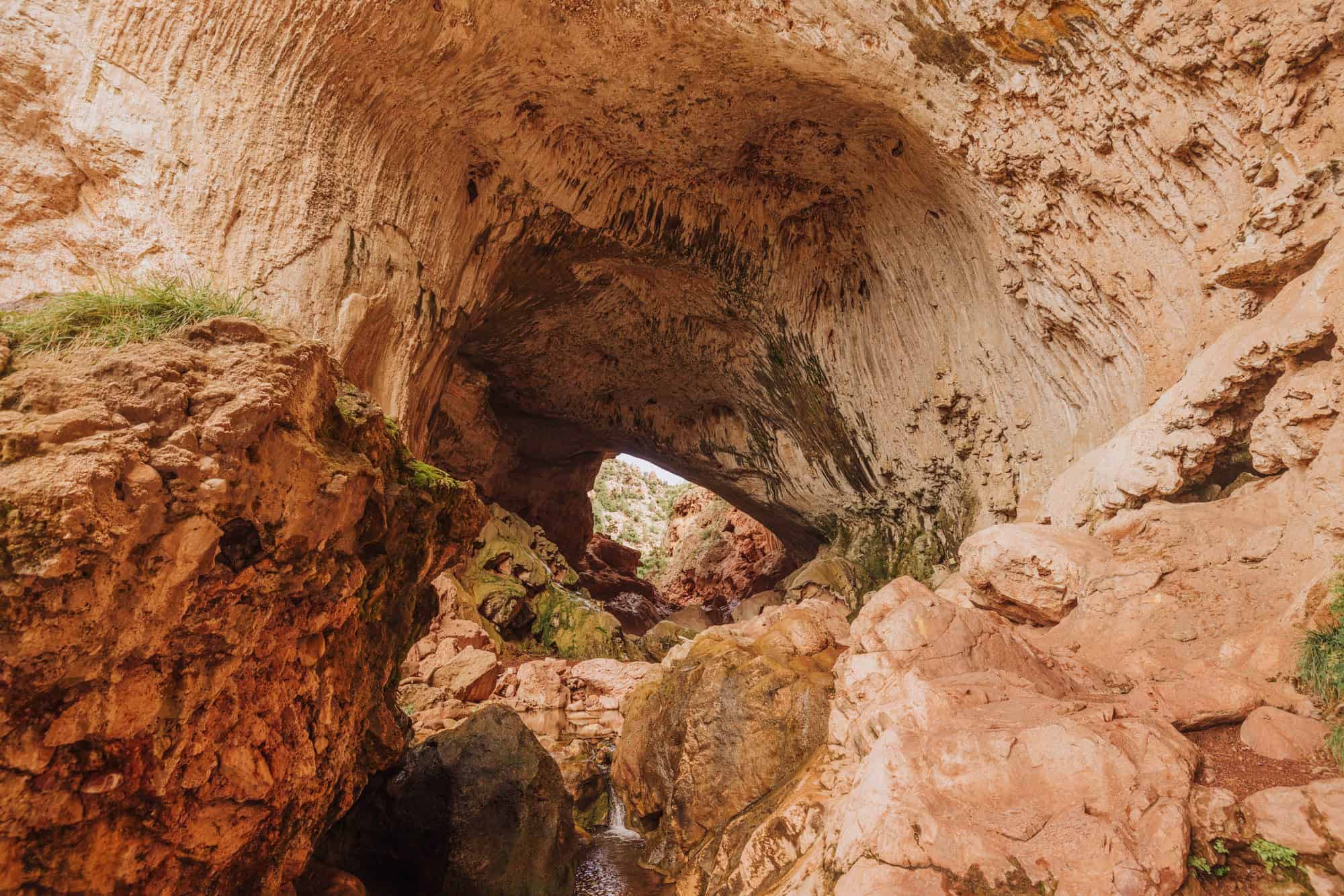
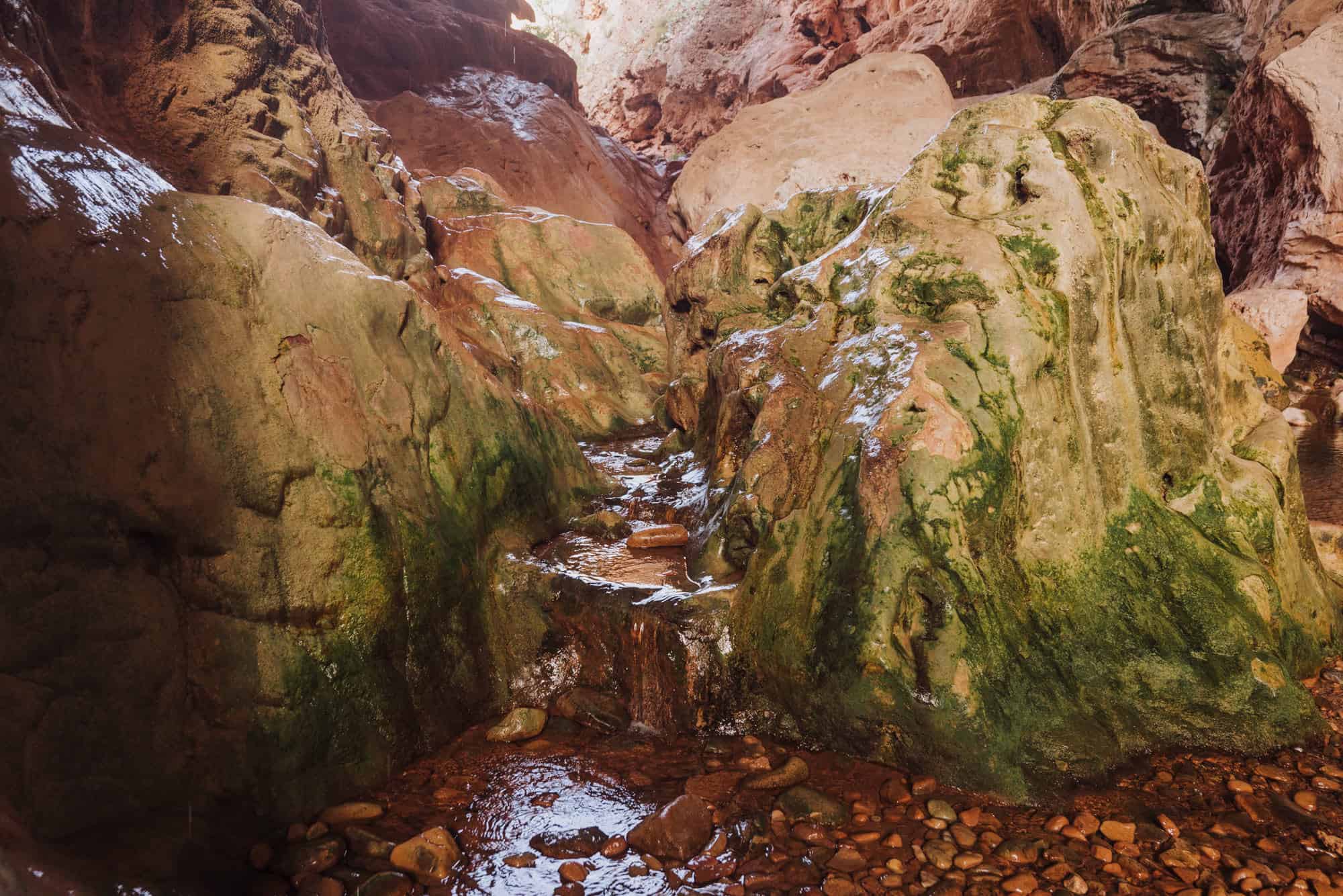
From here, you’ll be able to follow a rocky path down under the tunnel. You might get wet as you cross over to large rocks, which are slick to climb.
It looks a bit daunting from a distance, but there’s a clear trail to follow.
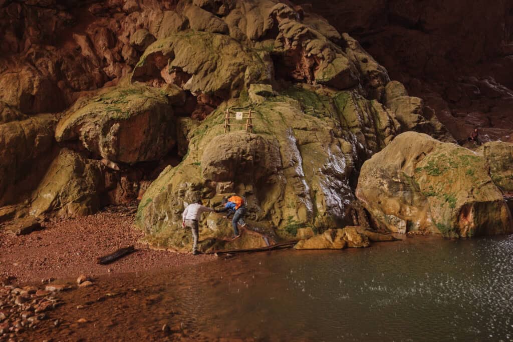
Here’s a closer-up photo of the rocks you’ll be climbing up and over as you hike under the bridge:
This photo shows the steps that are carved into the rocks, which will help hoist you up and over the boulders under the bridge:
Again, I’ve seen children and seniors accomplish this hike. Plus, if it’s too much, you can just turn back and exit the way you came in.
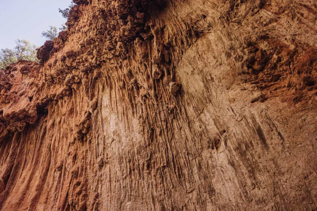
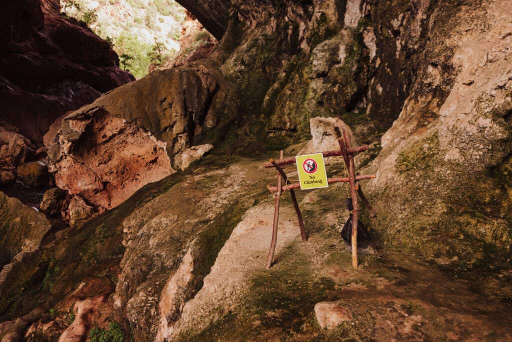
The trail includes steps carved into the rocks, along with signs that warn hikers not to stray off course or get too high. Additional rock climbing under the bridge is not allowed.
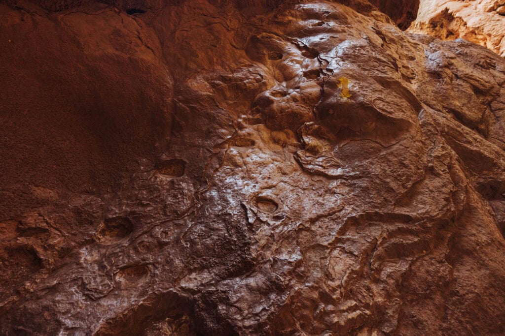
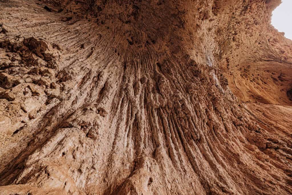
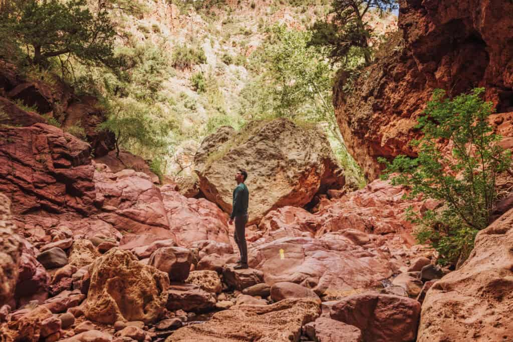
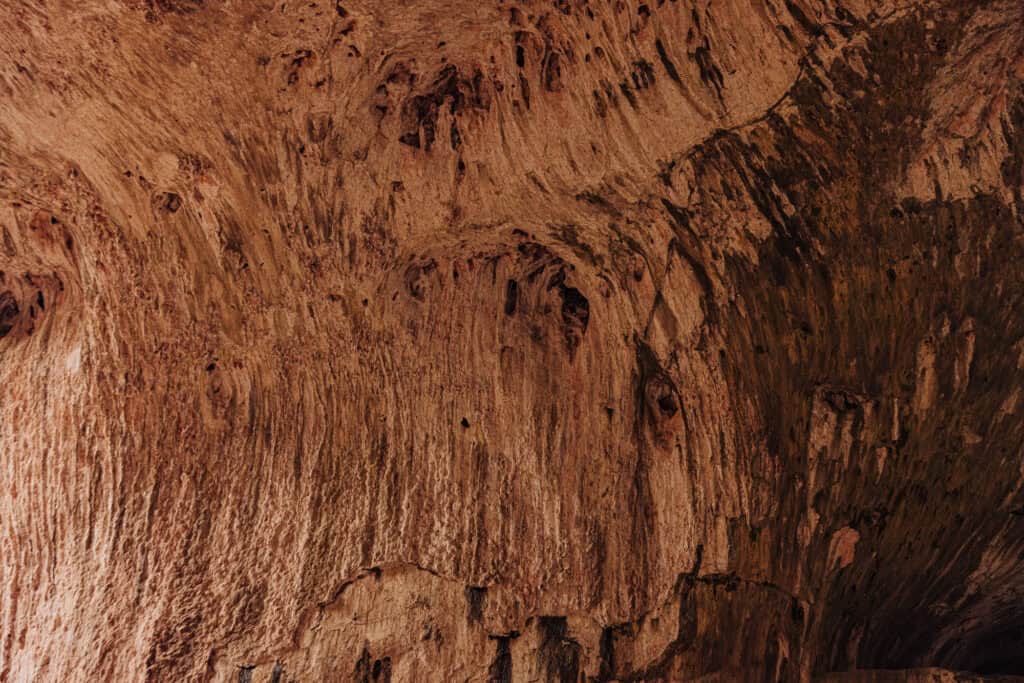
Under the bridge, you can look up and get a sense of how massive the span of travertine is.
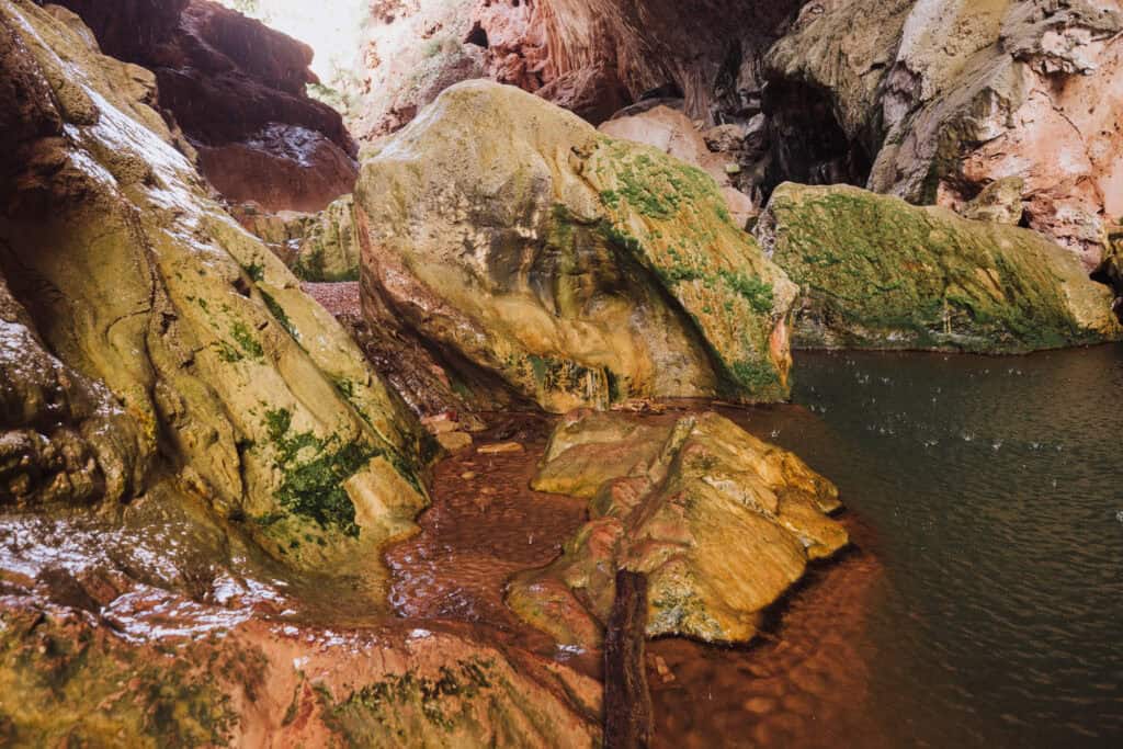
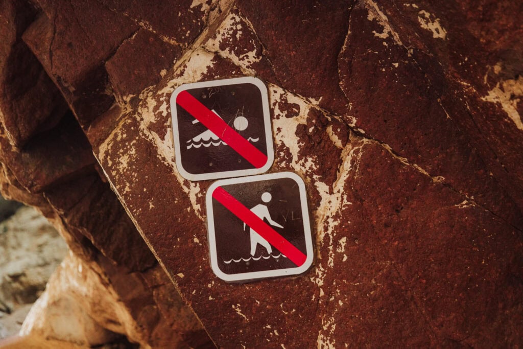
There are pools under the bridge, which may seem like great swimming holes, but there are signs warning against swimming on the hike.
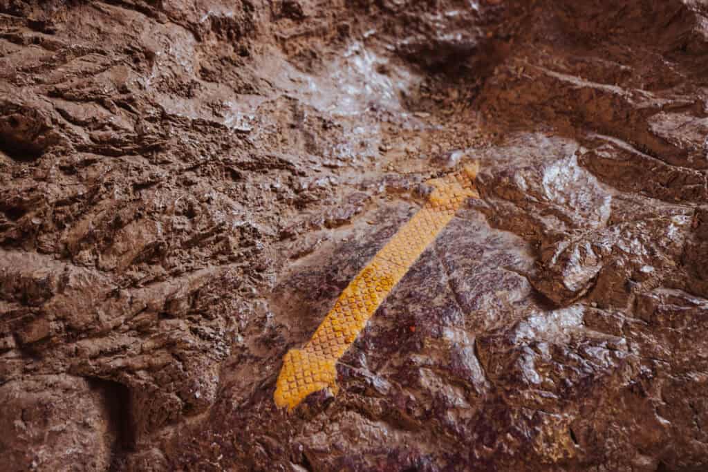
You’ll see yellow arrows on the rocks. Continue following them under the bridge. They’ll lead you out the other side.
Again, the rocks are uneven and pretty slick in spots, but you’ll see people of all ages making the trek.
Just continue following the yellow arrows. You can see in this photo how the rocks are usually wet from spray coming off the waterfall.
From here, you can look back into the tunnel you’ve walked through.
You’ll continue hiking out to link up with the Anna Mae Trail, which will bring you back up the hill.
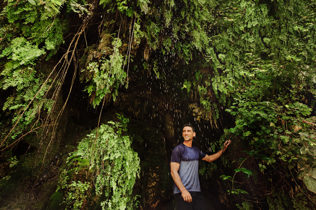
The Waterfall Trail
Another short “hike” will bring you down a set of uneven steps to a beautiful waterfall cave. It’s lined with ferns and other greenery. The water’s chilly, so it’s a nice way to cool off in the summer.
Waterfall Trail Info
- 300 feet long (down steps).
- Ends at a beautiful waterfall cave.
- Estimated: 20 minutes.
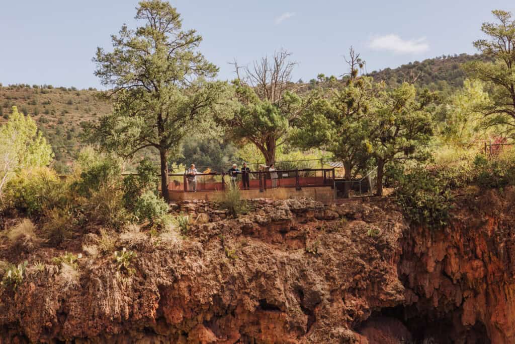
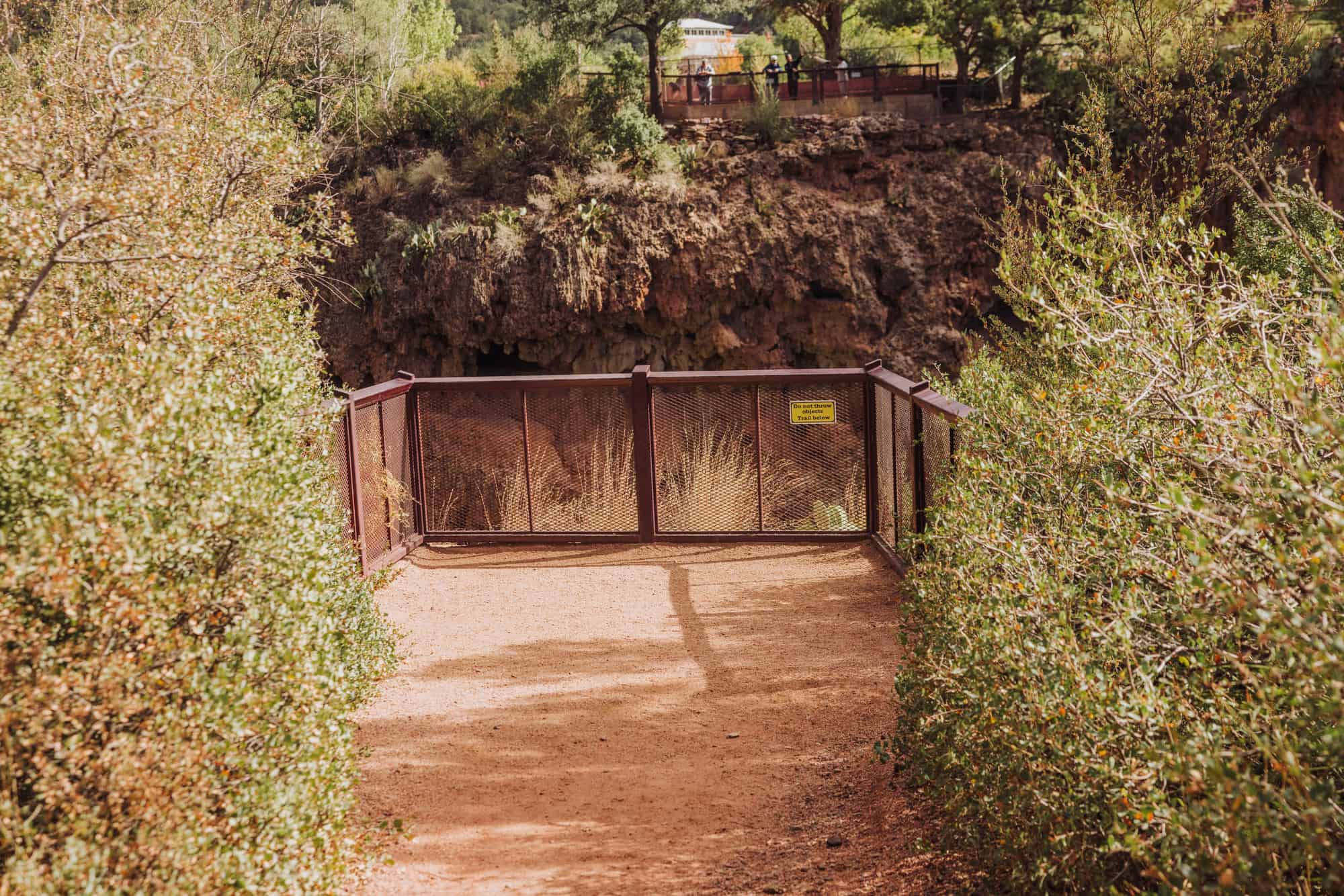
How to View the Bridge Without Hiking
Not far from the parking lot, you’ll find a few different viewpoints overlooking Tonto Natural Bridge. The design of the park makes it easy and accessible for people of all ages and abilities to get a sense of the grandeur of the bridge.
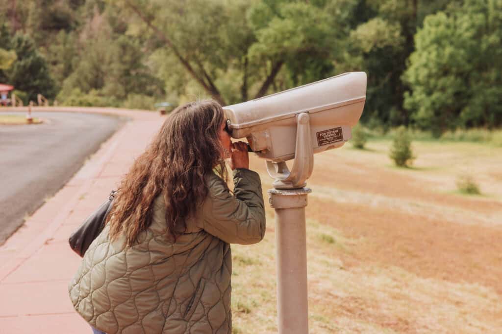
There are four viewpoints. Viewpoint #1 is the closest to the lot. It’s worth checking each out!
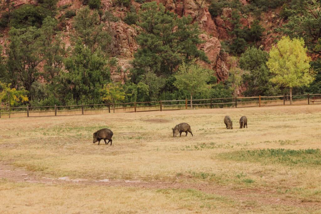
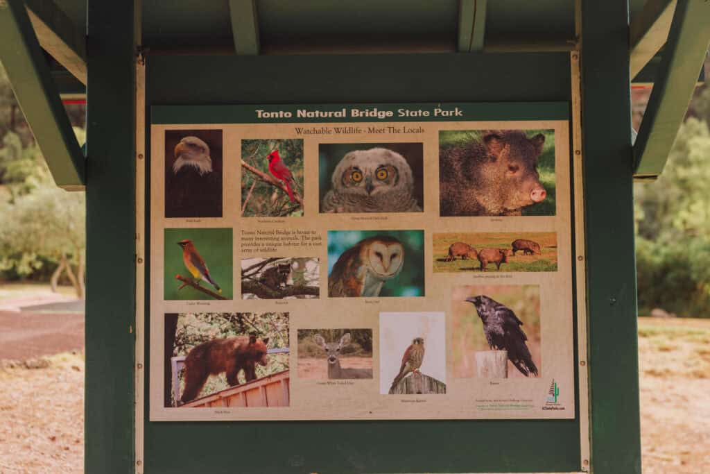
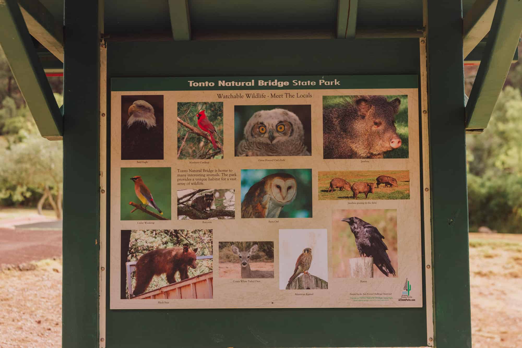
Wildlife at the Arizona State Park
Tonto Natural Bridge is home to wildlife, including deer, javelinas, and various bird species. Arriving early, you’re likely to spot some of the javelinas grazing on the grass.
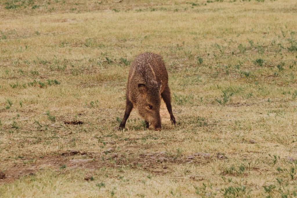
They tend to vanish into the vegetation as more people show up. They may look mean, but they have no interest in interacting with you and me!
Video: Visiting Tonto Natural Bridge
The Best Time to Visit
The weather will play a big role in your visit. While Payson is only 90 minutes from Phoenix, the climate is very different. The area sees all four seasons, and quite a bit of snow in winter!
While fall is my favorite time to visit Tonto Natural Bridge, it’s open and enjoyable year-round. Here’s what you can expect by season:
Winter (December to February)
- Average Highs: 50°F to 60°F
- Average Lows: 25°F to 35°F
- Snow is occasional, and it can take a day or two to clear the roads and highways.
Spring (March to May)
- Average Highs: 60°F to 80°F
- Average Lows: 30°F to 50°F
Summer (June to August)
- Average Highs: 85°F to 95°F
- Average Lows: 55°F to 65°F
- Summers are much cooler than the Phoenix area, but the monsoon season brings thunderstorms from July through September.
Autumn (September to November)
- Average Highs: 65°F to 80°F
- Average Lows: 40°F to 50°F
- Fall is beautiful in Payson, with warm, sunny days and crisp evenings.
History & How Tonto Bridge Became a State Park
Native American tribes were aware of the bridge for centuries, and valued the area as a water source.
The bridge was officially “discovered” in the 1870s by David Gowan, a Scottish prospector. Gowan settled near the bridge and his family homesteaded the land for several decades.
The Gowan family eventually sold the land to the state of Arizona. In 1991, the site became Tonto Natural Bridge State Park, ensuring its preservation and accessibility to the public.
Photos of Tonto Natural Bridge State Park


A Few Final Notes About Visiting Tonto Natural Bridge
Keep in mind:
- There’s little to no cellphone coverage in the park.
- Dogs are allowed in the park, but not on the trails.
- Ice or flooding may close the trail under the bridge.
- No drones allowed.
- No swimming in the pools under the bridge.
- No rock climbing under the bridge.
Other Sites to See in Arizona
If you’re in the Payson, area, check out the Bob Bear Trail to Fossil Springs and the Water Wheel Trail just outside town.
A few other sites I’d recommend for family and friends in Arizona include:
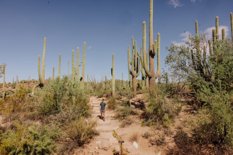
- Tombstone, Bisbee, Kartchner Caverns, Chiricahua National Monument, Saguaro National Park, and the wineries in Southern Arizona.
- Hiking Picacho Peak south of Phoenix and Devil’s Bridge in Sedona.
- Monument Valley, the Lava Tubes, Winslow, Walnut Canyon National Monument, and Meteor Crater in Northern Arizona.
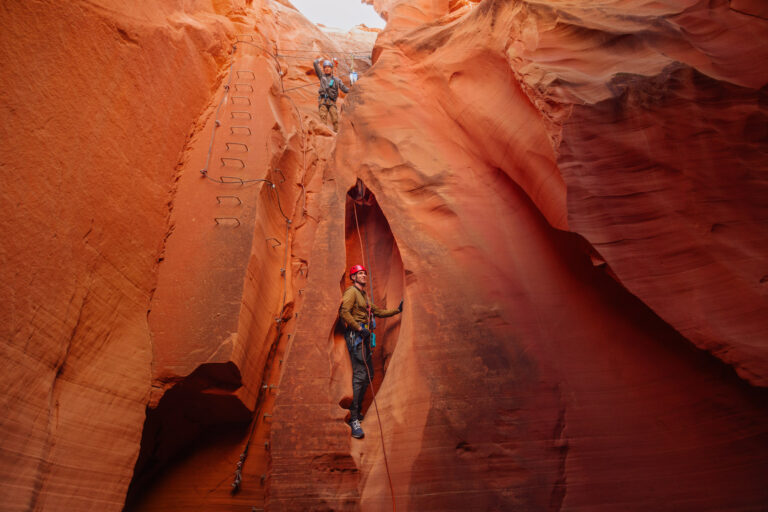
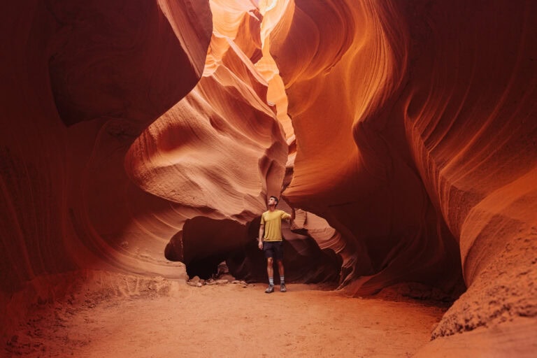
- Antelope Canyon, White Pocket, and other sites around Page, AZ.