Walnut Canyon National Monument: Explore Ancient Life in the Cliffs

I was on an Arizona road trip, when I happened to see a sign for Walnut Canyon National Monument, east of Flagstaff, and took the exit out of curiosity. I’m glad I did!
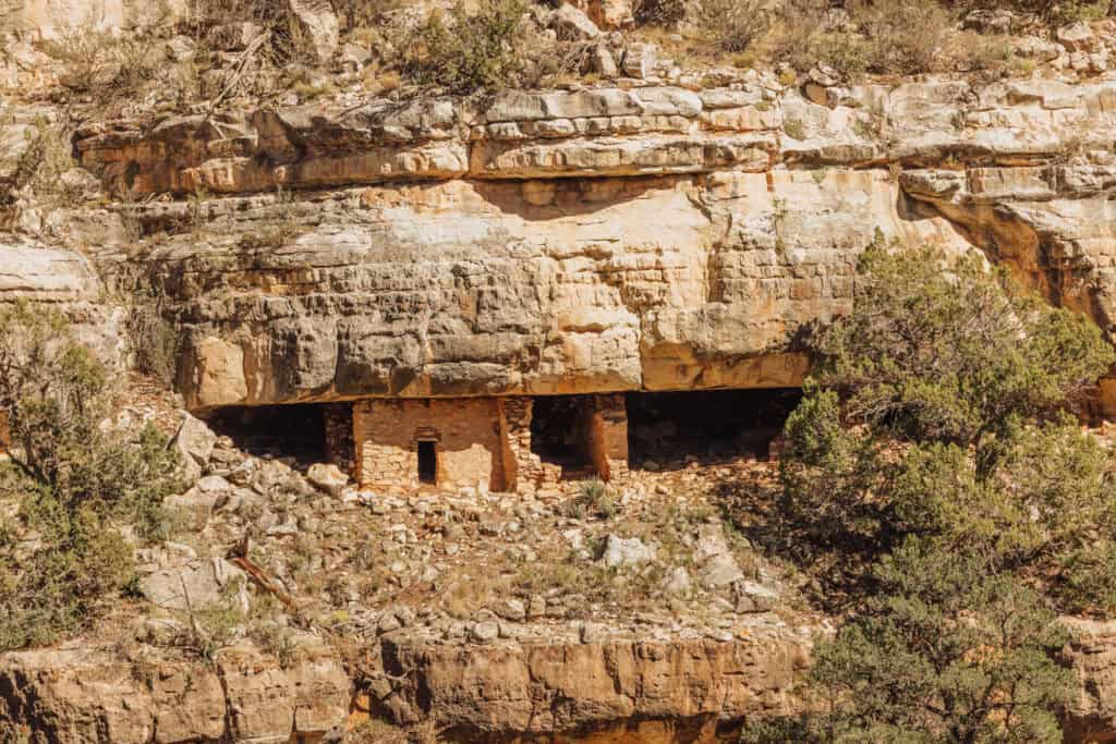
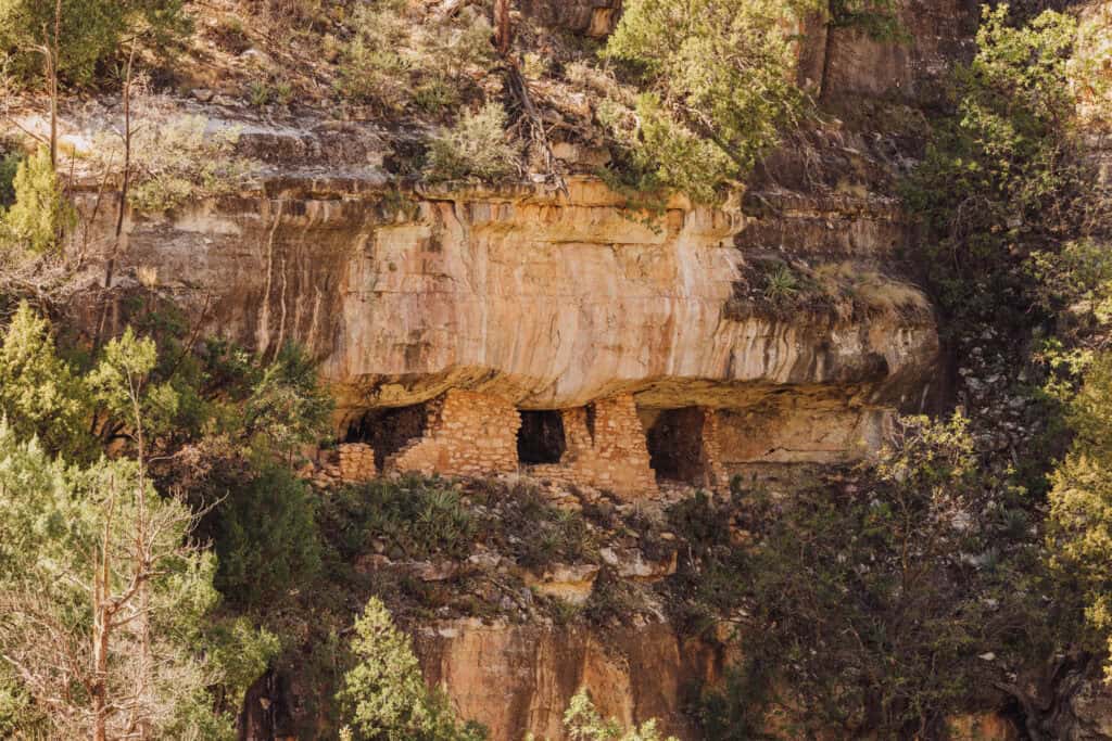
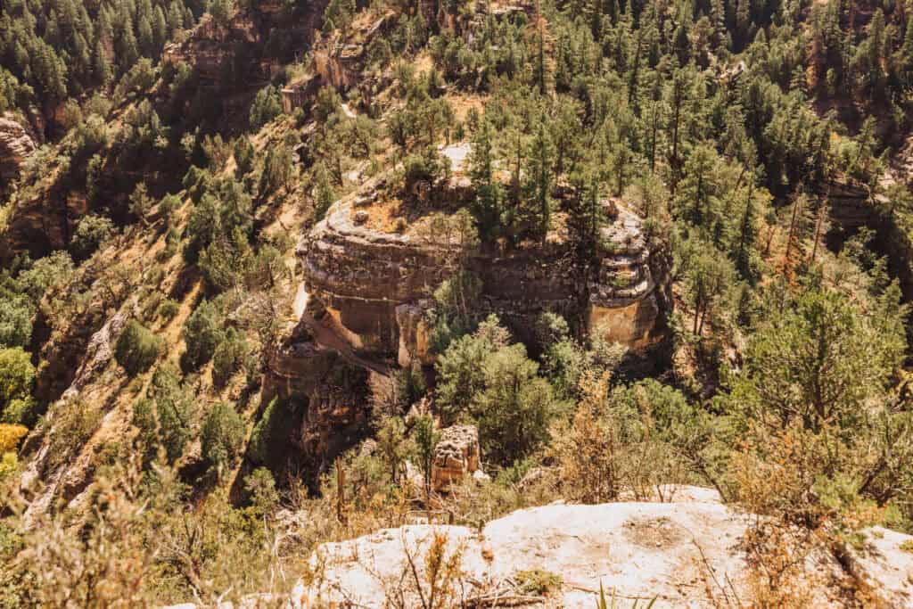
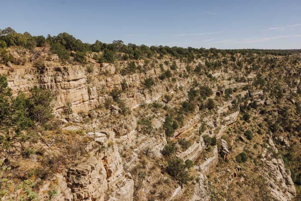
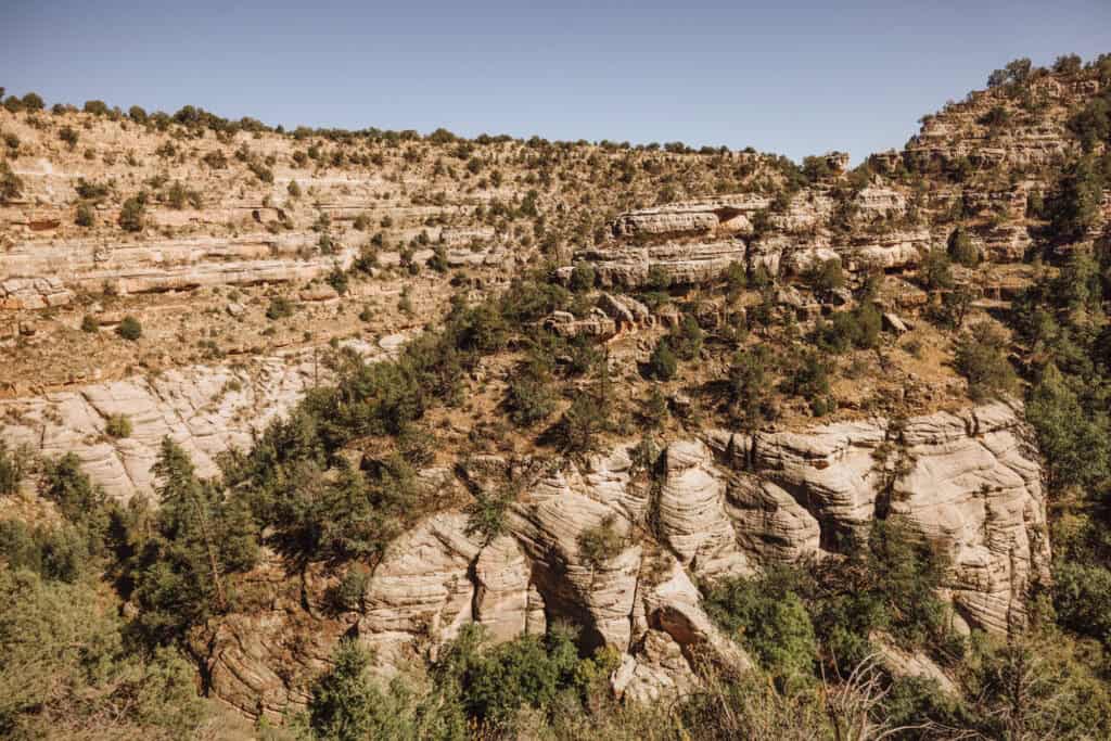
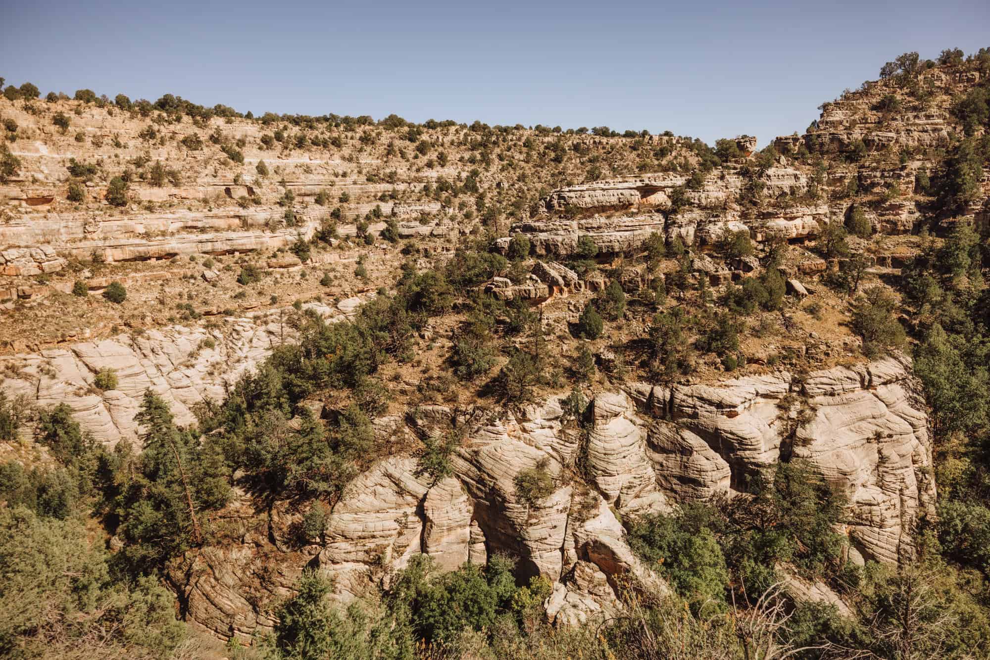
It’s home to cliff dwellings, carved into the rock more than 800 years ago.
Today, visitors can view them from above, or take a steep hike down for an up-close look at ancient life in this rugged landscape.
Key Info on Walnut Canyon
- Location: 10 miles east of Flagstaff, off Interstate 40
- Hours: Daily, 9:00am – 5:00pm
- Cost: $25 per car (or free if you have a $45 annual park pass)
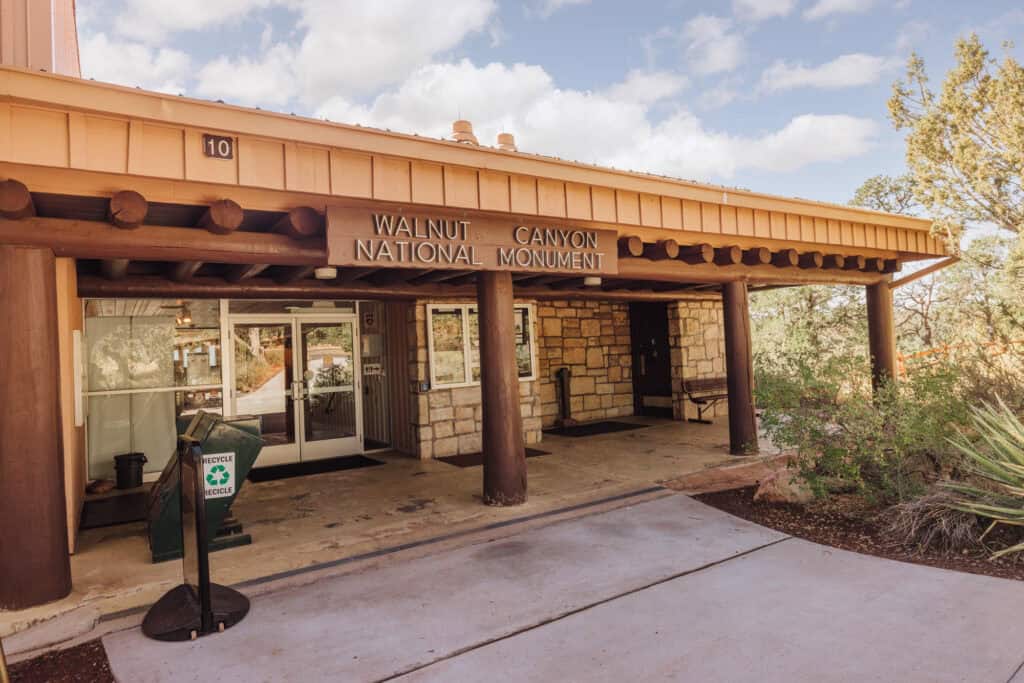
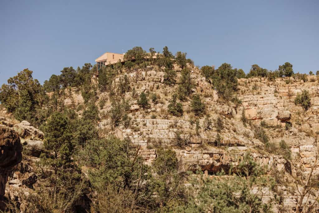
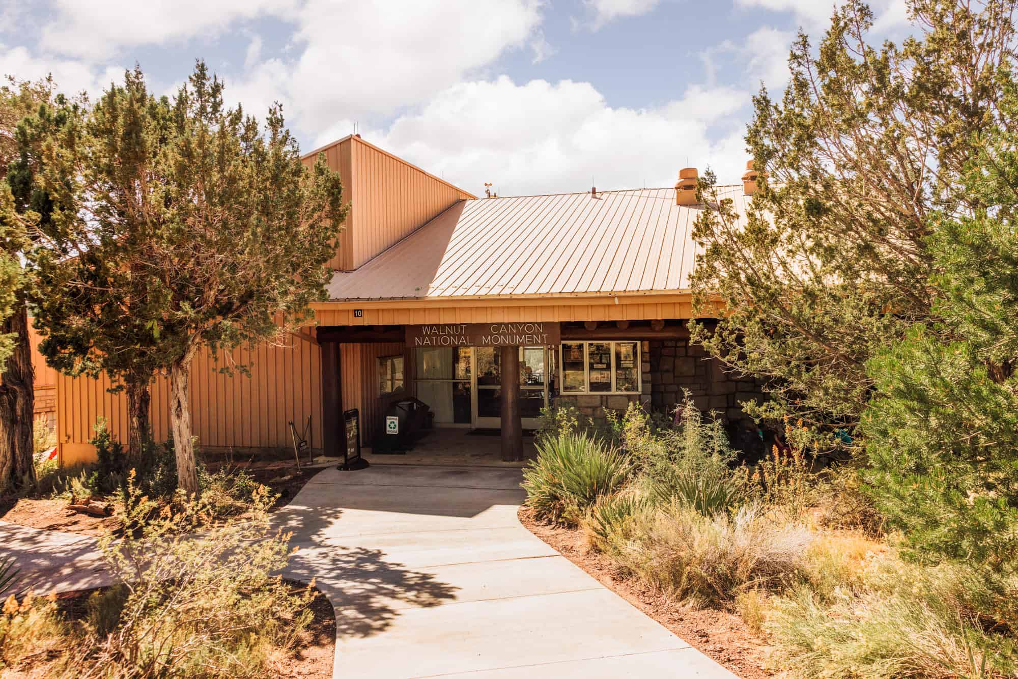
- Visitor Center: Exhibits about the Sinagua people and the canyon’s geology
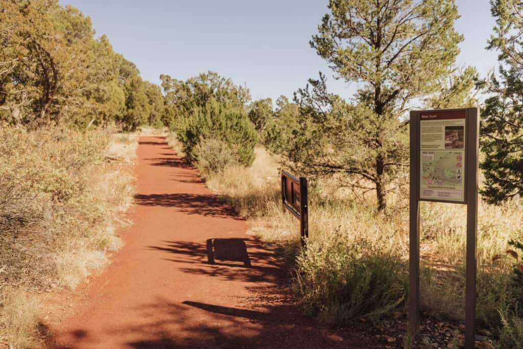
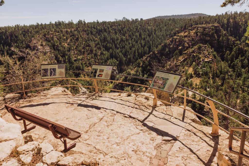
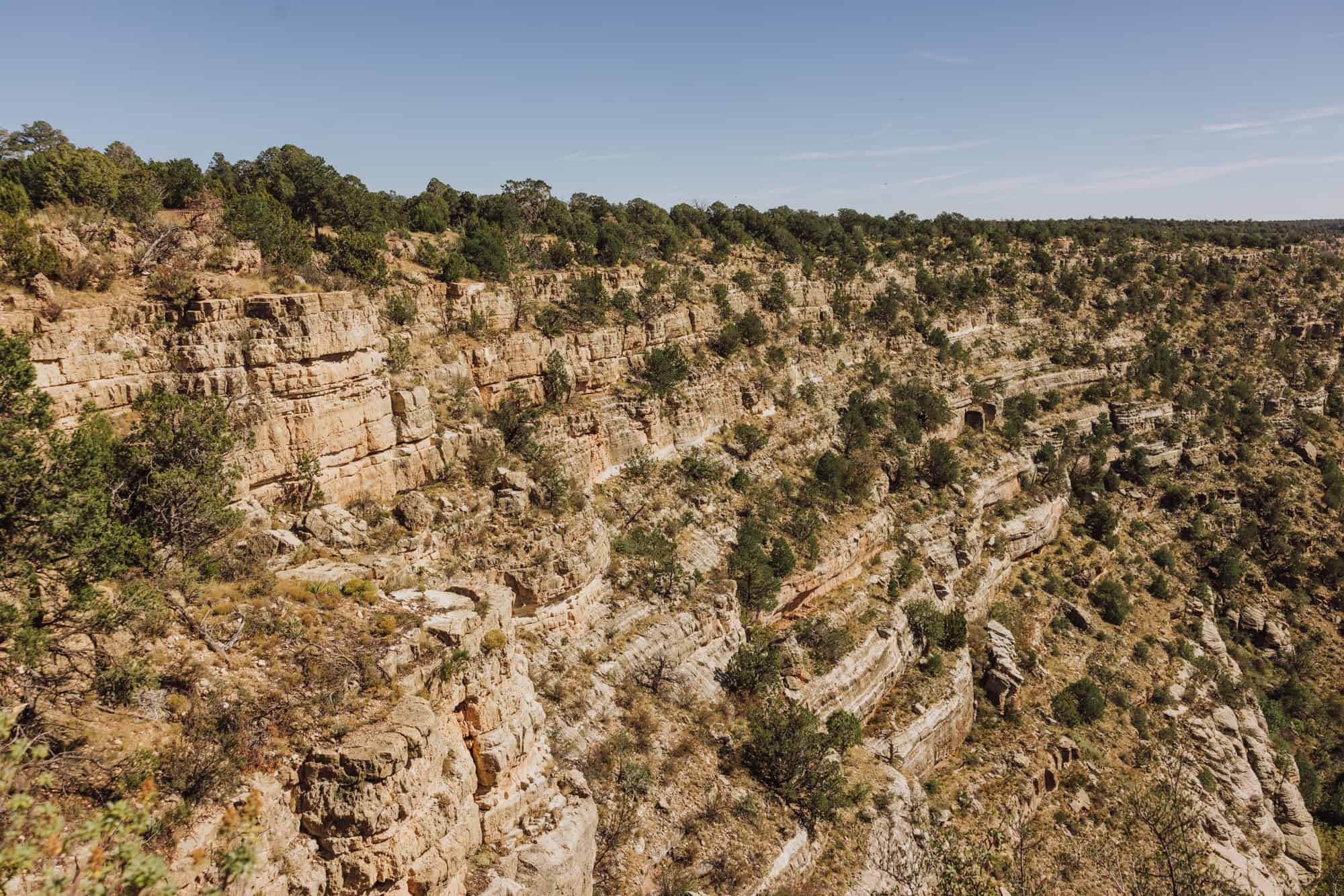
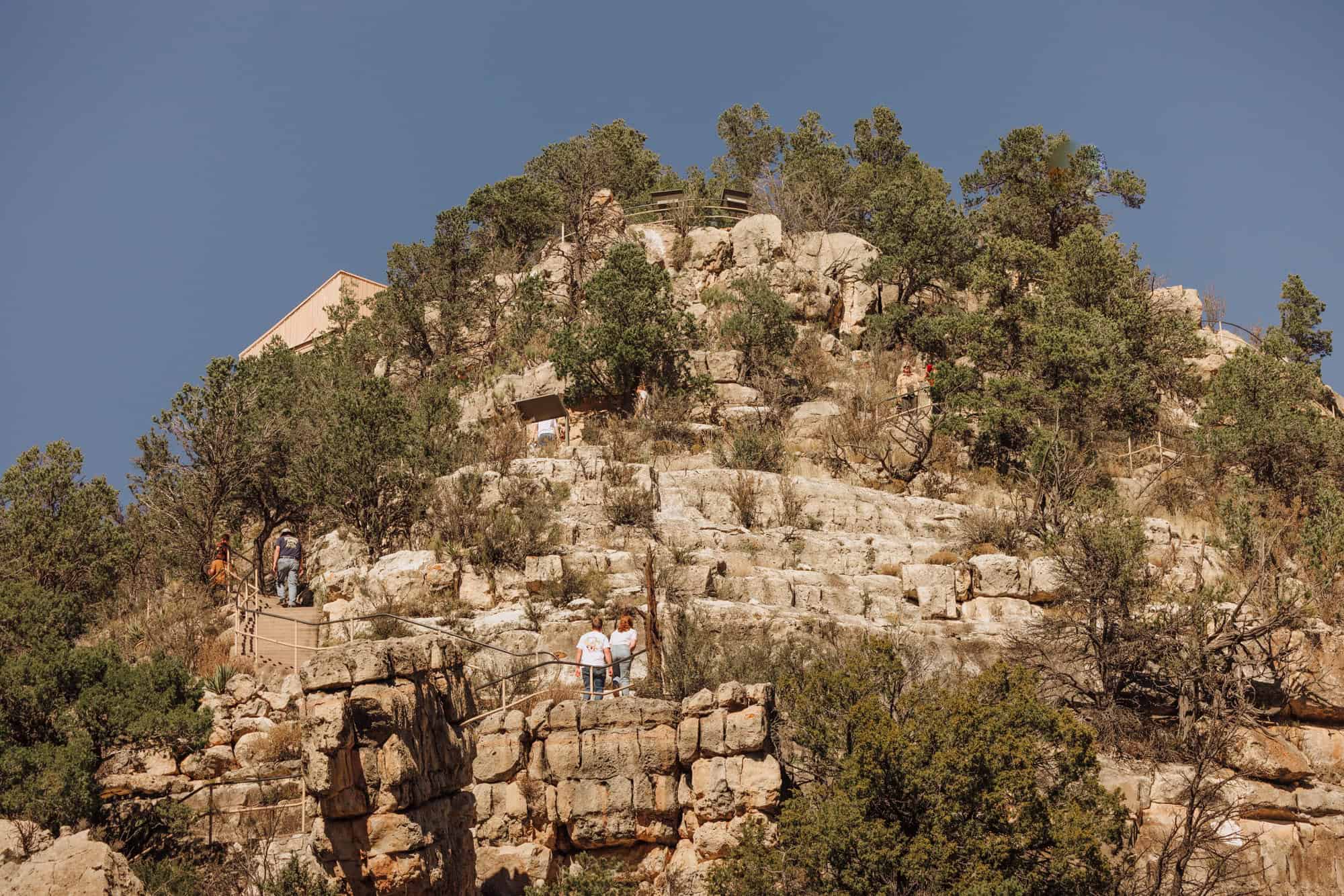
- Rim Trail: A flat trail to scenic overlooks
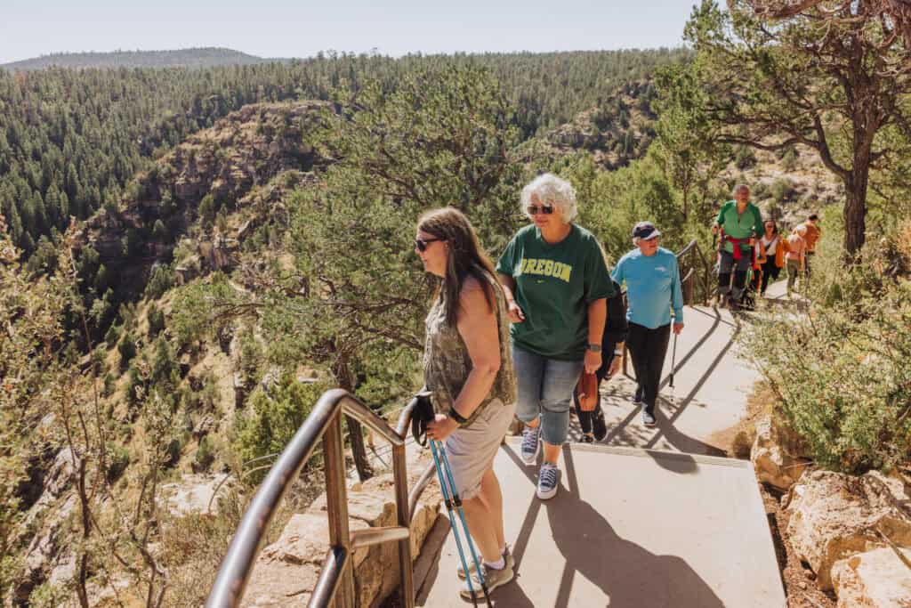
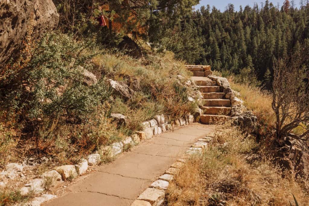
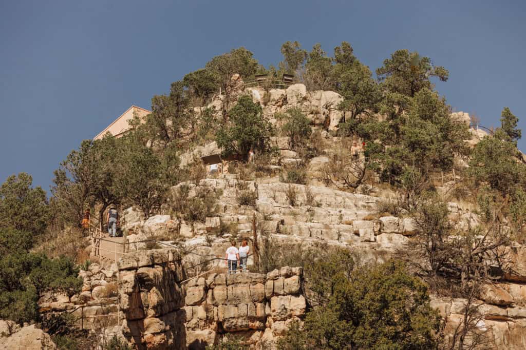
- Island Trail: A steep (but worthwhile) trek down nearly 200 steps to the cave dwellings
Hotels Near Walnut Canyon (Flagstaff, AZ)
Walnut Canyon is east of Flagstaff and just off Interstate 40.
You can plug your dates into this interactive map, and it’ll bring up the best rates on Expedia, Hotels, VRBO, and other trusted sites
Phoenix to Walnut Canyon Tour
If you’re in the Phoenix area, you can relax and hire a driver to take you on a day trip to both Meteor Crater and Walnut Canyon.
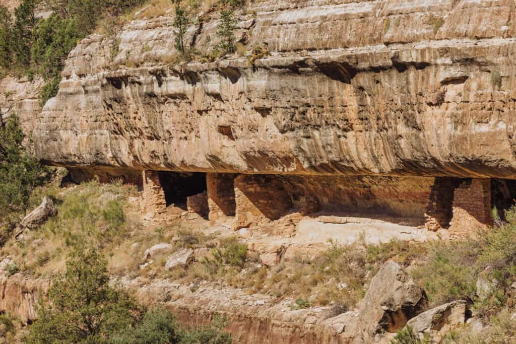
Ancient Life in the Cliff Dwellings
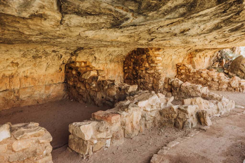
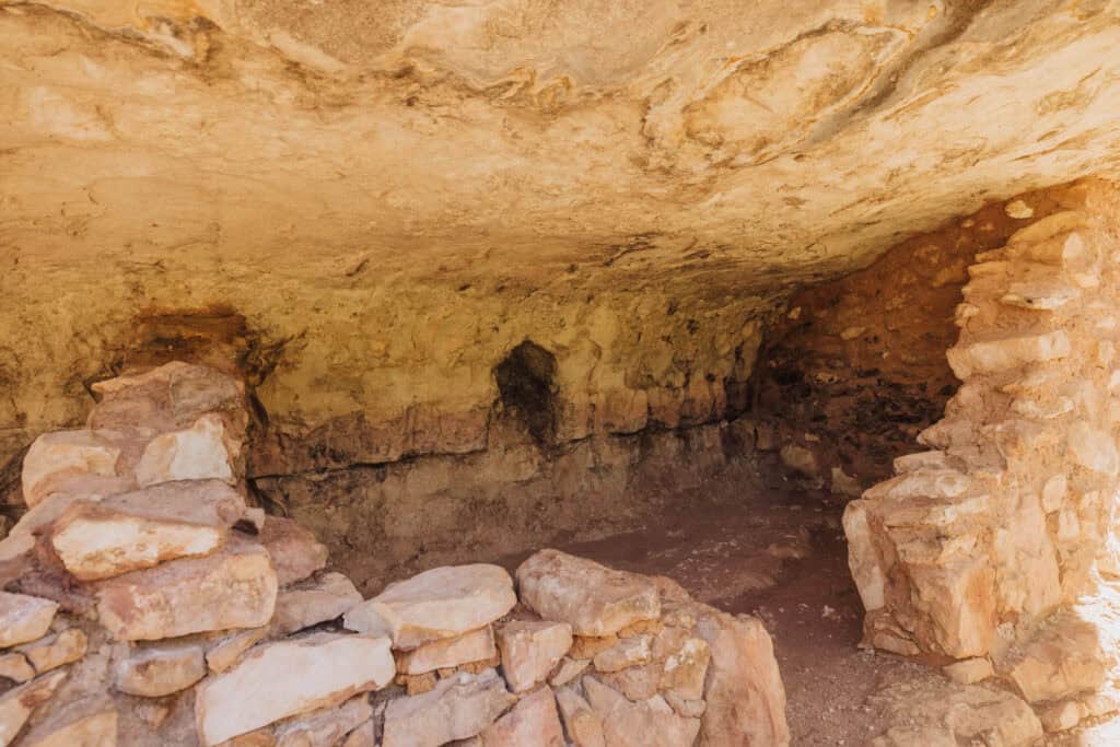
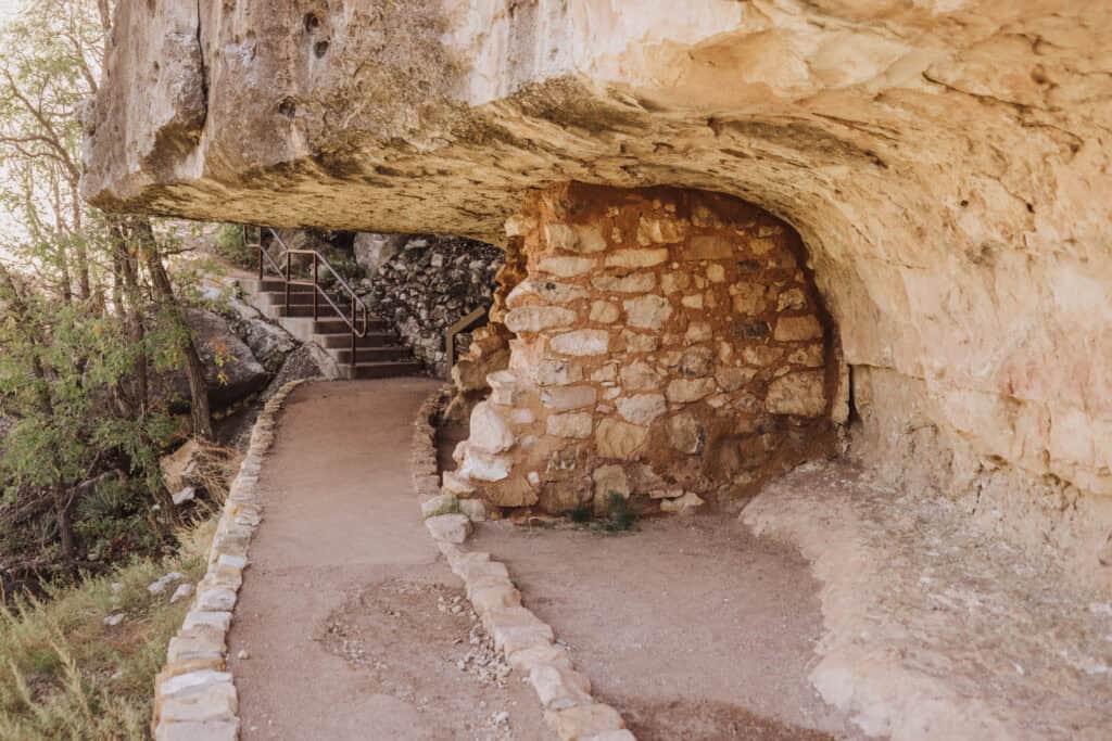
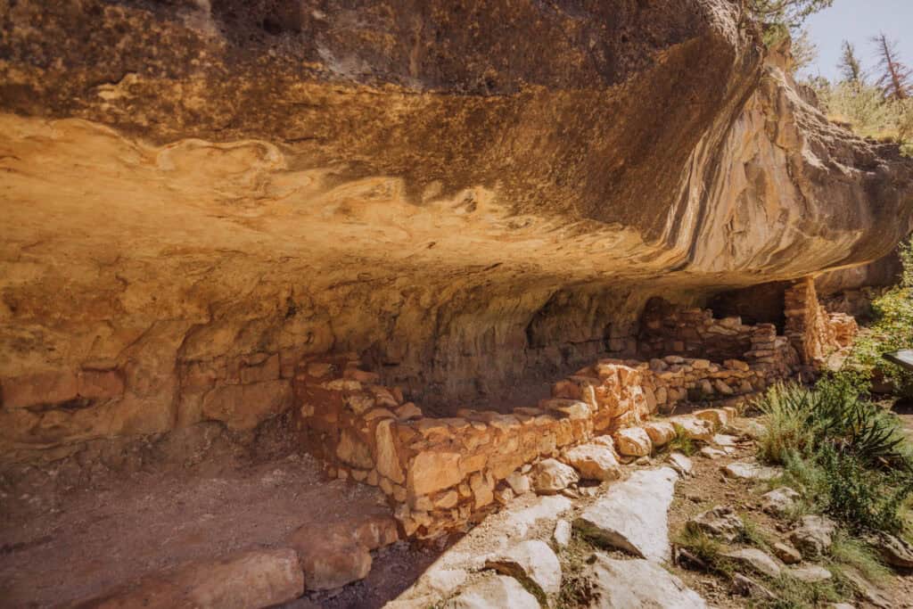
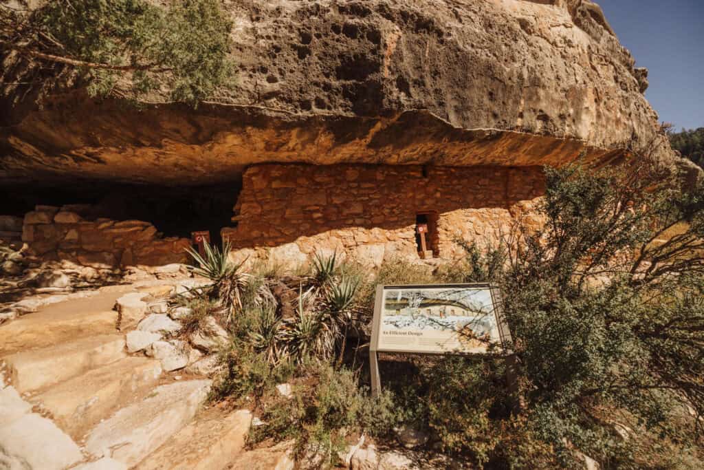
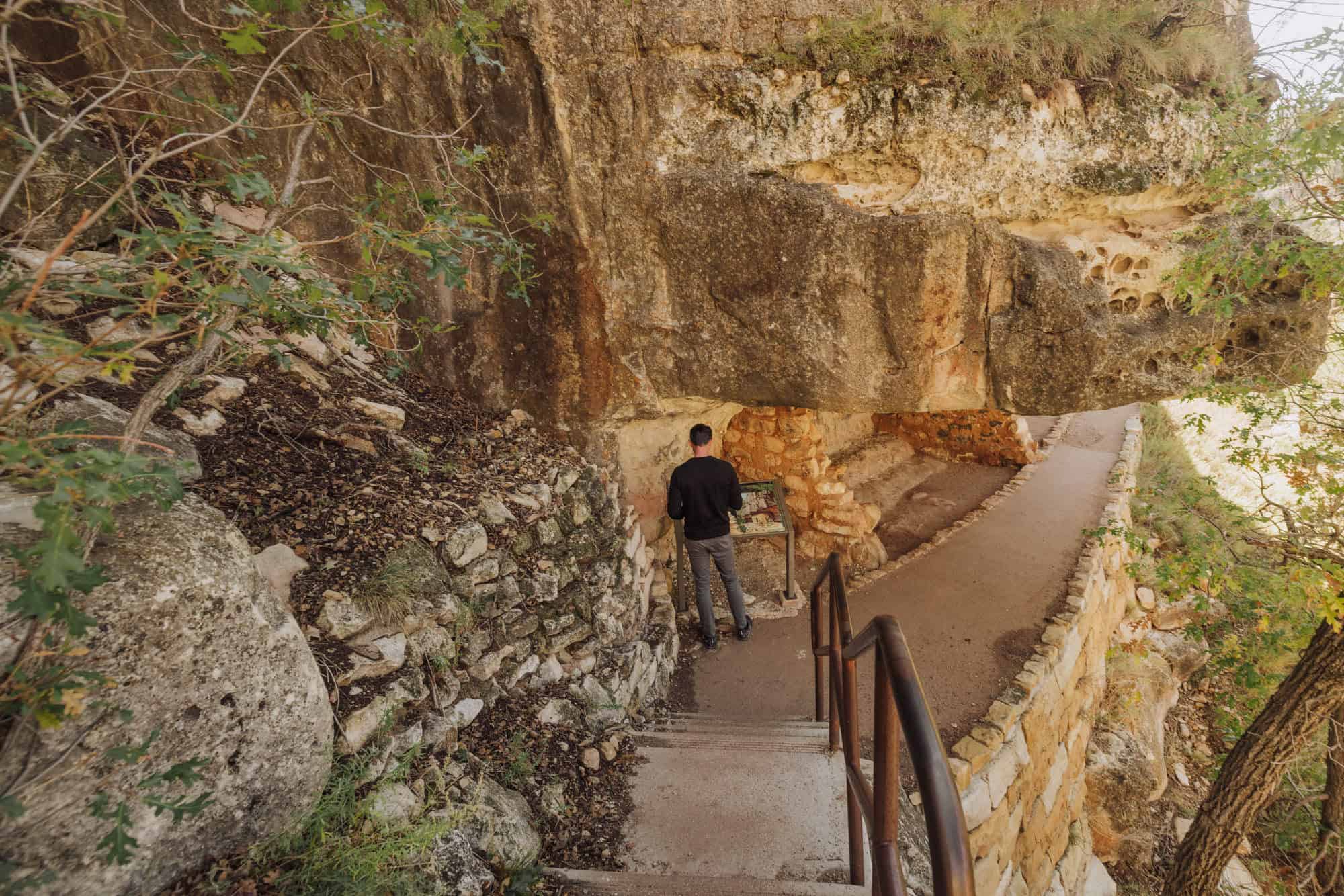
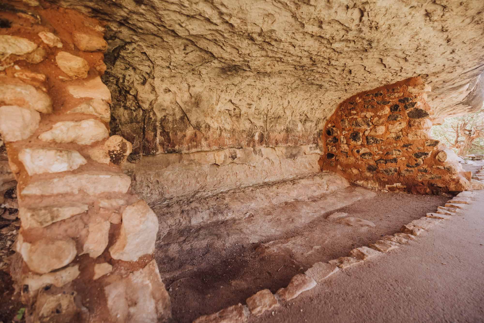
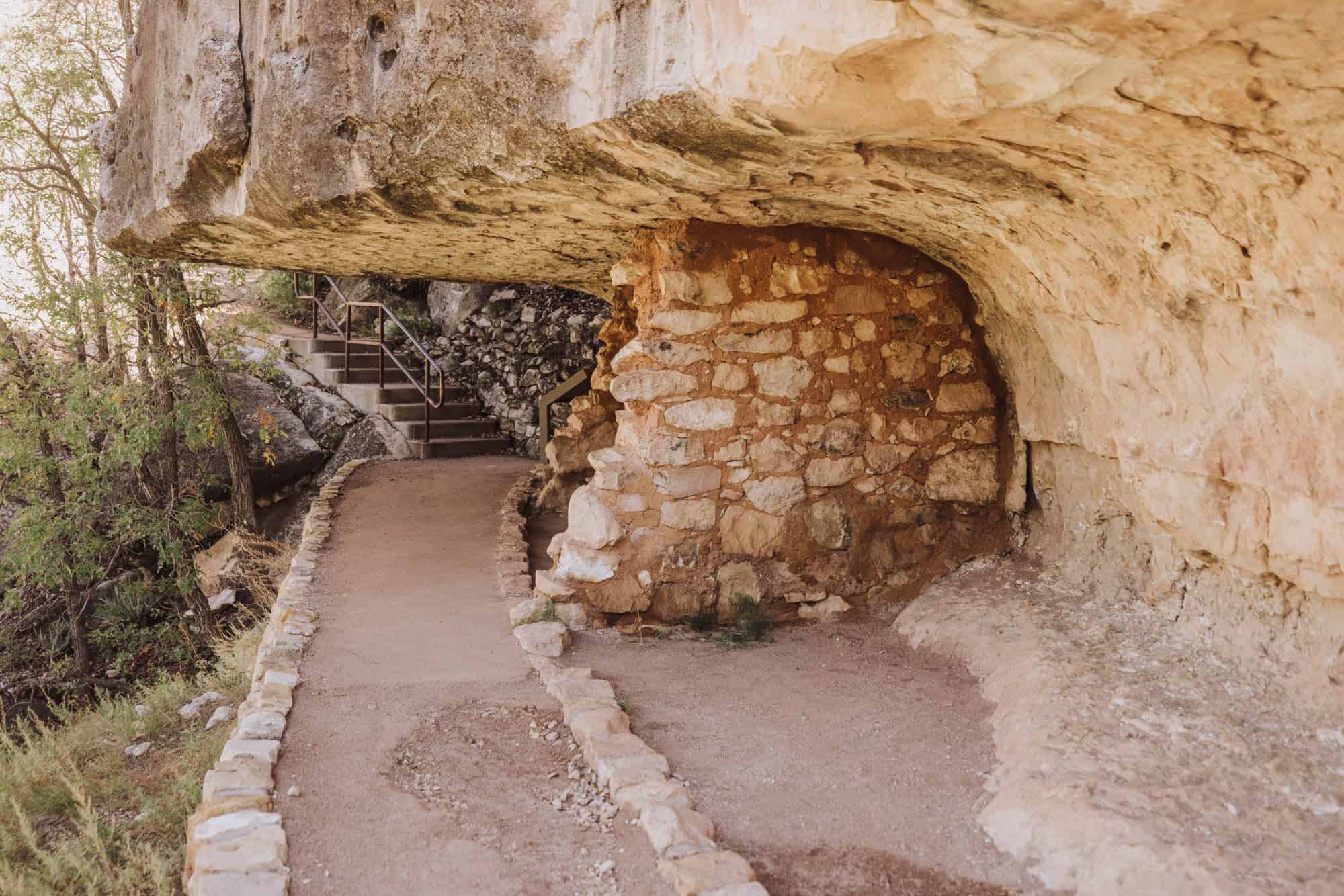
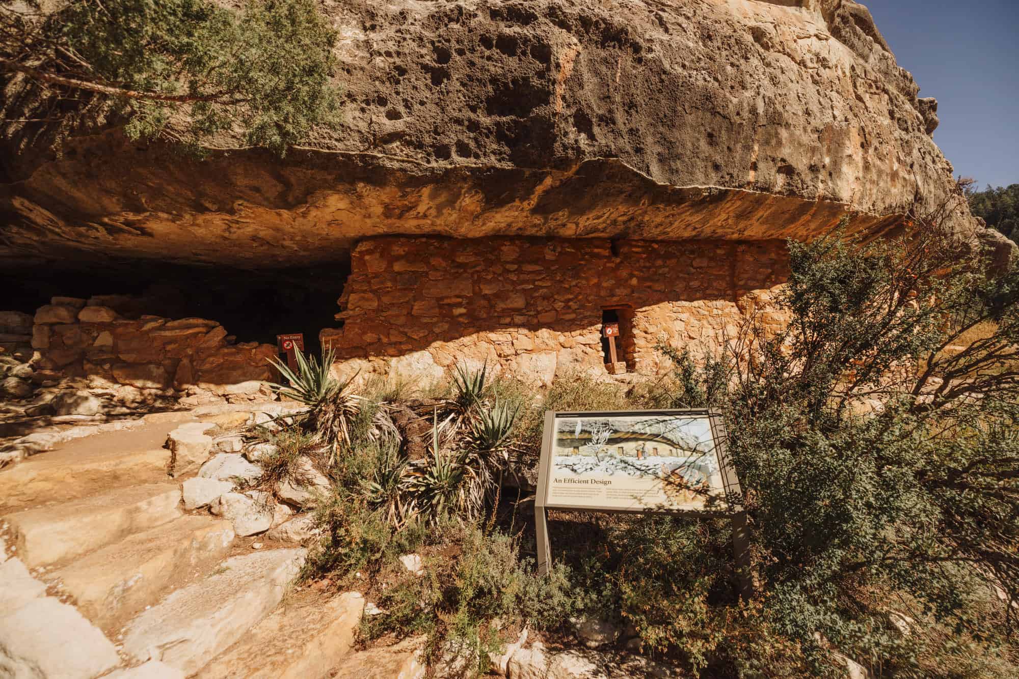
You’ll be amazed by the cliff dwellings, carved into the steep walls of Walnut Canyon. They were built in natural alcoves in the rock, using limestone blocks for walls.
The front doors led to narrow paths and overlooked the canyon below.
The Sinagua people lived in the region from about 1125 to 1250 AD. They cultivated corn, beans, and squash on the canyon’s rim and relied on the canyon itself for water.
Life here was a team effort. Neighbors worked together to haul water, hunt, farm, and gather plants. They shared resources, supported one another, and maintained close communication via a network of paths connecting the dwellings.
By 1250, environmental challenges led them to relocate to larger communities.
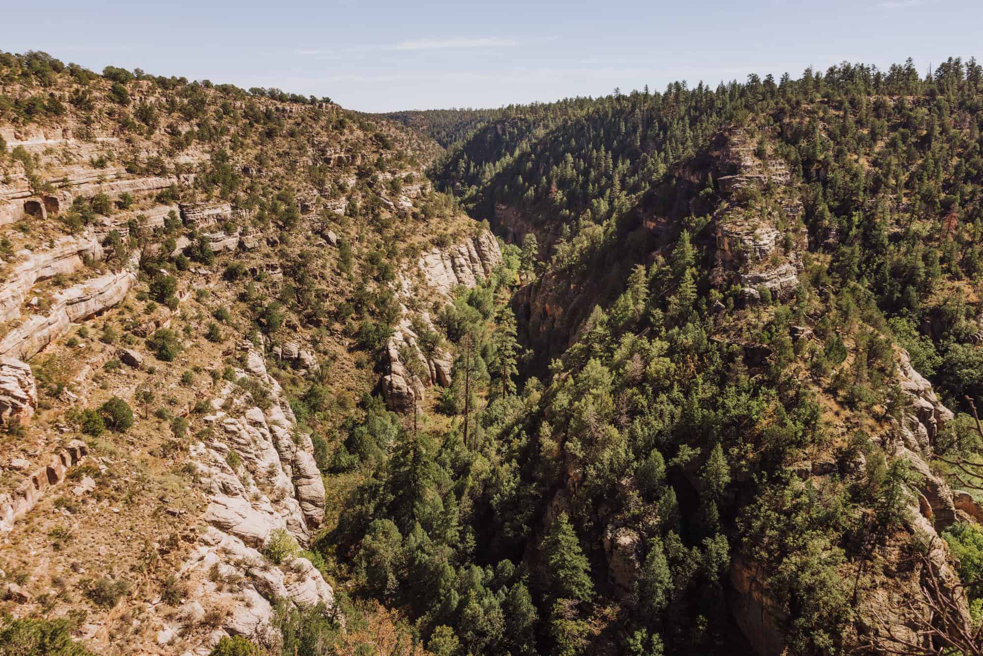
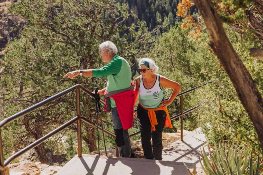
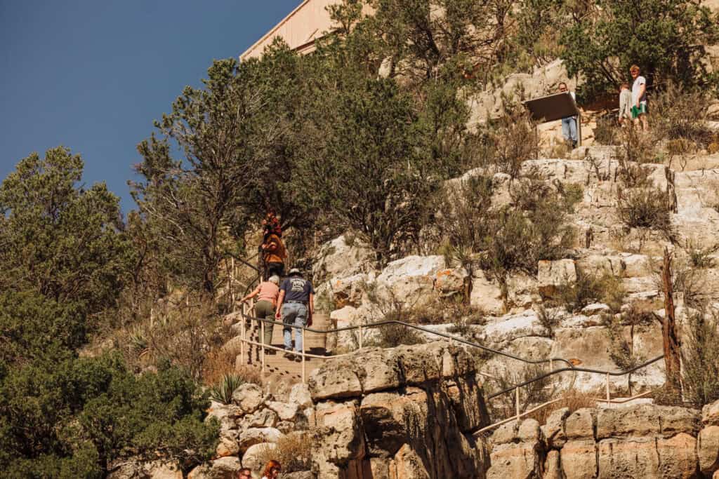
Hike Down into Walnut Canyon
You have two options to explore Walnut Canyon National Monument:
- A scenic overlook trail along the rim, which is suitable and accessible to all ages and abilities… OR…
- A steep walk down steps into the canyon, where you can get a much better sense of the ancient civilization.
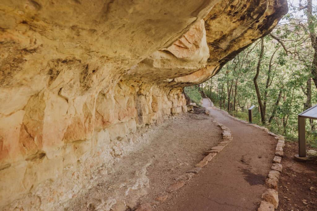
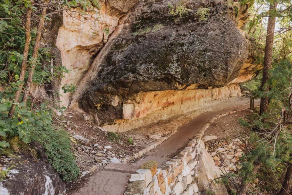
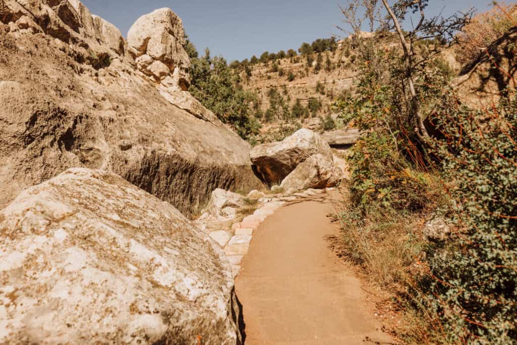
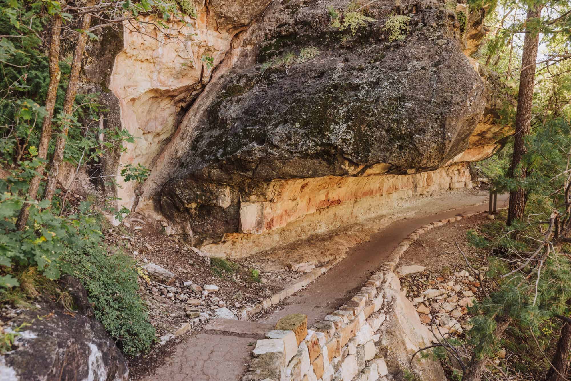
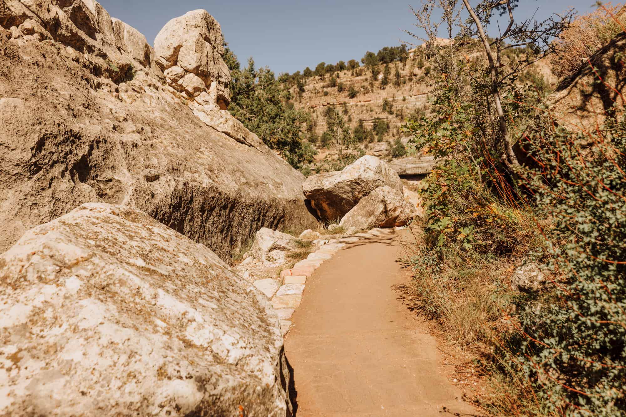
The Island Trail
It’s steep, but well worth the hike down!
- 1-mile loop trail
- Drops 185 vertical feet into the canyon
- 273 stairs down to the trail and dwellings
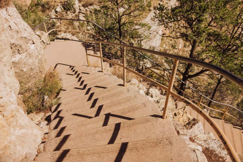
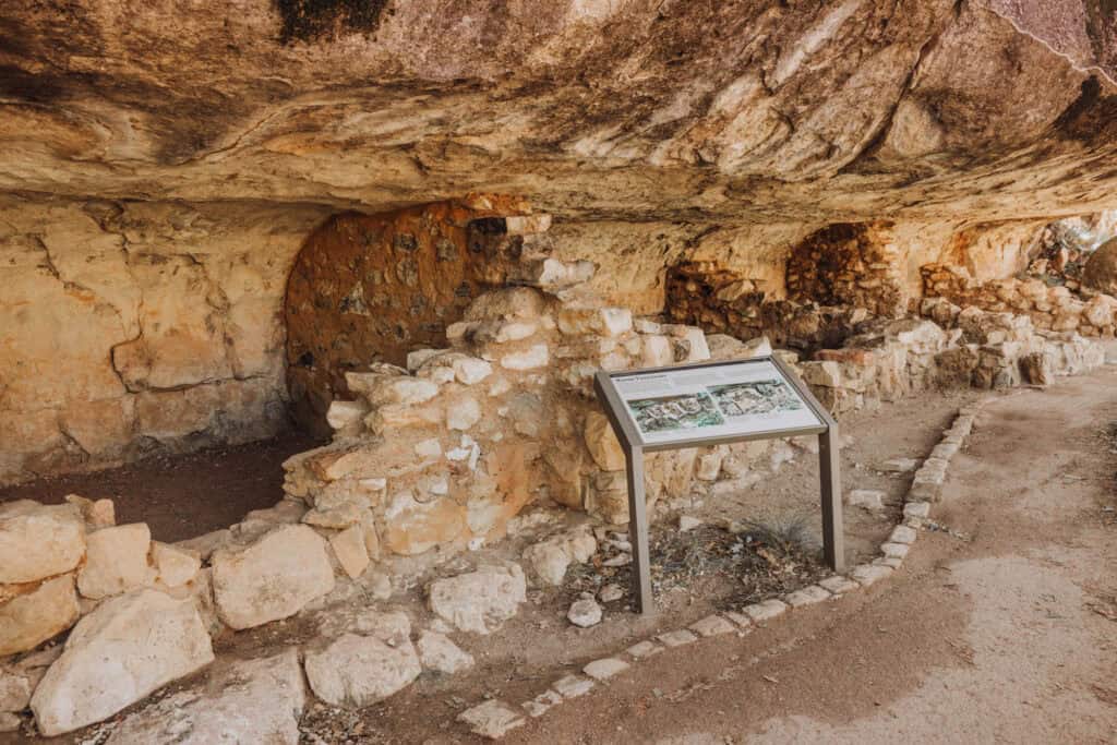
The trail follows the edge of the cliffs, in front of the ancient cave dwellings. In the narrow areas, there are handrails for safety.
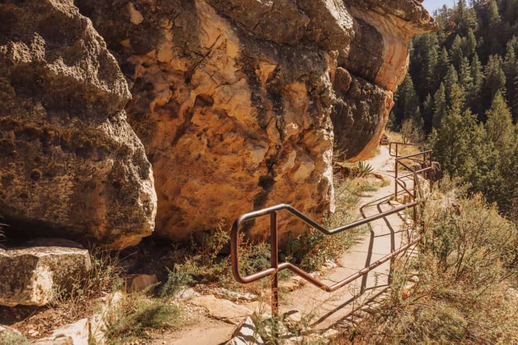
The dwellings along the public trail have been stabilized and patched in modern times. They also include the original mortar, still holding in the walls.
Many of these rooms weren’t for people. They stored food, water, and tools.
People likely gathered snowmelt in the spring and relied on shaded pools during drier months. It’s likely they kept a 100-day supply of water. In addition to packing snow into large pots and collecting runoff during storms, women would hike down to the creek below to haul water back up to the caves.
The Rim Trail
The Rim Trail is a short, easy trail that runs along the ledge of the canyon. It provides stunning views of the canyon from an easily-accessible, paved path. It runs less than one mile.
More on Visiting Walnut Canyon Today
Here are a few more things to keep in mind if you’re planning a visit:
Trail Access
The last hikers are allowed down to the Island Trail at 4:00pm. Visitors should start the upper Rim Trail no later than 4:30pm, to be back by the time the gates close to the park at 5:00pm.
Consider the Elevation
Walnut Canyon National Monument’s elevation is 7,000 feet. If you’re not used to it, climbing the stairs on the Island Trail will be tough.
Consider the Weather
The Flagstaff area gets quite a bit of snow in the winter. The I-40 is notorious for snow and ice-related crashes.
Cell Service
There’s limited, spotty cellphone service at this national monument, and zero signal at all in many spots.
Dogs at Walnut Canyon
Leashed pets are allowed in the parking lot and along the Rim Trail.
Keep in mind: even in Northern Arizona, the heat is intense in the summer, so don’t leave pets in vehicles.
Holidays
Walnut Canyon is usually closed on Christmas and New Year’s Day, with limited hours on Thanksgiving.
Video: Visiting Walnut Canyon National Monument
How Walnut Canyon Got its Name
The Arizona walnut tree once thrived along the canyon’s floor, giving Walnut Canyon and Walnut Creek their names. These trees provided nuts that were a staple in the diet of ancient inhabitants.
While upstream dams have reduced the number of walnut trees today, you can still spot them in the canyon today along the steep trails.
Looters Destroyed & Defaced the Dwellings
Sadly, many of Walnut Canyon’s dwellings were damaged by looters in the late 1800s. Souvenir hunters brought shovels and hauled away loads of artifacts from the ancient site.
They took pottery, tools, and other items crafted by the Sinagua people.
Digging around, they dismantled parts of the cliff dwellings, defacing the walls and destroying rooms altogether.
Despite the damage, much of the site remains intact today.
Creating Walnut Canyon National Monument
Outraged by the looting and damage, people living nearby lobbied for federal protection. In 1915, President Woodrow Wilson established Walnut Canyon National Monument, ensuring its preservation for generations.
During the Great Depression, the Civilian Conservation Corps (CCC) helped shape Walnut Canyon into what we see today. Between 1938 and 1942, young men from the nearby Mount Elden Camp built trails, stabilized archaeological sites, and created modern amenities like roads, restrooms, and a visitor center.
Photos of Walnut Canyon National Monument


Other Sites to See in Arizona
Farther east on the I-40, Winslow, Arizona, is a throwback to the glory days of historic Route 66.
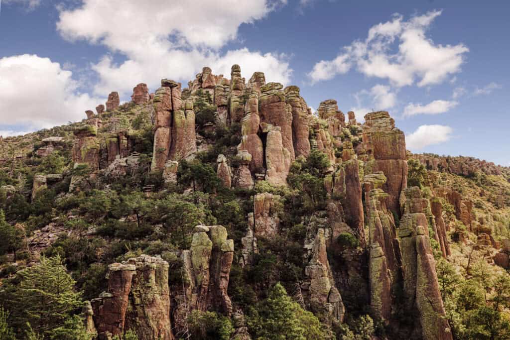
Northern Arizona is also home to Petrified Forest National Park, which is one of three national parks in the state. The other two are the Grand Canyon and Saguaro National Park (near Tucson). Chiricahua National Monument, also in Southern Arizona, is likely to become a national park in the future (photo below).
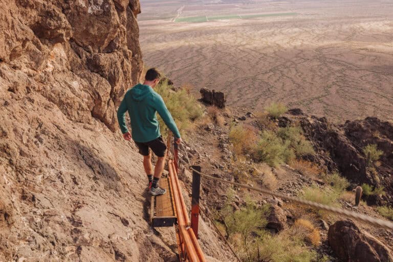
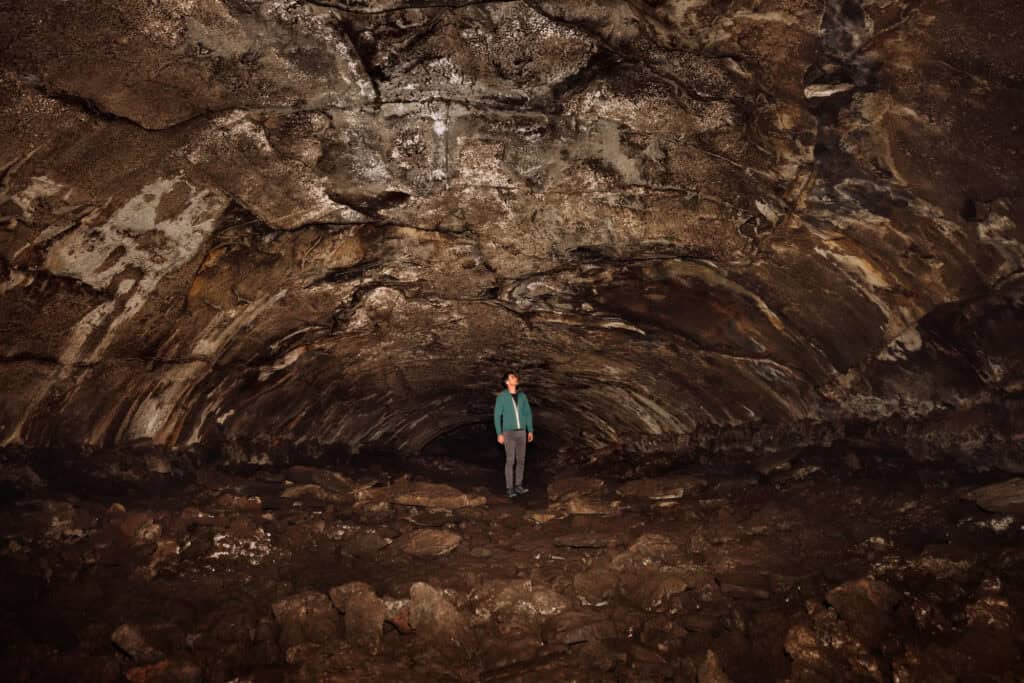
Down the I-40 from Meteor Crater, you’ll find Walnut Canyon National Monument on the way to Flagstaff. The city is home to a wide array of attractions from the famous Lowell Observatory to underground Lava Tubes (photo below) to Snowbowl Ski Resort.
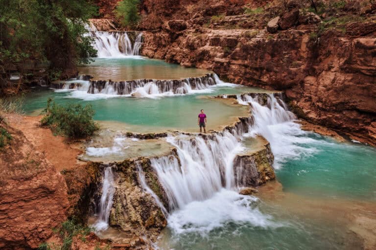
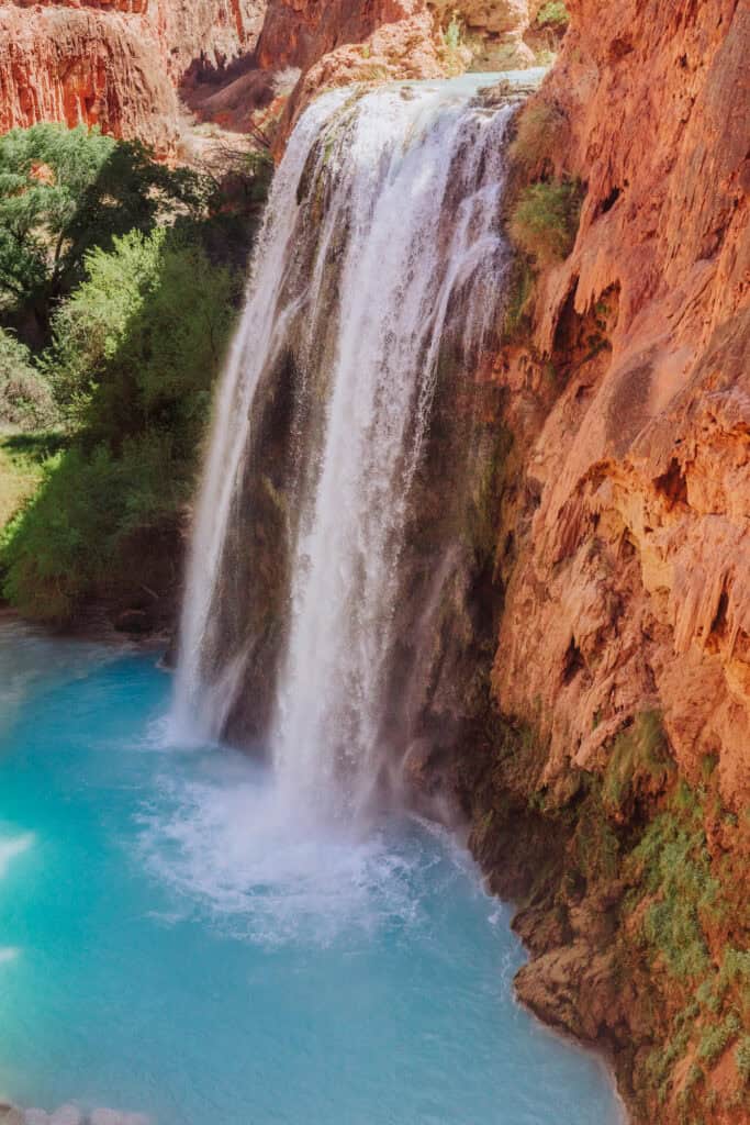
Hikers heading to Arizona can explore trails at Piestewa Peak and Camelback Mountain in Phoenix, Devil’s Bridge in Sedona, Picacho Peak near Tucson, the beautiful sites around Page, and the oasis at the bottom of the Grand Canyon: Havasupai Falls (photo below).
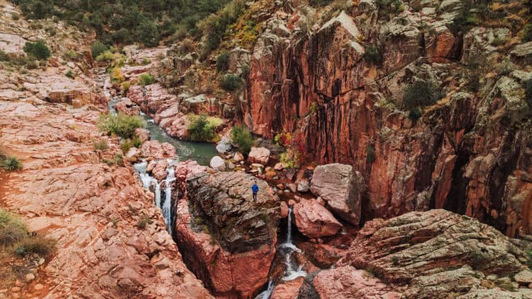
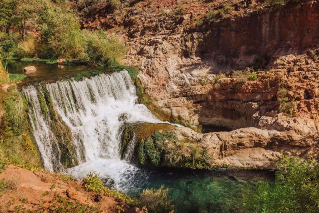
Arizona is also home to unique geological features, like the underground Kartchner Caverns, Fossil Springs (photo below), and the world’s largest travertine bridge: Tonto Natural Bridge.
Visitors looking for more relaxed trips to Arizona might enjoy the wineries around Sonoita and Elgin, like Dos Cabezas and Los Milics.
If you’re looking for Wild West history, check out the mining town of Bisbee (photo below), which is near Lowell and Tombstone.