22 Waterfalls in Arizona: A Guide to the Hikes, Permits, and Hidden Gems


Everyone knows Arizona for its red rocks, desert scenery, and canyons.
Tucked away in the same dry, sun-baked state, you’ll find a surprising number of waterfalls, some of which are a lot easier to reach than others.
A word of caution before you start planning a trip to visit Arizona waterfalls:
- Social media tends to get the details wrong on a lot of these spots.
- Some need permits.
- Some only run part of the year.
- A couple Arizona waterfalls are now completely inaccessible.
PAYSON AREA WATERFALLS
Fossil Springs
If I had to pick my favorite Arizona destinations (waterfall or otherwise) Fossil Springs would be in the top 10.
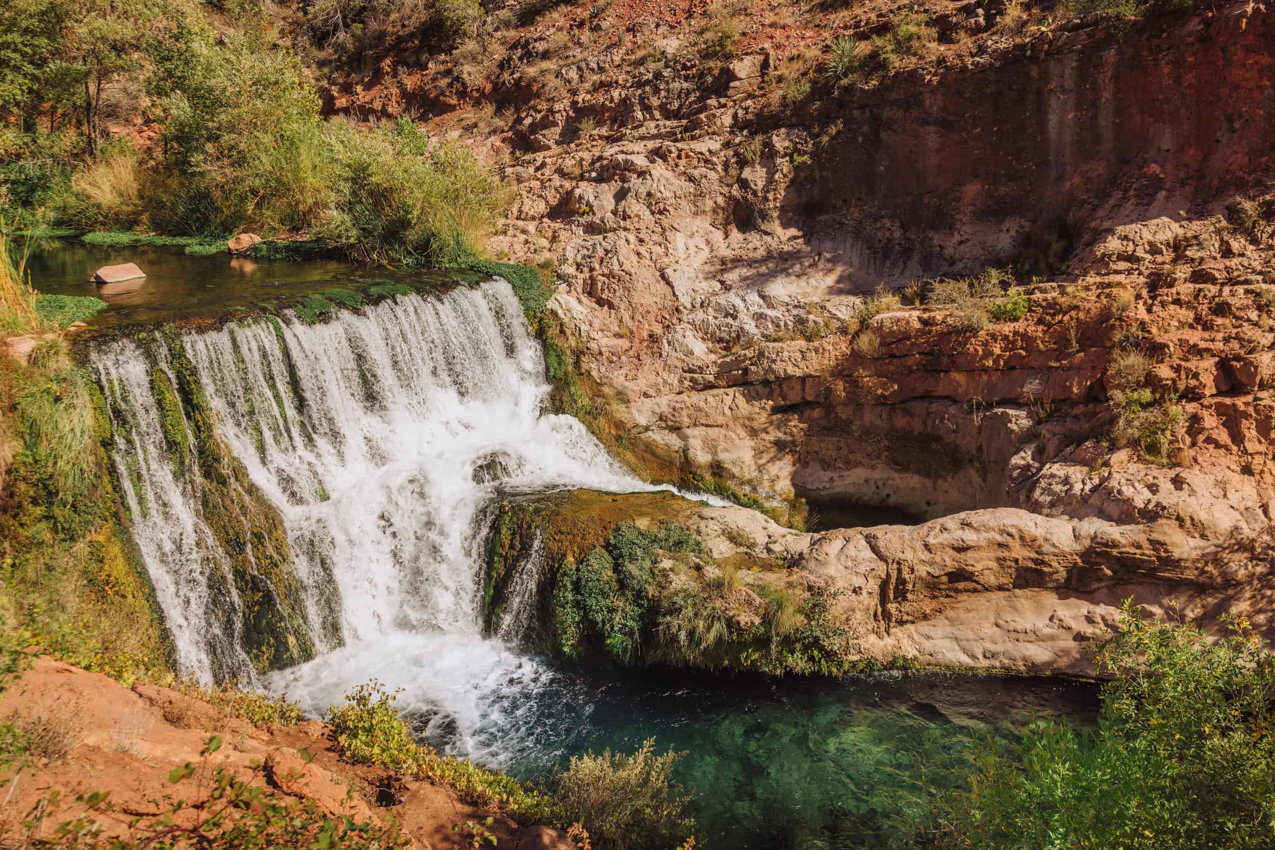
Crystal clear water plunges from a cliff into a beautiful swimming hole below.
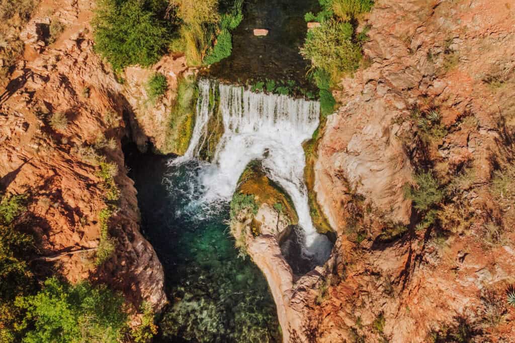
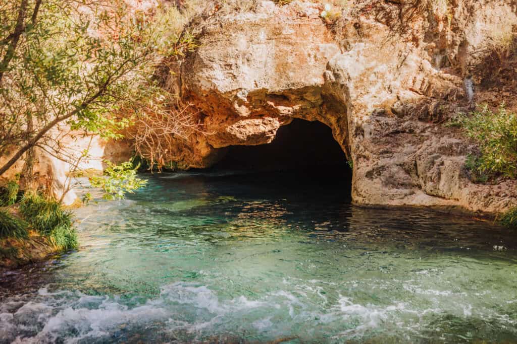
It requires a challenging hike from the Bob Bear Trailhead near Payson, which leads to a gorgeous waterfall, a spring-fed creek, and a small hidden cave you can actually swim into.
The hike is about 10 miles round trip, and because you’re heading straight downhill on the way in and straight back uphill on the way out, it earns its “difficult” rating.
There’s not much shade along the way either, so summer hikers should plan accordingly.
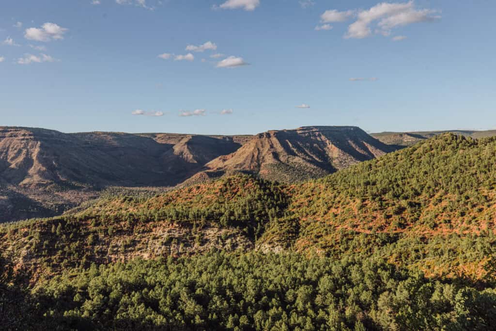
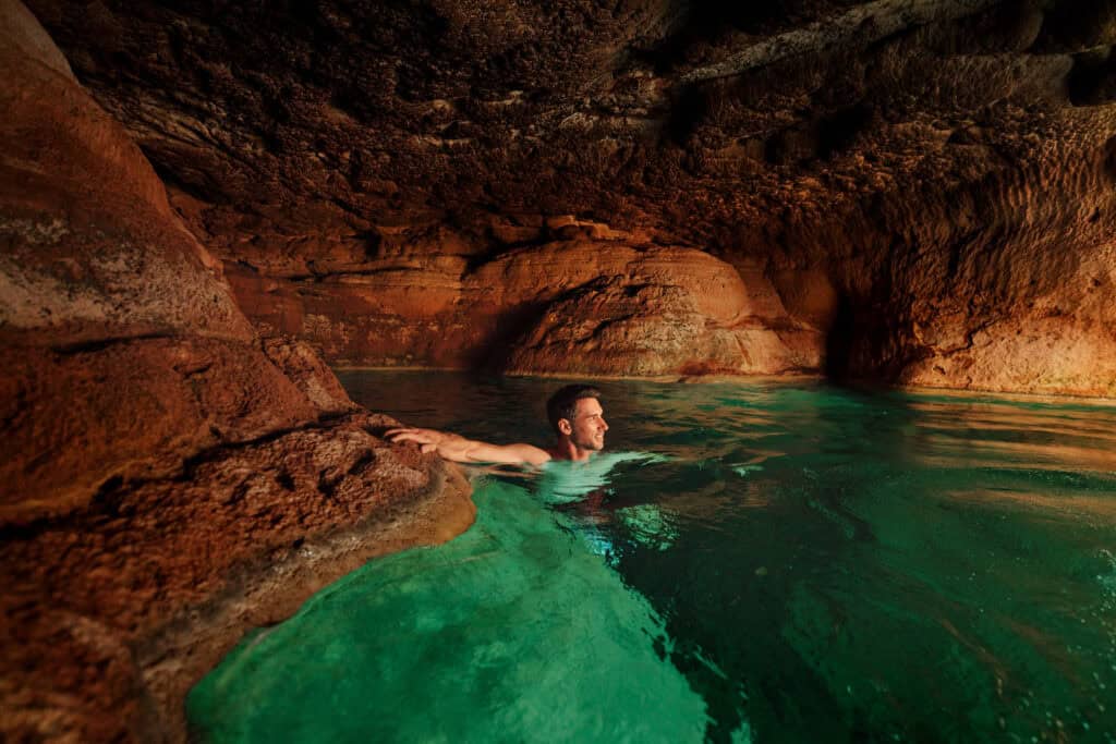
The reward is worth the grind, though. Below the main falls, you can swim into a cave where sunlight bounces off the travertine and creates an almost iridescent glow.
A permit is required for visits between April and September, and they can be hard to come by. My favorite time to visit is on a warm day in early October or late March, when permits aren’t an issue!
Important: bring more water than you think you’ll need, and save more than half of it for the challenging hike out.
- Click Here: Full post on Fossil Springs permits and hiking.
- Location: Near Strawberry, AZ (a 2-hour drive from Phoenix)
- Cost: Small fee, assuming you can snag a permit through recreation.gov
- Parking: Bob Bear Trailhead, roughly 30 minutes northwest of Payson
- Hiking Distance: 10 miles round trip (rated ‘difficult’)
- Warning: Reserve more than half of your water for the steep hike out.
- Heads up: Cell service is unreliable or nonexistent along most of the trail
Tonto Natural Bridge (Two Waterfalls in One Stop)
This state park near Payson is home to what’s believed to be the largest natural travertine bridge on Earth. It’s home to two waterfalls.
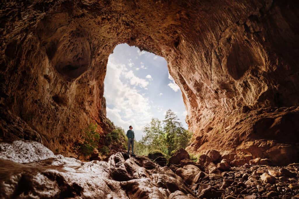
The main falls sit right under the bridge itself. A second one is tucked up a side trail. Both involve misty trickles of water, rather than raging cascades. Still, this is a great spot to visit, and a great day trip from the Phoenix area
To reach the main falls, the Gowan Trail takes you down a steep, occasionally slick route into Pine Creek, ending at a waterfall fed by springs above.
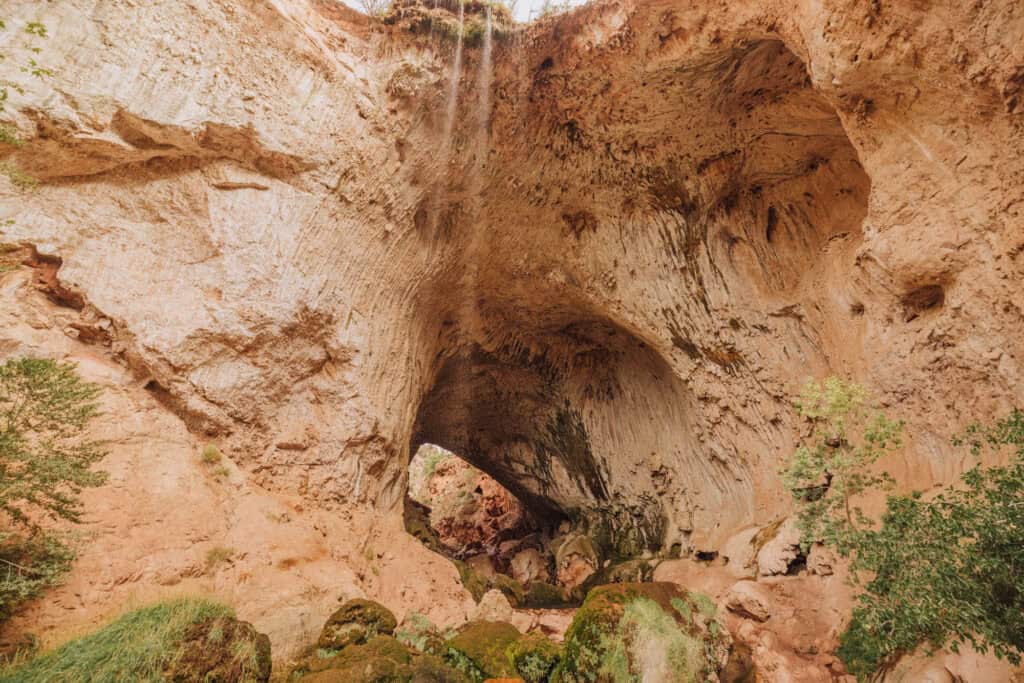
The bridge itself towers 183 feet high, with a tunnel that stretches 150 feet wide.
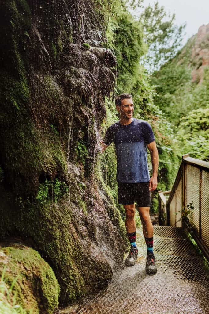
For the second waterfall, follow the appropriately named Waterfall Trail about 300 steps down into a mossy, green grotto.
- Click Here: Full post on visiting Tonto Natural Bridge
- Location: Tonto Natural Bridge State Park, near Payson, AZ
- Cost: $10 for adults, $5 for kids
- Trail Parking: Large lots on-site (opens daily at 9:00am)
- Heads up: Rescues happen often here due to slick rocks near the bridge
Water Wheel Falls
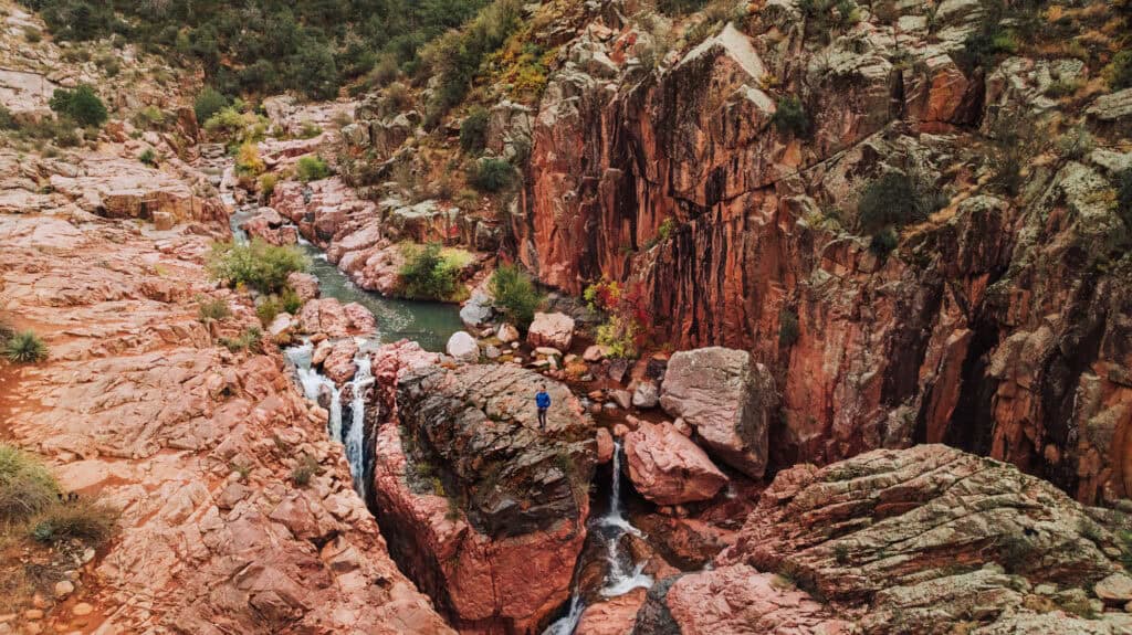
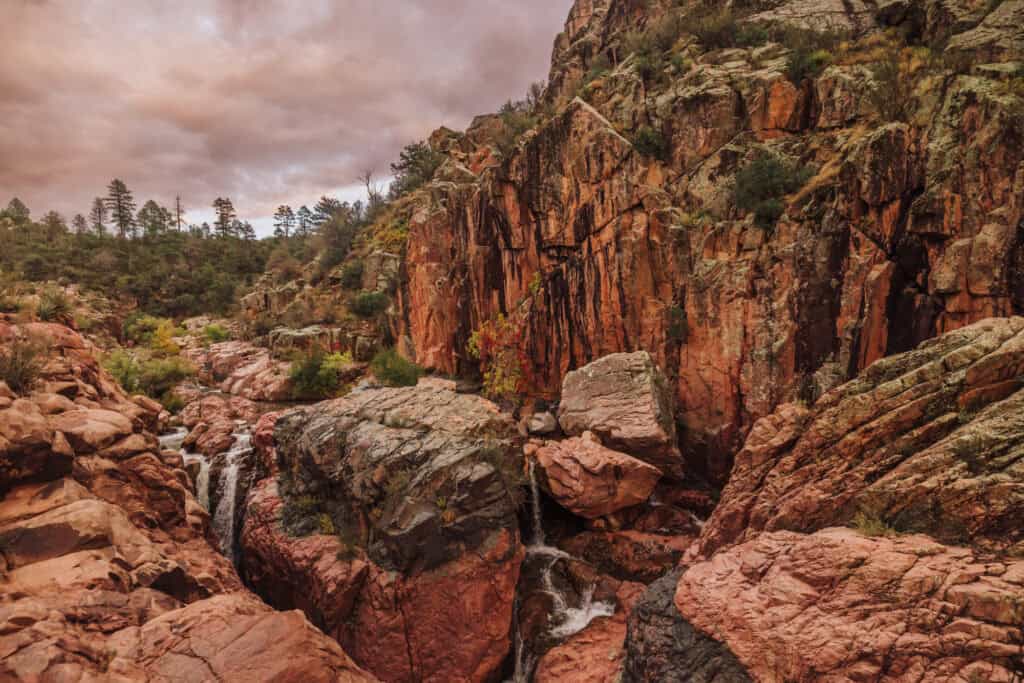
Tucked into the Tonto National Forest near Payson, Water Wheel Falls is a great pick for families. The trail leads to a run of cascades and swimming holes that’s easy enough for most hikers to handle.
Heads up on parking: the lot only fits 40 vehicles, and it fills up fast on busy summer weekends. The trailhead sits at the north end of the lot and follows Ellison Creek upstream from there.
Keep in mind: rescue teams get called out here fairly often for hikers who twist or injure an ankle on the rocks.
- Click Here: Full post on visiting Water Wheel Falls
- Location: 10 miles north of Payson
- Cost: $8 day pass, available for purchase along the road
- Trailhead Parking: Houston Mesa Rd. lot — fills up on busy summer days
- Hiking Distance: About 1.5 miles
- Heads up: Limited parking, and no cell service on the trail
NORTHERN ARIZONA WATERFALLS
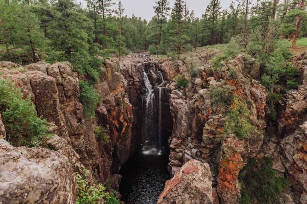
Sycamore Falls
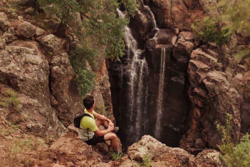
This one’s up in Northern Arizona, and it’s about as low-effort as waterfall hikes get. It’s about a mile through the forest, and pretty easy.
Just know: Sycamore Falls is somewhat seasonal.
After a dry spell, you might find nothing more than a trickle. After a good storm or a solid snowmelt, though, it can really roar.
Also, keep in mind: you’ll be on rough US Forest Service roads, which can close if it gets too snowy or muddy.
There’s a campground nearby for overnight stays.
- Location: Near Williams, AZ
- Cost: Free (no permits or reservations needed)
- Trailhead Parking: Small lot, about 50 minutes from Flagstaff
- Hiking Distance: Roughly 2 miles round trip
Fossil Creek
Fossil Creek and Fossil Springs are easily confused. They’re on the same waterway, but the entrance and trailheads are different, and frankly- the experience is completely different.
Fossil Creek leads to a different waterfall and swimming hole. The hike is mostly flat, and much easier for families.
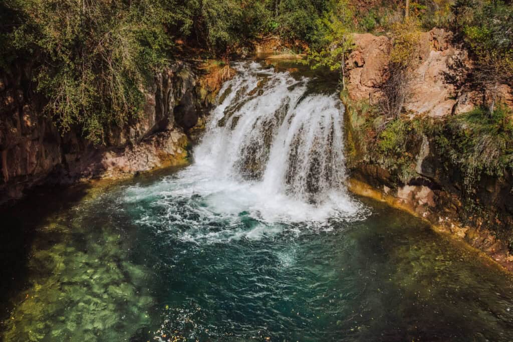
The Fossil Creek trail still follows a clear, cold creek up to a nice waterfall — just don’t expect the same drama as Fossil Springs. It’s an easier hike overall, and you’ll access the parking lots through Camp Verde rather than Strawberry.
Between April and September, you’ll need a reserved parking permit, and the lots fill up quickly in summer.
- Click Here: Complete post on Fossil Creek’s permits and hike
- Location: Camp Verde, AZ
- Cost: $6 per car, plus a parking reservation through recreation.gov
- Trailhead Parking: 8 designated lots
- Hiking Distance: Varies by lot — the Dixon Lewis Lot is closest, just over a mile from the falls
- Heads up: Getting there means a 15-mile drive on a rough dirt road
Ribbon Falls (Grand Canyon)
Ribbon Falls is the showstopper of the North Kaibab Trail inside the Grand Canyon.
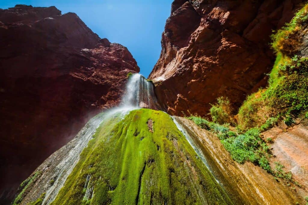
Water drops roughly 100 feet onto a travertine dome covered in moss.
From the North Rim, plan on about 17 miles round trip with roughly 4,500 feet of elevation change. Most people break it into an overnight trip, hiking in, camping, then hiking back out the next day.
Parking is available at the North Kaibab Trailhead Lot, a free area on Highway 67. It fills up often, so roadside parking becomes the backup. There’s additional parking at the Backcountry Information Center.
Always check current conditions before heading out, since the North Rim shuts down for several months each winter.
- Location: Grand Canyon National Park, off the North Kaibab Trail below the North Rim
- Cost: Grand Canyon entrance fee, plus a backcountry permit if camping
- Parking: Grand Canyon’s North Rim
- Hiking Distance: About 17 miles round trip from the North Rim
- Heads up: This is a demanding, remote hike with major elevation change, little shade, and creek crossings.
Grand Falls (Chocolate Falls)
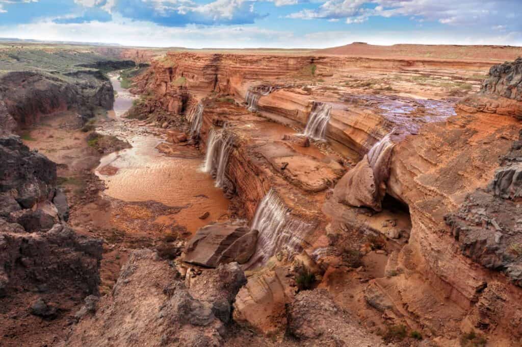
Grand Falls, better known locally as Chocolate Falls, is currently closed to the public.
Located on Navajo Nation land north of Flagstaff, it transforms dry cliffs into a thundering waterfall that can rival Niagara Falls… especially during spring snowmelt or right after a big monsoon.
Unfortunately, its popularity got out of hand a few years back, and the mess visitors left behind led the tribe to shut off public access.
- Location: About 30 miles northeast of Flagstaff, on Navajo Nation land near Leupp
- Visiting: Legal access now requires being escorted by someone with land rights.
HAVASUPAI WATERFALLS
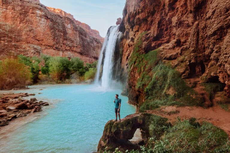
Havasupai Falls is the most visually stunning part of Arizona.
Getting there requires a permit, an overnight camping stay, and a long trek through desert canyon terrain.
Key things to keep in mind about Havasupai Falls:
- It’s a series of waterfalls along Havasu Creek, on Havasupai tribal land in the Grand Canyon.
- It’s not a day trip in any way.
- A permit is required ($450 for 4 days/3 nights).
- The hike from the trailhead is about 10 miles to the campground.
- While a helicopter makes the flight, it’s never guaranteed.
I’ve written a whole series of posts covering Havasu Falls and the rest of the falls along Havasu Creek on the Havasupai Reservation if you want the full breakdown:
Let’s go through a few of the waterfalls at Havasupai
Havasu Falls
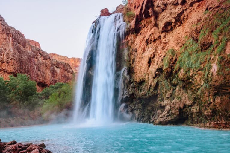
Havasu might be the most iconic waterfall along Havasu Creek.
Havasu Falls is about a 10 mile hike from the trailhead, and about 2 miles from the village of Supai.
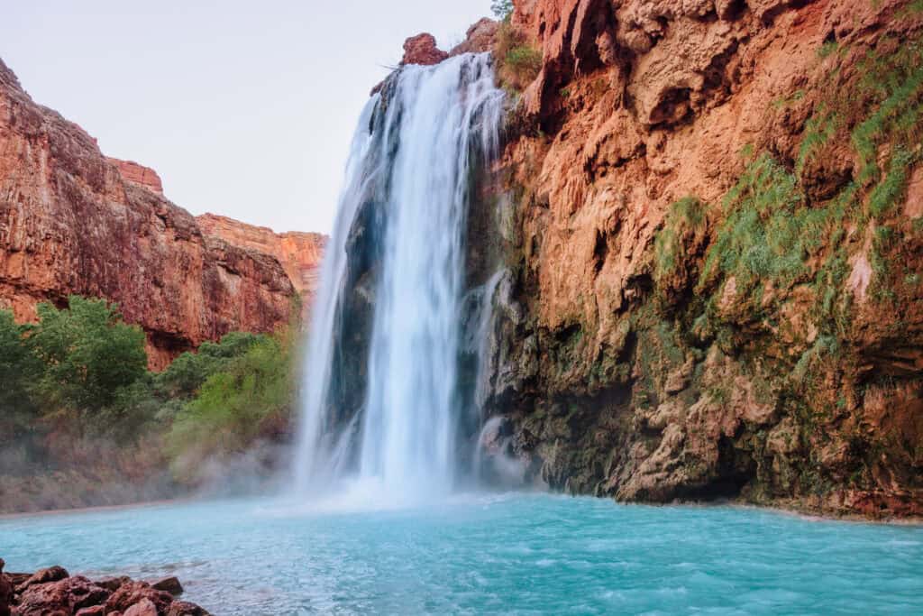
At the top, you’ll often find an Indian taco stand (a favorite among the campers).
At the base of the falls is a large picnic beach area, with a swimming hole that turns back into the flowing Havasu Creek.
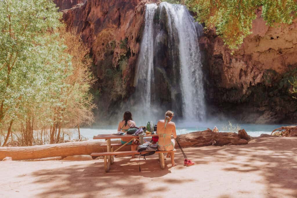
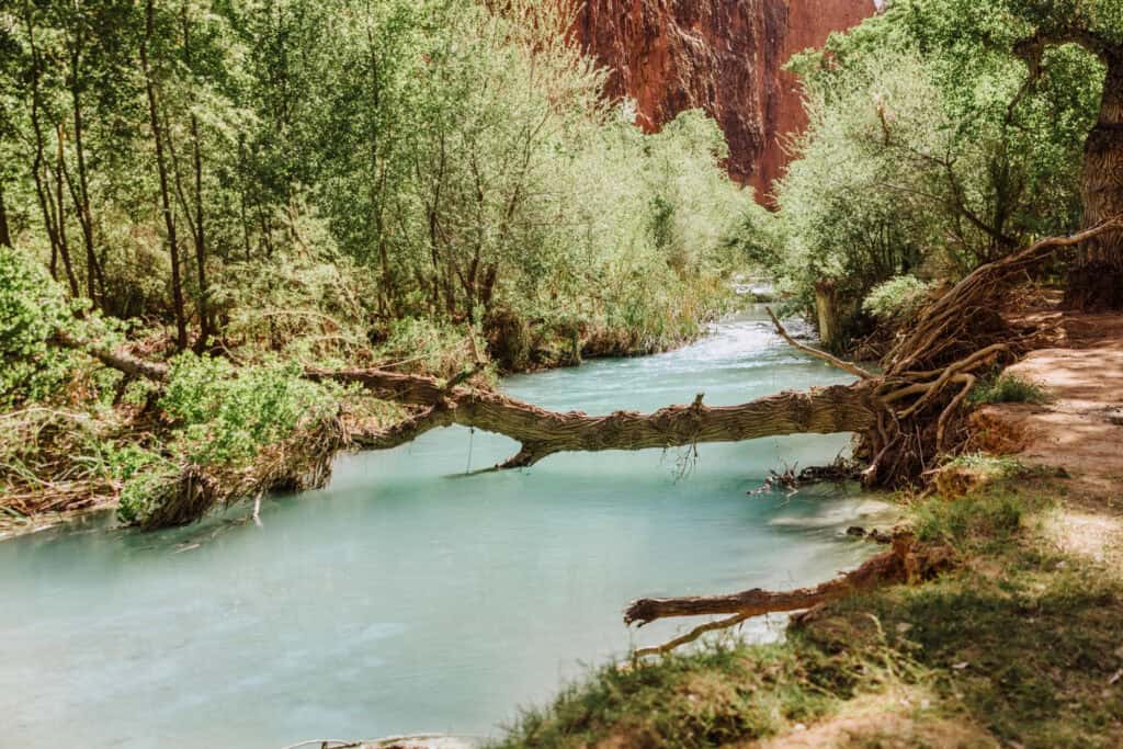
The beautiful blue water runs along the campsites, through the mile-long Havasupai Campground.
Mooney Falls
Mooney is the tallest of the Havasu Creek waterfalls, and known for its (terrifying to some) descent to reach the bottom.
- Click Here: Full post on the descent down Mooney
- Click Here: Full post on Mooney Falls, history, etc.
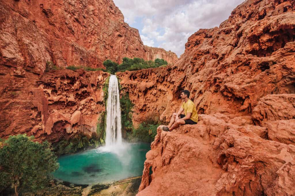
You’ll find it about 3 miles past the village of Supai, right at the edge of the Havasupai Campground.
While the view from above is stunning, most people venture down to the base of Mooney Falls.
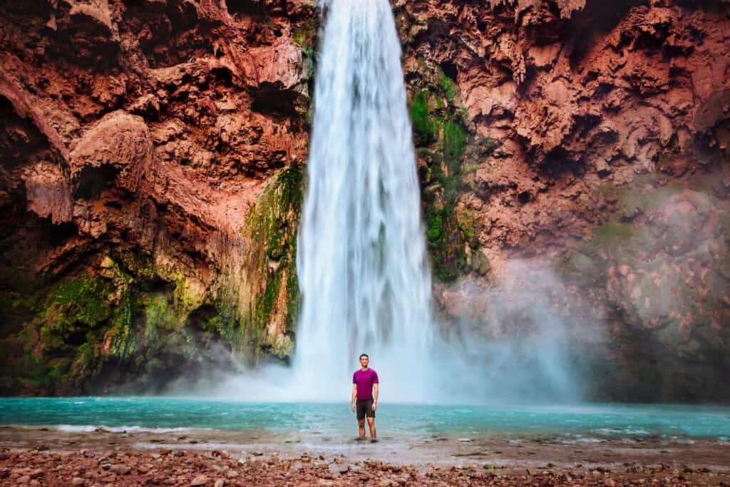
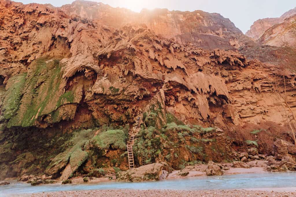
The pathway down involves a rock tunnel followed by a series of wooden ladders and carved rock steps. It’s not for the faint of heart if you’re uneasy with heights, but pushing through and hanging onto the chains bolted into the rocks pays off once you’re standing at the base.
Little Navajo Falls
Little Navajo is one of the “newer” additions to Havasu Creek’s lineup of waterfalls.
A 2008 flood reshaped Havasu Creek’s path, carving out this new waterfall and swimming hole in the process.
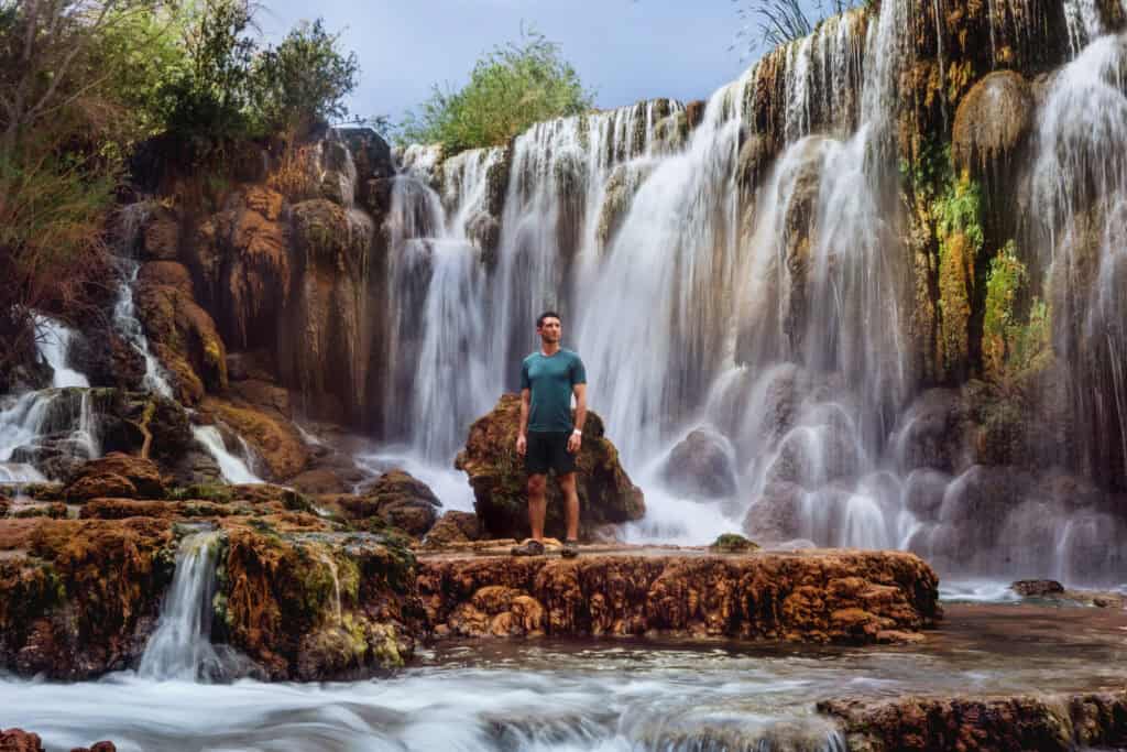
Little Navajo is the first waterfall hikers reach after leaving the village of Supai on the way to the campground.
It doesn’t have the same fame or striking blue water as Havasu or Mooney, which makes it a much quieter place to spend a few hours.
50 Foot Falls
This used to be one of my favorite spots at Havasupai … emphasis on used to, since a 2024 flood rerouted Havasu Creek away from this site entirely.
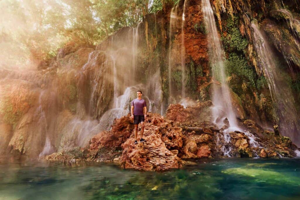
Reaching it meant hiking down an unmarked path and through a marsh, but it was always worth the effort. There’s a chance the creek could shift back over these cliffs and someday bring Fifty Foot Falls back to life.
Beaver Falls
Beaver Falls is a true oasis on the Havasupai Reservation, just overshadowed by its more Instagram-famous upstream neighbor, Havasu Falls.
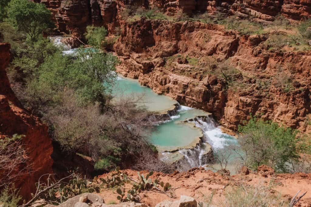
Travertine shelves create swimming holes and falls through a large section of the canyon. It’s absolutely gorgeous!
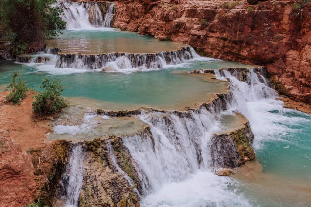
It takes some extra effort to reach, but it might be home to the most unique swimming hole in the entire state. This isn’t a trip you can do from anywhere except the Havasupai Campground itself.
While a lot of people take a day trip to Beaver Falls from the campground, it’s so spread out that the area never feels crowded.
- Hiking Distance: 3 miles downstream from the campground (Havasu Creek)
- Heads up: Requires descending the ladders and chains at Mooney Falls.
PHOENIX (& SURROUNDING) WATERFALLS
Massacre Falls
Massacre Falls is another seasonal cascade found in the Superstition Wilderness, named after a 19th-century legend involving Apache warriors and Mexican gold miners.
The trail passes an old mine shaft and a sweeping overlook before reaching the falls.
Like most waterfalls in the Superstitions, it depends entirely on recent rain or snowmelt, so timing matters more here than almost anywhere else on this list. Right after a monsoon storm or during higher-elevation snowmelt are your best odds of seeing real water.
- Location: Superstition Wilderness, near Apache Junction
- Cost: Free
- Trailhead Parking: Crosscut Trailhead, Massacre Grounds Trailhead, or Canyon of the Waterfalls Trailhead
- Hiking Distance: 6 miles roundtrip, rated moderate
- Heads up: Almost no shade along the route except right at the falls (skip the midday summer heat).
Canyon of the Waterfalls
On the rare occasions it’s flowing well, Canyon of the Waterfalls will become home to cascades pouring down the cliffs in a scene you wouldn’t expect from the desert.
On dry days, it’s still a solid hike with some rock scrambling, just without the waterfall payoff.
November through April, right after a good rain, gives you the best odds of catching it flowing.
- Location: Superstition Wilderness, near Apache Junction
- Cost: $10 per vehicle at Lost Dutchman State Park, or free at the Canyon of the Waterfalls Trailhead
- Trailhead Parking: Lost Dutchman State Park or Canyon of the Waterfalls Trailhead
- Hiking Distance: Roughly 5 miles round trip, rated difficult
- Heads up: The trail is largely unmarked past a certain point, rocks get slippery when wet, and whether you see any water at all depends entirely on recent weather
Carney Springs Waterfall
Carney Springs only flows after heavy rainfall in the Superstitions, about an hour east of Phoenix. When it’s running, it’s an impressive sight at over 200 feet tall.
The Shaka Cave and Wave Cave are both nearby if you want to extend the trip.
- Location: Superstition Wilderness, an hour east of Phoenix
- Trailhead Parking: Peralta Trailhead or Lost Goldmine East Trailhead
- Cost: Free
- Hiking Distance: About 4 miles round trip from the Lost Goldmine East Trailhead
- Heads up: Peralta Road can flood and wash out after storms.
Arizona Falls
This one’s entirely man-made, and right in the Arcadia Neighborhood of Phoenix.
Arizona Falls is a 20-foot waterfall, along the Arizona Canal. It doubles as both a functioning hydroelectric plant and a public art piece, complete with poetry carved into the concrete.
While it’s far from a wilderness experience, it’s a nice stop in the city.
- Location: 5802 E. Indian School Rd., Phoenix (Arcadia)
- Trailhead Parking: G.R. Herberger Park
- Cost: Free
- Hike: None required
- Heads up: This is a man-made feature, not a natural waterfall.
Horseshoe Dam
Horseshoe Dam has a waterfall you can literally walk behind …*but only* when SRP (Salt River Project) is actively releasing water from Horseshoe Reservoir into the Verde River.
When it’s flowing (usually a brief window in spring), it’s a dramatic, tiered cascade pouring over a concrete spillway. Since the flow depends entirely on SRP’s water management decisions rather than rainy weather, it’s one of the least predictable waterfalls on this list.
Check SRP’s release schedule before making the drive, since things can change with little warning.
- Location: Tonto National Forest, about 58 miles northeast of Phoenix near Rio Verde
- Cost: Tonto Discovery Pass required ($8 daily or $80 annually)
- Hiking Distance: Essentially none
- Heads up: The final 9 miles of road are rough, so a truck or SUV is recommended
Cibecue Falls
Cibecue Falls is a 50-foot waterfall hidden inside a red-rock canyon on the Fort Apache Indian Reservation.
Most of the hike involves wading directly up Cibecue Creek, crossing back and forth repeatedly before reaching the falls. It’s remote and beautiful.
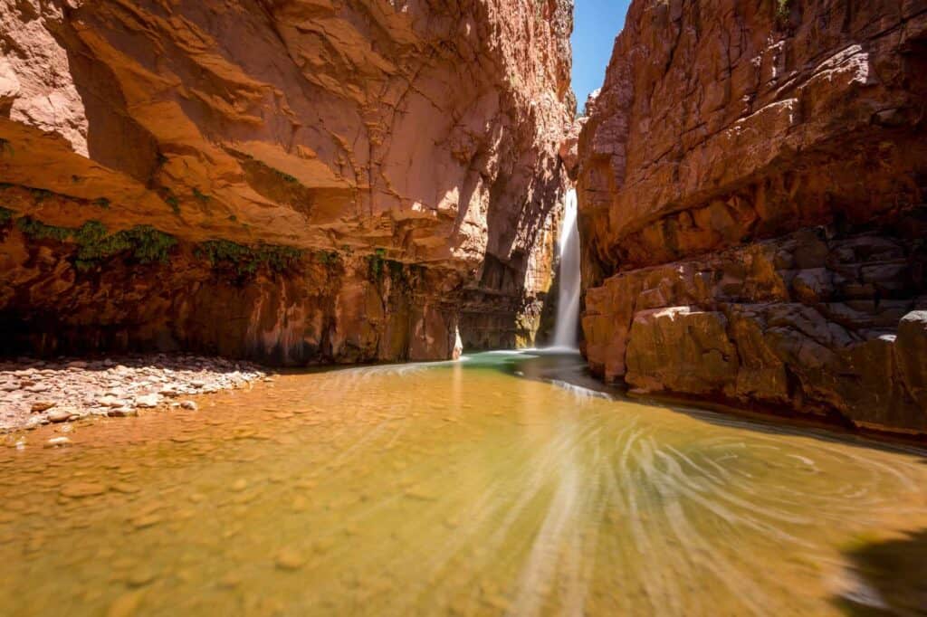
The hike itself only runs about 3 miles round-trip.
The permit process here is one of the odder ones you’ll come across. You actually have to buy it at a Sinclair gas station (the Carrizo C-Store) at the junction of Highways 60 and 73.
Double-check the tribe’s website for current rules before you go.
- Location: Near Cibecue, AZ (roughly 2.5–3 hours northeast of Phoenix)
- Cost: $45 per person for a tribal access permit
- Trailhead Parking: Cibecue Creek Trailhead (small dirt lot), about an hour north of Globe, AZ
- Hiking Distance: About 3 miles round trip, rated moderate
- Heads up: Swimming is technically not allowed in reservation waters. The final stretch of road includes a creek crossing better suited to high-clearance vehicles, and the hike closes during rain due to flash flood risk.
TUCSON AREA WATERFALLS
Seven Falls
Seven Falls earns its name from a chain of seven cascades and pools inside Tucson’s Sabino Canyon Recreation Area.
The stream here runs nearly year-round, which is unusual for the desert, and the granite pools at the bottom are deep enough to swim in. It’s one of Tucson’s most popular hikes thanks to the consistent water flow and the swimmable payoff at the end.
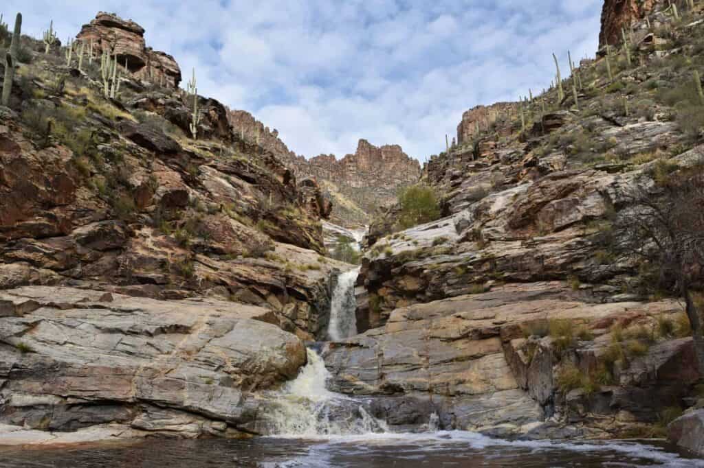
Best conditions tend to run from October through May, when the creek is flowing higher.
- Location: Sabino Canyon Recreation Area, Tucson
- Cost: Day-use fee at Sabino Canyon; optional shuttle fee to the trailhead
- Trailhead Parking: Sabino Canyon
- Hiking Distance: Nearly 9 miles round trip from the visitor center; the shuttle cuts that in half.
- Heads up: Little shade, extreme summer heat, multiple creek crossings, and a parking lot that fills fast on weekends
Tanque Verde Falls
Tanque Verde Falls is a series of seasonal cascades just east of Tucson, with the main drop plunging 80 feet into a swimming hole.
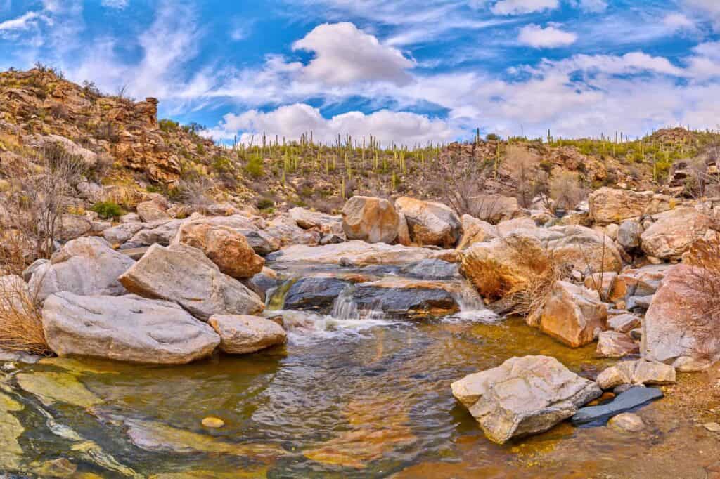
Fair warning: this one’s beautiful but has a history of cliff-jumping accidents and injuries on the slick rocks.
- Location: Redington Road, east of Tucson (Coronado National Forest)
- Cost: Free
- Trailhead Parking: Upper or Lower Tanque Verde Falls Trailhead
- Hiking Distance: About 2 miles round trip, with some scrambling involved
- Heads up: Slippery rocks, a history of serious injuries and drownings, and real flash-flood risk during monsoon season. Skip it if rain is forecast anywhere upstream.
Chiva Falls
Chiva Falls is a roughly 75-foot seasonal waterfall tucked in a canyon east of Tucson. Plenty of visitors ride ATVs out to it in addition to hiking.
The trail winds through rocky washes and hillsides dotted with saguaro and ocotillo before dropping into the canyon where the falls are hidden. Like most desert waterfalls, it only really flows after decent rainfall, so January through April is generally your best shot.
- Location: Coronado National Forest, east of Tucson
- Trailhead Parking: Chiva Falls Trailhead
- Cost: Free
- Hiking Distance: Nearly 9 miles round trip, rated difficult
- Heads up: Creek crossings and exposed, rocky terrain make this a genuinely tough hike in the heat. Start early and pack more water than you think you’ll need