Arizona’s 25 Best Hikes, Waterfalls & Natural Wonders


Arizona is far more than the Grand Canyon, Spring Training, and golf courses in Scottsdale!
Many of the most remarkable spots require visitors (and local Arizonans) to veer off the interstate.
Let me show you how to navigate permits, rugged backcountry roads, and desert trails .. to get to swimming holes, waterfalls, and jaw-dropping rock formations around Arizona!
Rugged Off-Road & Geological Anomalies
1. White Pocket (Vermilion Cliffs)
If you fail to win the highly competitive daily lottery for The Wave, don’t be disappointed! White Pocket is the ultimate detour.
Frankly, I think it’s more impressive!
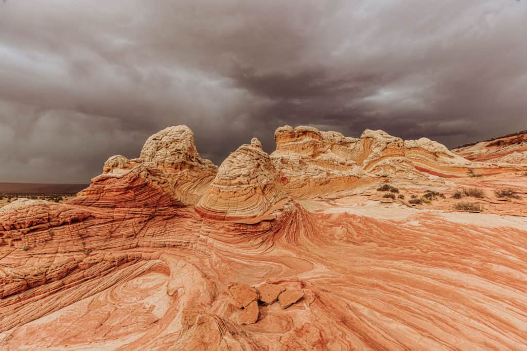
The brain-like, swirled orange and white sandstone formations feel entirely extraterrestrial.
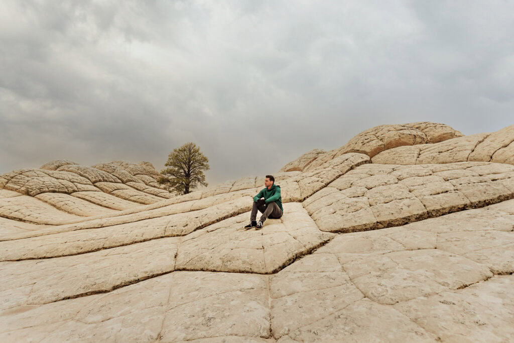
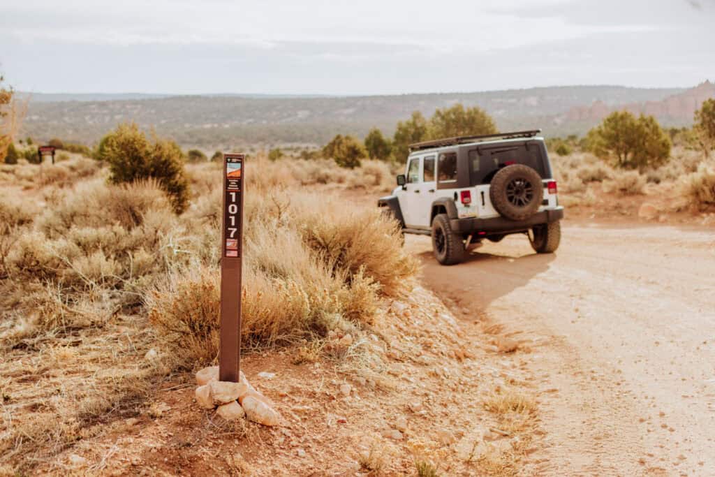
Warning: this one *requires* a 4×4 to get through the remote area between Page, AZ, and Kanab, UT.
I’ve watched under-prepared drivers bury their vehicles axle-deep in the soft sand paths out here, so don’t underestimate the terrain.
Book a Tour:
Details on White Pocket
- Location: Northern Arizona, west of Page
- Best Time to Visit: Spring or Fall. Avoid during summer if there’s any risk of monsoon rainfall.
- Cost / Permits: Free to visit for now, though the Bureau of Land Management (BLM) is considering adding a permit requirement as White Pocket gets more popular.
- Cell Service: Zero connectivity. Download offline maps before leaving Page or Kanab.
- Vehicle: Strict 4×4 high-clearance vehicle required (all-wheel drive will not cut it).
- Services: None. Bring double the water you think you’ll need, and all of your own food.
Read More on White Pocket:
- The BLM might start a permit system for White Pocket.
- Full post: everything you need to know about getting to White Pocket.
2. The Edge of the World (Jenga Rocks)
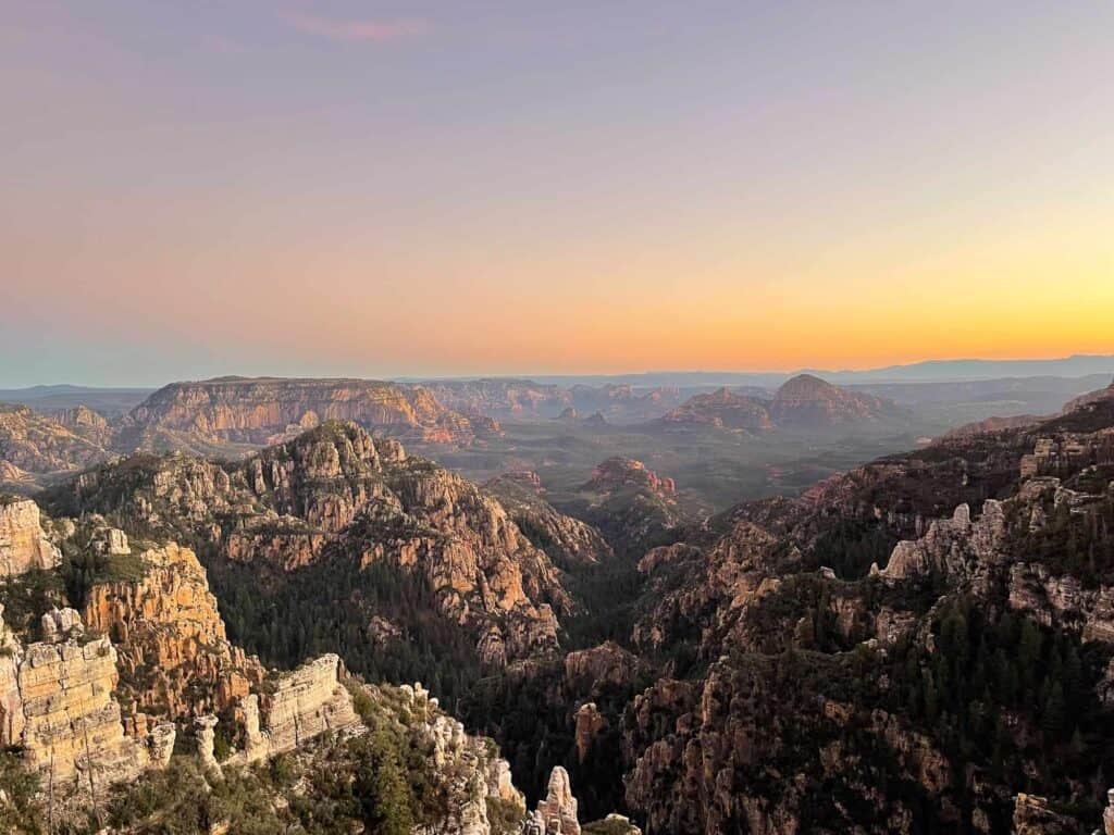
Perched on a towering cliffside in the Coconino National Forest between Sedona and Flagstaff, this spot offers unparalleled views over the sheer drop-off below.
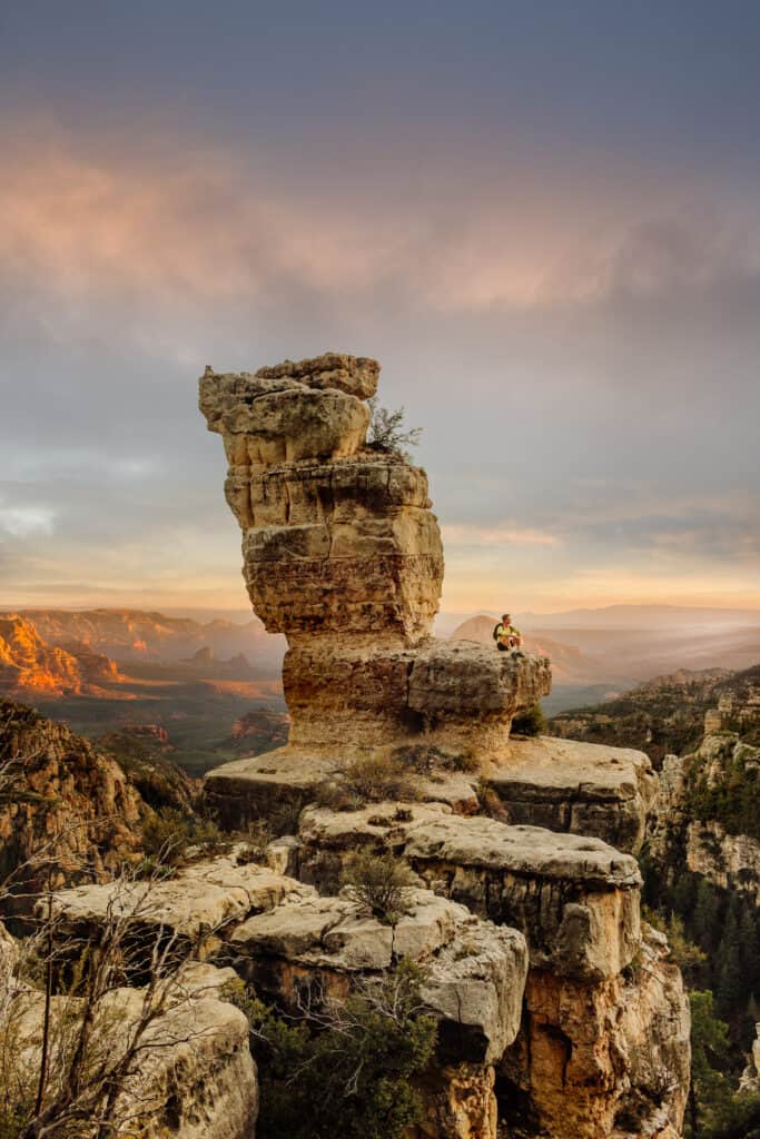
Known formally as East Pocket, it features the famous “Jenga Rocks” formation, which have a view of Sedona in the valley below. Others know it as “The Knob.”
The crowd sizes are growing as it gains popularity on social media, but it remains a premier dispersed camping site.
Details on Edge of the World
- Location: North of Sedona, off 89A (about a 60- 90 minute drive along rough USFS roads)
- Best Time to Visit: Late Spring through Late Fall before winter snow closes the forest roads.
- Cost / Permits: Free; no reservations or permits are required for dispersed camping.
- Cell Service: Spotty to non-existent.
- Vehicle: You will navigate bumpy, muddy US Forest Service roads for miles. A high-clearance 4×4 truck or SUV is highly recommended.
- Services: None, bring everything you need
Read More on Edge of the World:
3. Coal Mine Canyon
Located on the border of the Navajo and Hopi nations, Coal Mine Canyon exposes a stark landscape of colorful spires, hoodoos, and deep ravines.
The contrast of red, orange, and white clay layers cuts sharply into the high desert plains. It’s a fragile environment that remains heavily protected by local communities.
The Navajo Nation occupies the western portion of the Canyon while the Hopi Tribe occupies the eastern portion.
Details on Coalmine Canyon
- Location: East of Tuba City
- Best Time to Visit: Late afternoon for the best photography angles when the shadows deepen.
- Cost / Permits: Contact: 928-280-0700 or coalmine@navajochapters.org
- Cell Service: Extremely weak. Do not rely on digital navigation.
- Gear & Vehicle: Accessible via a dirt road off Highway 264. Sturdy, high-traction hiking boots are essential if you walk along the rim.
- Tribal Rules: Visit the Tribal site for regulations
4. Blue Canyon
Hidden deep within the Moenkopi Wash on Hopi tribal lands, Blue Canyon features rare, geometric white-patterned rocks layered over deep red sandstone.
The formations look like hand-painted blocks twisting out of the desert floor.
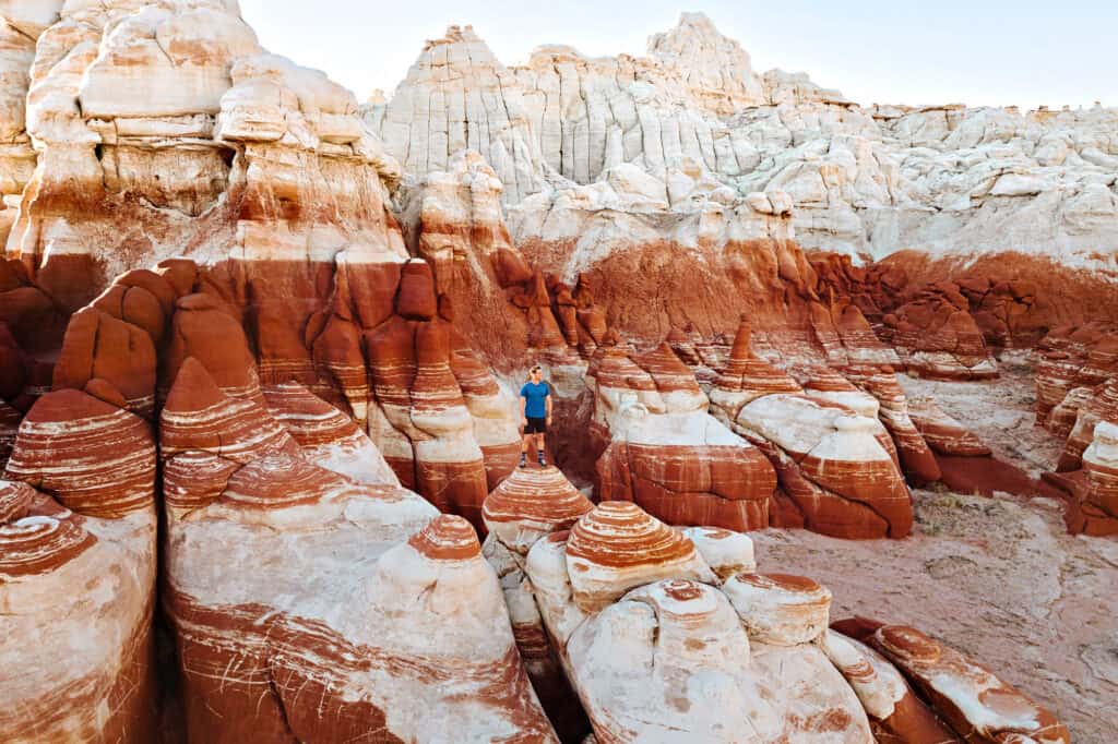
Because of its cultural significance and remote location, you cannot wander here without strict adherence to tribal laws.
Honestly, I wouldn’t know how to get back there on my own without a guide!
Details on Blue Canyon
- Location: Remote, on Hopi land
- Best Time to Visit: Spring or Winter to avoid scorching triple-digit valley temperatures.
- Cost / Permits: You must hire an official Hopi tour guide to access this area legally: https://discoverhopi.com/
- Cell Service: None.
- Vehicle: Do not follow standard Google Maps directions. You’ll need a 4×4 to follow your guide across the unmarked washes and over rocky terrain.
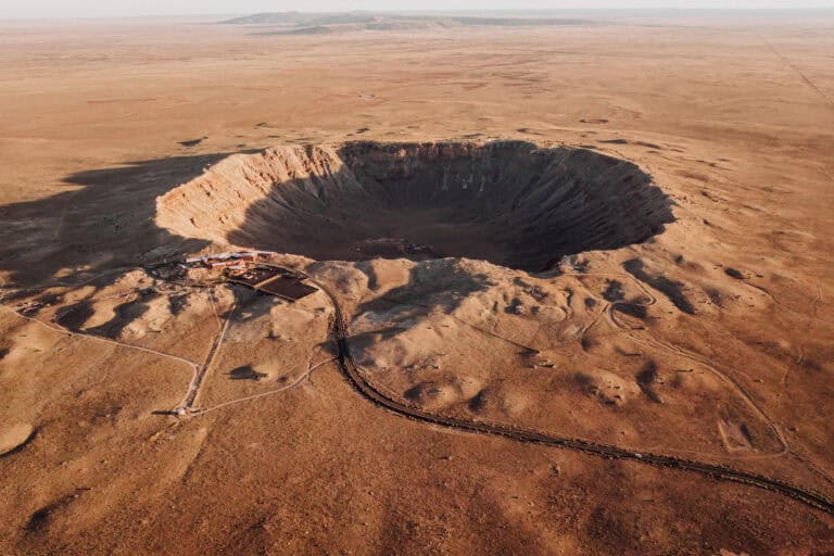
5. Meteor Crater
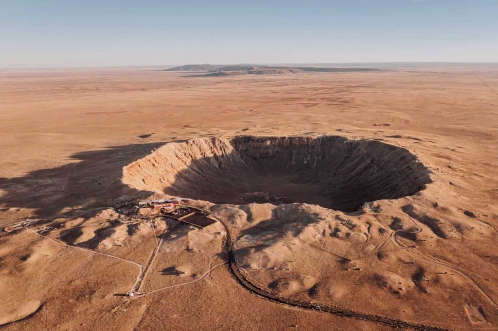
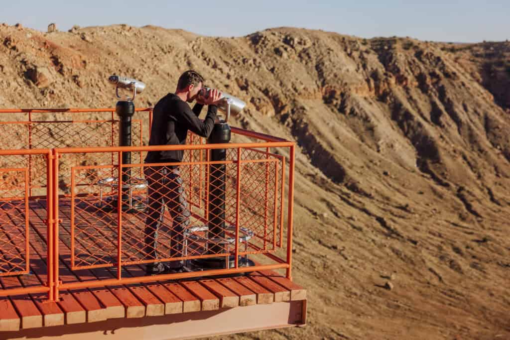
This is one of the best-preserved meteorite impact sites on Earth, created when a massive rock slammed into northern Arizona 50,000 years ago.
The crater is nearly one mile wide and 550 feet deep!
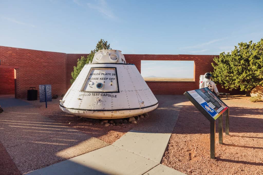
The Apollo astronauts actually used this rugged bowl as a simulated lunar training ground.
New in 2026, they started offering hikes down *into* Meteor Crater for the first time ever. They’re limited, and more expensive, but what a cool experience!
Book a Tour from Phoenix
Details on Meteor Crater
- Location: Between Flagstaff and Winslow, off I-40 in Northern Arizona
- Best Time to Visit: Year-round; mornings are best to beat the high winds on the rim.
- Cost / Permits: General admission is roughly $25–$29 per adult; includes access to the indoor museum.
- New: They now offer hiking tours to the center of the crater (limited, so book in advance).
- Cell Service: Strong cellular signals across the visitor center area.
- Vehicle: Any standard passenger car can easily access the paved parking lot right off I-40.
Read More about Meteor Crater:
6. Chiricahua National Monument
Nicknamed the “Wonderland of Rocks,” Chiricahua features towering rock pinnacles created by ancient volcanic activity and millions of years of erosion. It sits in southeastern Arizona and is currently on track to potentially become a full national park.
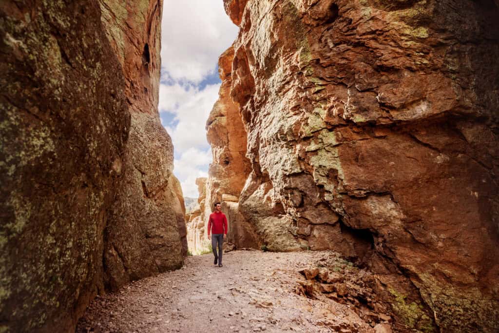
For now, it remains an uncrowded haven where you can hike for miles along the towering rocks.
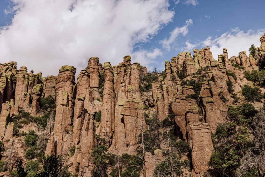
It’s also interesting to learn how the Civilian Conservation Corps first established the trails and created a visitor experience a century ago!
Details on Chiricahua
- Location: Near Willcox, in southeastern Arizona
- Best Time to Visit: Spring for mild temperatures and potential wildflower blooms. Summer and fall are nice, too.
- Cost / Permits: Free entry; Bonita Canyon Campground requires reservations. This would change if it becomes a national park.
- Cell Service: Unreliable, once you drive past the visitor center.
- Vehicle: Standard vehicles can easily drive Echo Canyon Park Drive.
Read More about Chiricahua:
7. Devil’s Bridge
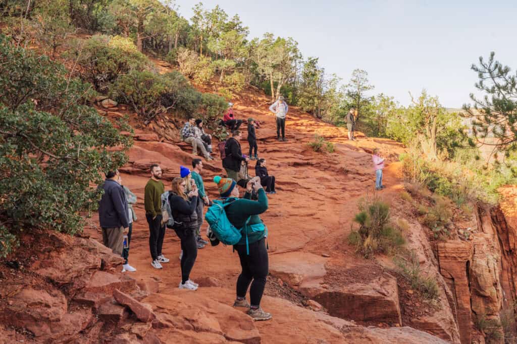
The largest natural sandstone arch in the Sedona area is definitely not a hidden gem.
It’s one of the more photographed spots in Arizona, and still worth a visit.
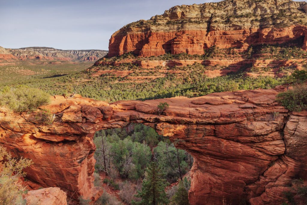
The hike is kind of boring (along a dirt road for a while) before you start the climb.
Expect a line at the top for the classic shot.
Details on Devil’s Bridge
- Location: Sedona
- Best Time to Visit: Early morning (before 7 a.m.) year-round to beat both the heat and the crowds.
- Cost/Permits: No permit or reservation needed to hike, but you must display a Red Rock Pass ($5/day) to park at the trailhead.
- Parking: Dry Creek Vista or Mescal Trailhead. A free Sedona shuttle also runs to the Dry Creek Vista and Mescal lots for most of the year, from Thursday through Sunday.
Read More about Devil’s Bridge:
Hidden Waterfalls & Swimming Holes
8. Havasu Falls
Havasu Falls is one of the iconic waterfalls on the Havasupai Reservation, deep in the Grand Canyon.
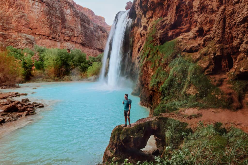
This stunning spot requires advanced planning and a permit.
Most people camp for three nights (the length of the permit) and visit the other waterfalls in the area. The campsites are setup along beautifully blue Havasu Creek.
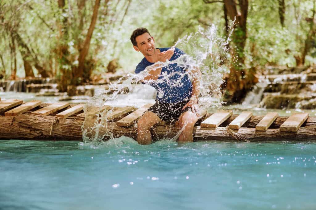
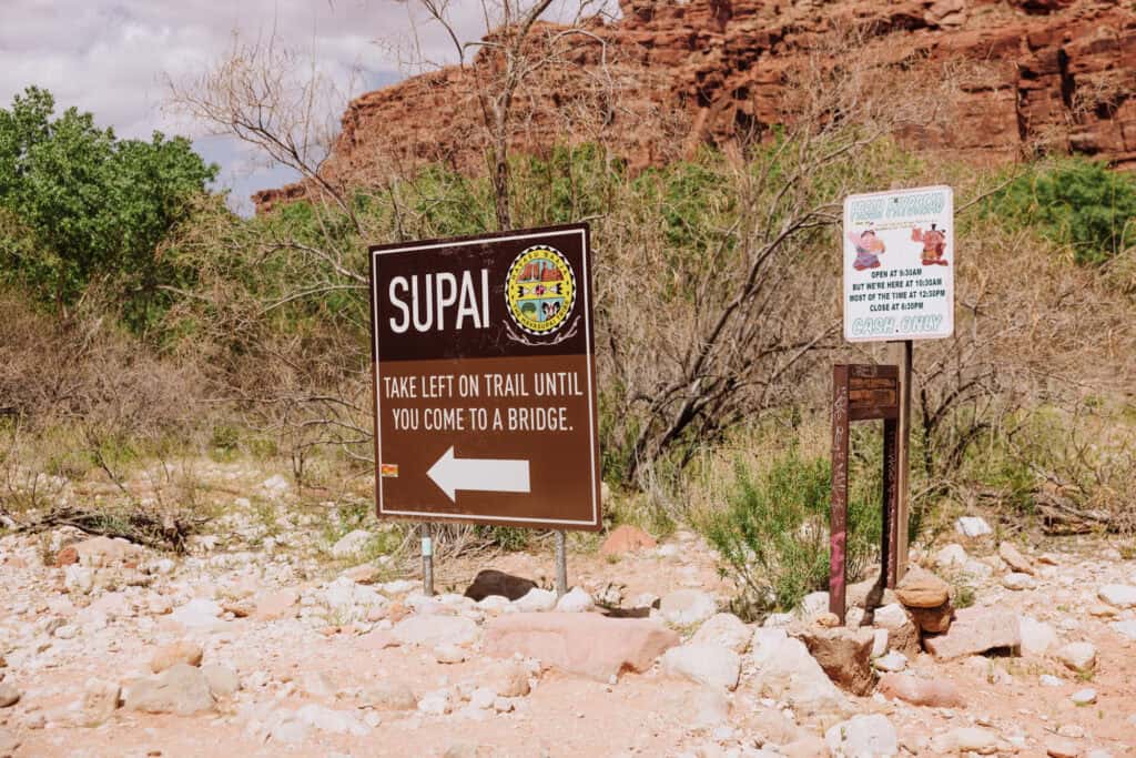
There are no roads. You’ll have to hike 10+ miles in from a rural area one hour north of Peach Springs, AZ.
There’s a lodge in the village of Supai for people who don’t want to camp, and a helicopter flies certain days for people who don’t want to hike. With that said, the helicopter is never a guarantee, so always be prepared to hike.
Details on Havasu:
- Location: The Havasupai Reservation, in a remote part of the Grand Canyon
- Best Time to Visit: Spring or early Summer before the monsoon season begins in July.
- Cost / Permits: Mandatory 3-night permit packages through the Havasupai Tribe, starting around $450
- Cell Service: Minimal and unreliable, though you might get a signal at the top of the falls.
- Gear: High-quality water shoes with aggressive tread and a durable backpacking pack are non-negotiable. You’ll also need to pack-in your food and camping equipment.
Read More on Havasupai:
9. Mooney Falls
Mooney Falls is downstream (along Havasu Creek) from Havasu Falls. Mooney is at the end of the Havasupai Campground.
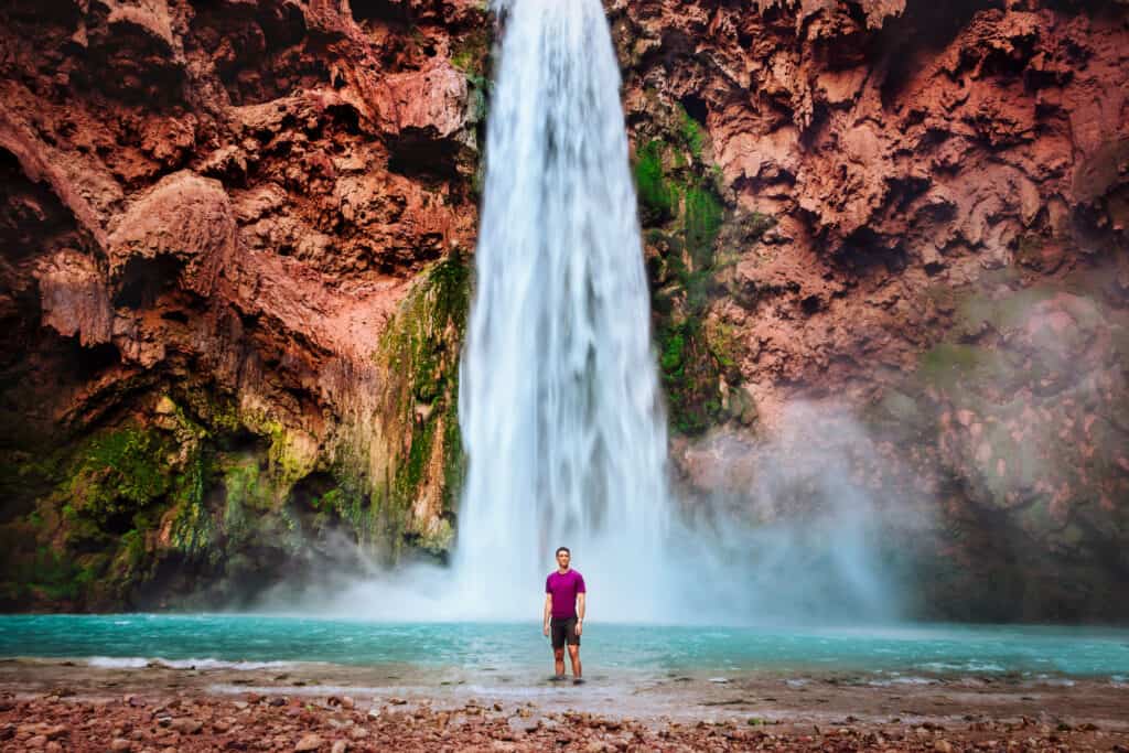
It’s the tallest waterfall at Havasupai, and includes a notorious climb down to the bottom. The pathway includes a climb down through a rock cave, and a vertical drop down rickety steps and ladder rungs.
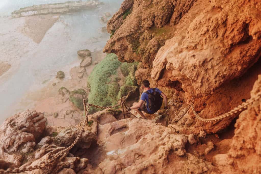
Details on Mooney:
- Location: The Havasupai Reservation, in a remote part of the Grand Canyon
- Best Time to Visit: Spring or early Summer before the monsoon season begins in July.
- Cost / Permits: Mandatory 3-night permit packages through the Havasupai Tribe, starting around $450
- Cell Service: Minimal and unreliable.
Read More:
10. Beaver Falls
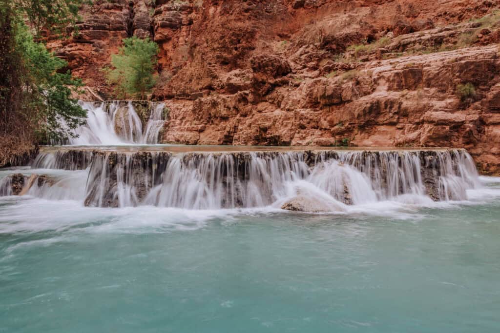
Beaver Falls is an emerald oasis downstream from Mooney Falls. Minerals in the water have formed ledges and pools, which fill with the bright blue water of Havasu Creek.
While it gets overshadowed by the more dramatic Havasu and Mooney Waterfalls, it remains my personal favorite swimming hole in Arizona.
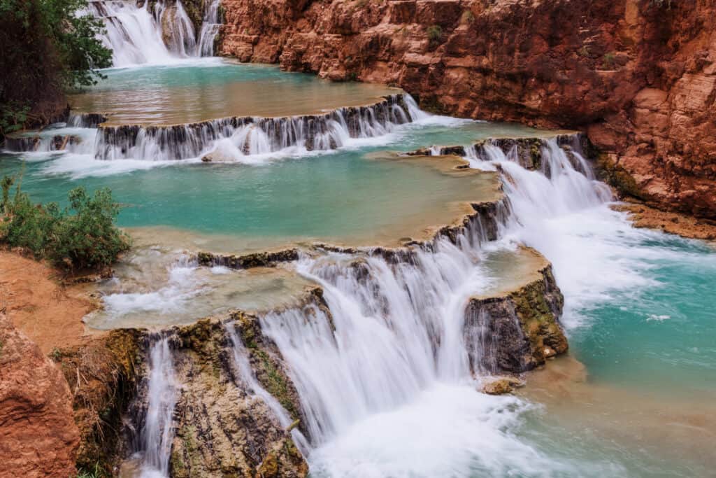
Reaching it requires a lengthy, technical hike down Mooney Falls. Once you’re at the base, it’s a trail that’ll lead you back and forth across Havasu Creek a few times before you arrive at Beaver Falls.
Read More:
11. Havasu Creek-Colorado River Confluence
This is an advanced trek for serious hikers staying at the Havasupai campground, which is far beyond Beaver Falls.
You will hike roughly 8 miles down-canyon from the campsite to the exact spot where the bright, turquoise Havasu Creek slams directly into the muddy brown Colorado River.
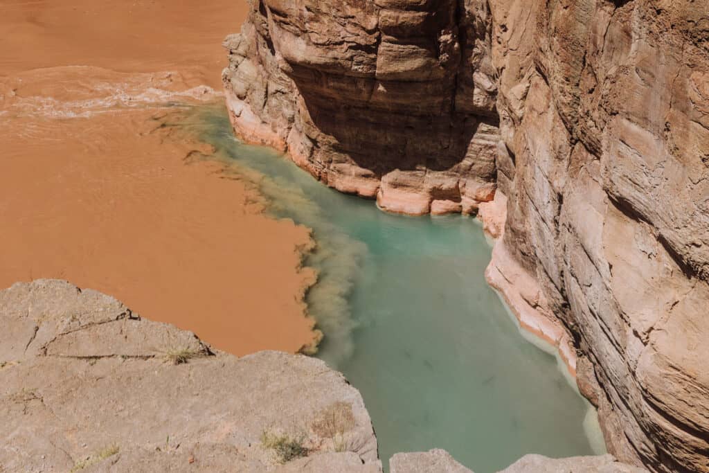
Standing at the junction inside the massive canyon walls is a humbling experience.
This is a challenging hike that’s not well-marked. While you’ll be following the creek the entire way, you’ll have to cross it several times.
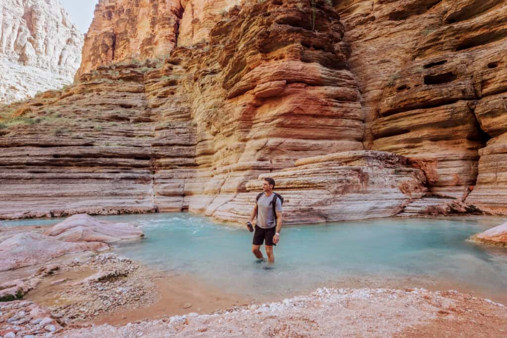
Details on the Confluence
- Best Time to Go: Late spring, when daylight hours are longer.
- Warning: Don’t attempt if there’s rain in the forecast. Flash floods can be deadly.
- Also: The general guidance is: don’t leave Beaver Falls after 10:00am if you want to return to the campground by 6:00pm.
- Cell Service: None.
- Gear: A reliable headlamp is mandatory, as this 16-mile round-trip day hike from camp might end after dark.
Read More:
12. Fossil Springs (Bob Bear Trail)
This ranks in my top 5 favorite sites to visit in Arizona. At the end of a 4-mile trail, you’ll find a waterfall, a fast-moving creek, and a unique swimming hole.
In sharp contrast to the surrounding desert, 70°F water surges out of this canyon at an incredible 20,000 gallons per minute.
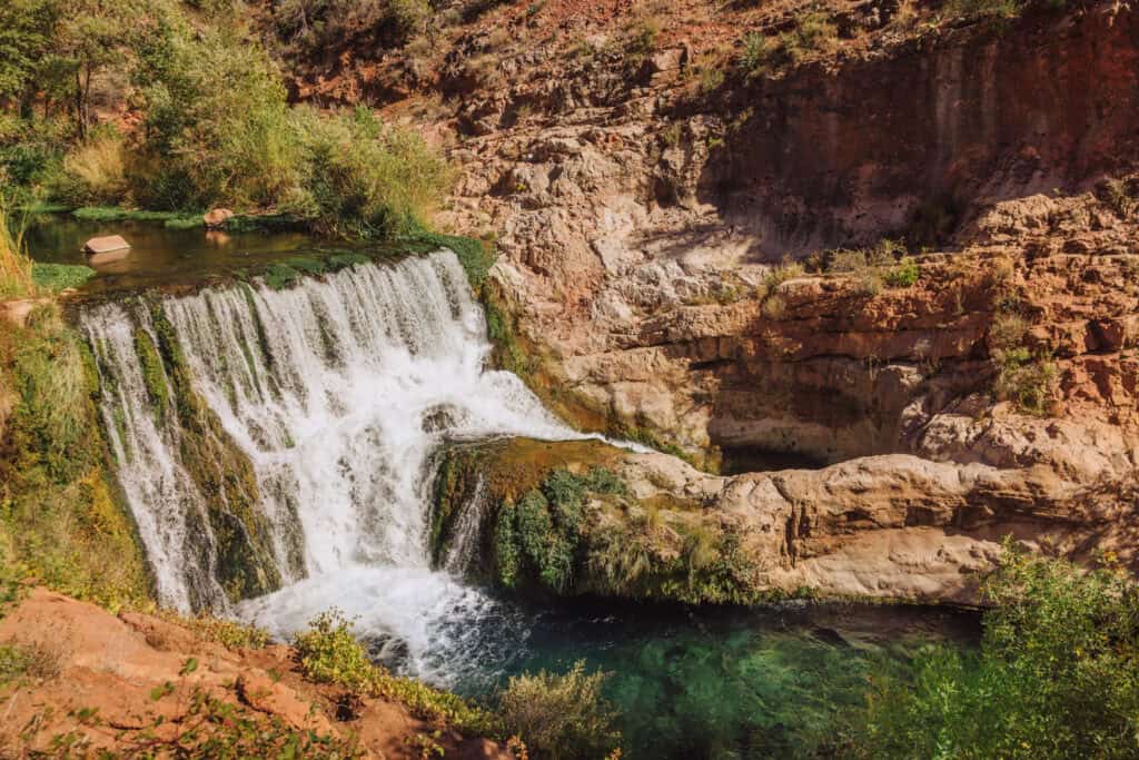
The hike down the Bob Bear Trail to the waterfall and swimming hole turns into a brutal, steep incline on the return trip.
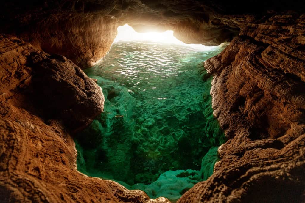
The reward is swimming into a cave, where light reflects off the travertine riverbed and turns the water an iridescent green-blue.
Details on Fossil Springs
- Location: The trailhead is near Strawberry, Arizona (Payson area)
- Best Time to Visit: May or September. Summer is great, but the heat makes the climb out dangerous.
- Cost / Permits: A $6 seasonal permit is strictly required between April 1 and October 1. They’re available in a lottery system posted on recreation.gov.
- Also: Competition for permits is fierce, so it’s easier if you go midweek, rather than on a weekend.
- Cell Service: Unreliable.
- Gear: You must carry at least one gallon of water per person for the grueling 8-mile round-trip hike.
- Services: None, pack in everything you need.
Read More about Fossil Springs:
13. Fossil Creek
Often confused for Fossil Springs, Fossil Creek is in the same region … BUT … the access point is from Camp Verde, Arizona.
You’ll need permits from recreation.gov from May through September. They’ll give you a parking spot in one of the lots along the creek.
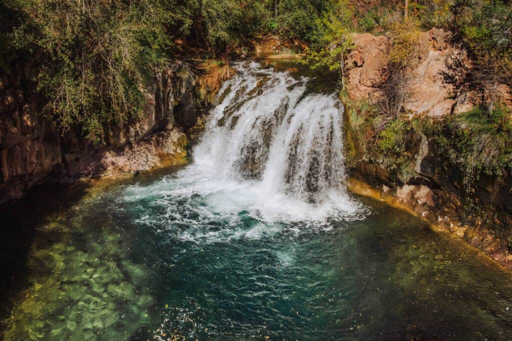
The trail system will lead you upstream to a waterfall and swimming hole.
The hike is far less strenuous than the Bob Bear Trail to Fossil Springs.
Details on Fossil Creek
- Location: The trailhead is near Camp Verde, Arizona
- Warning: You’ll be driving 14 miles on a rough dirt road
- Cost / Permits: A $6 parking permit is required
- Cell Service: Spotty
- Services: Vaulted toilets only
Read More About Fossil Creek:
14. Water Wheel Falls
Located just north of Payson inside the Tonto National Forest, Water Wheel Falls offers a rapid reward for minimal hiking effort.
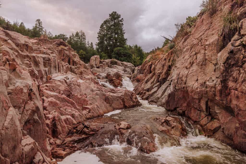
This one’s family-friendly, for sure.
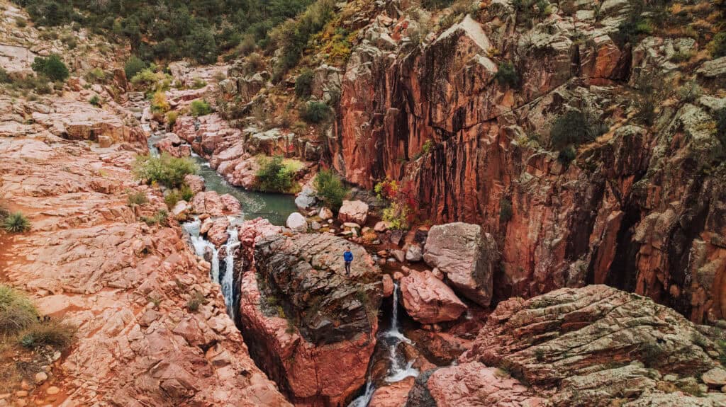
The trail winds along the East Verde River, leading to a cascading waterfall and a swimming hole, framed by massive granite boulders.
Details on Water Wheel Falls
- Location: Near Payson
- Best Time to Visit: Late Spring through early Summer.
- Cost / Permits: A $10 vehicle parking fee is required at the trailhead.
- Cell Service: Very weak.
- Gear: Wear shoes with excellent grip on wet granite to prevent falls on the slippery rocks.
- Vehicle: Paved access right up to the lot.
Read More on Water Wheel:
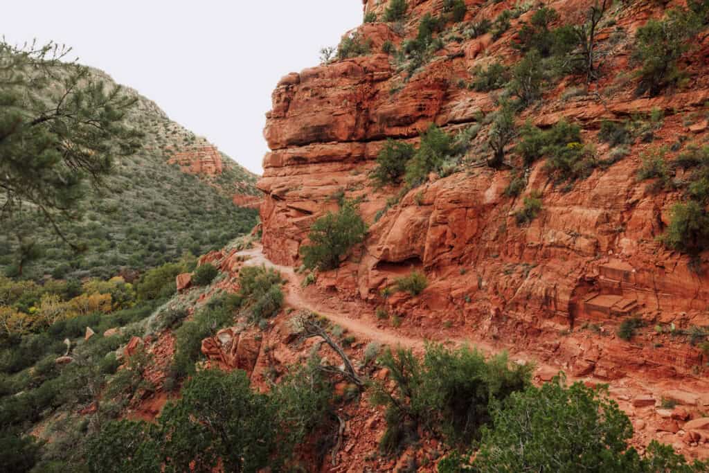
15. The Crack at Wet Beaver Creek
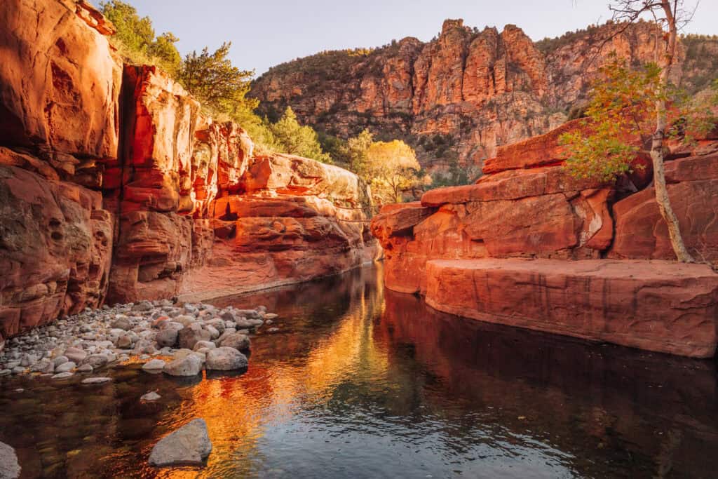
This is a classic Arizona swimming hole where the canyon walls narrow to form a deep, natural pool.
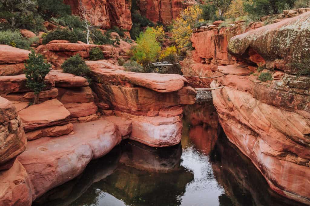
The main attraction here is a rock ledge you can use for cliff-jumping.
The hike (also known as the Bell Trail) is relatively flat, but also exposed with minimal shade for 4 miles (each way). You’ll roast on a hot day!
The payoff is worth it!
Details on the Crack
- Location: Rimrock (east of Sedona)
- Best Time to Visit: Late Spring mornings or fall to avoid the heat on the hike.
- Cost / Permits: No reservations needed, but there’s a small parking fee you can pay at a kiosk.
- Parking: The Bell Trail or Bruce Brockett lots (and there’s a spillover lot, too)
- Cell Service: Unreliable and spotty.
- Gear & Vehicle: Accessible by any standard car. Bring a lightweight hydration pack and sun protection for the exposed 7-8 mile round-trip.
Read More:
16. Tonto Natural Bridge
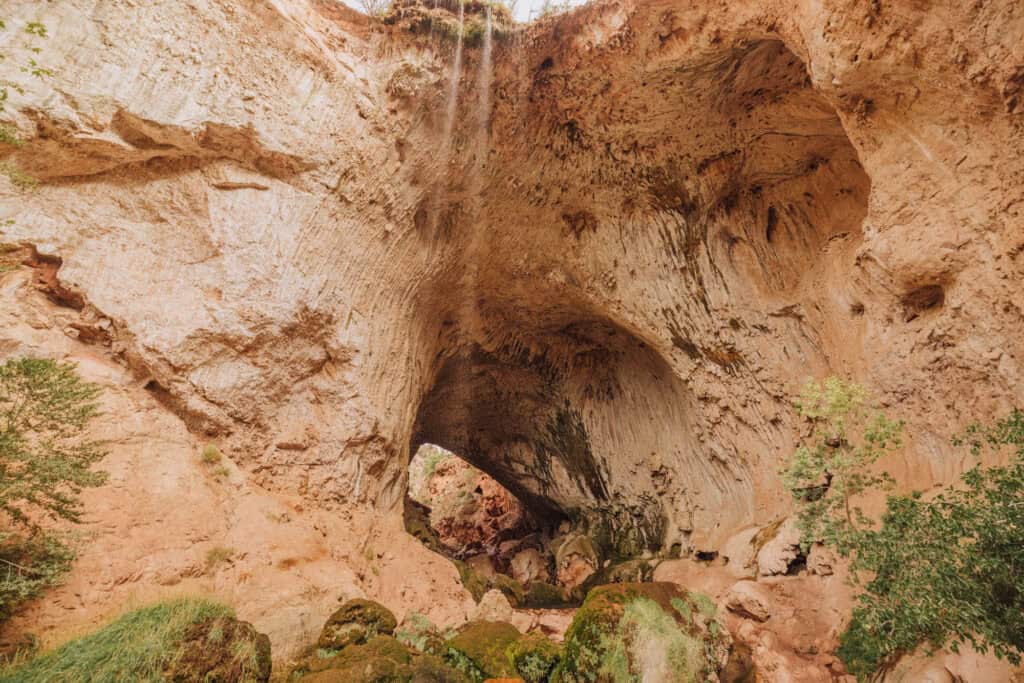
Tonto Natural Bridge State Park houses what is believed to be the world’s largest natural travertine bridge.
The tunnel stands 183 feet high and stretches 400 feet long.
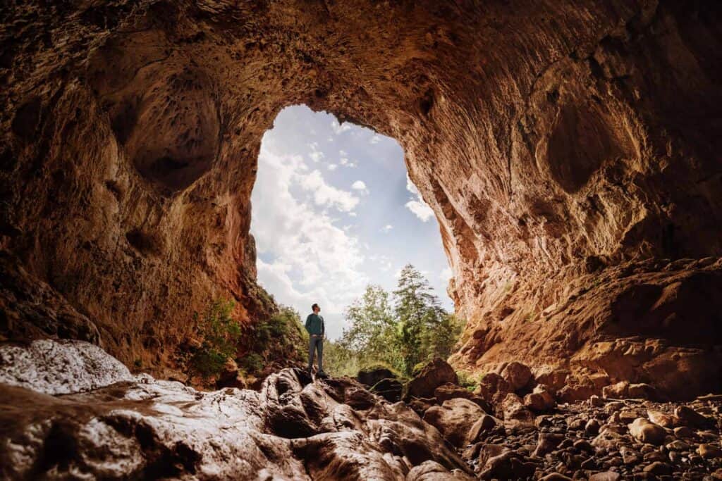
Visitors can choose their own adventure, either viewing the massive opening from paved rim overlooks or hiking down a series of steep, slippery rustic steps to stand directly beneath it.
Details on Tonto Natural Bridge
- Location: Near Payson
- Best Time to Visit: Anytime, spring through fall.
- Cost / Permits: Park entry fees are $7 per adult. No advance permits needed.
- Cell Service: Good
- Gear & Vehicle: Paved roads lead directly to the park.
Read More about Tonto Natural Bridge:
17. Kayak to Antelope Canyon
This one technically isn’t a swimming hole, unless you consider all of Lake Powell a swimming hole!
While the lake is dwindling down to a fraction of what it was, you can still paddle through part of it into the mouth of Antelope Canyon.
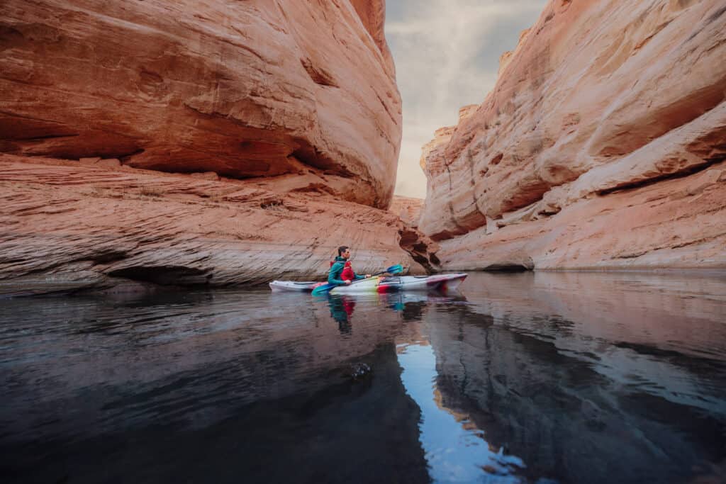
No experience is necessary, and you’ll do around 5 miles of kayaking, plus a hike into Antelope Canyon.
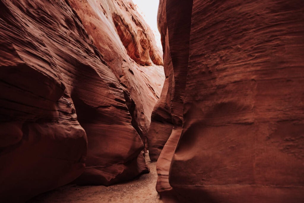
Details on Kayaking
- Location: Page
- Best Time to Visit: March through October
- Cost: Prices range from $90 to $120
Book a Tour:
Read More about Kayaking:
Underground Caves & Canyons
18. Walnut Canyon National Monument
Located just outside Flagstaff, Walnut Canyon allows you to walk directly alongside ancient history.
The Island Trail descends 240 stone steps into a steep canyon gorge, taking you past cliff dwellings built into the limestone alcoves over 700 years ago.
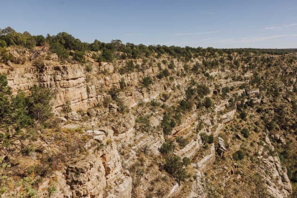
It provides an incredibly close-up look at prehistoric architecture.
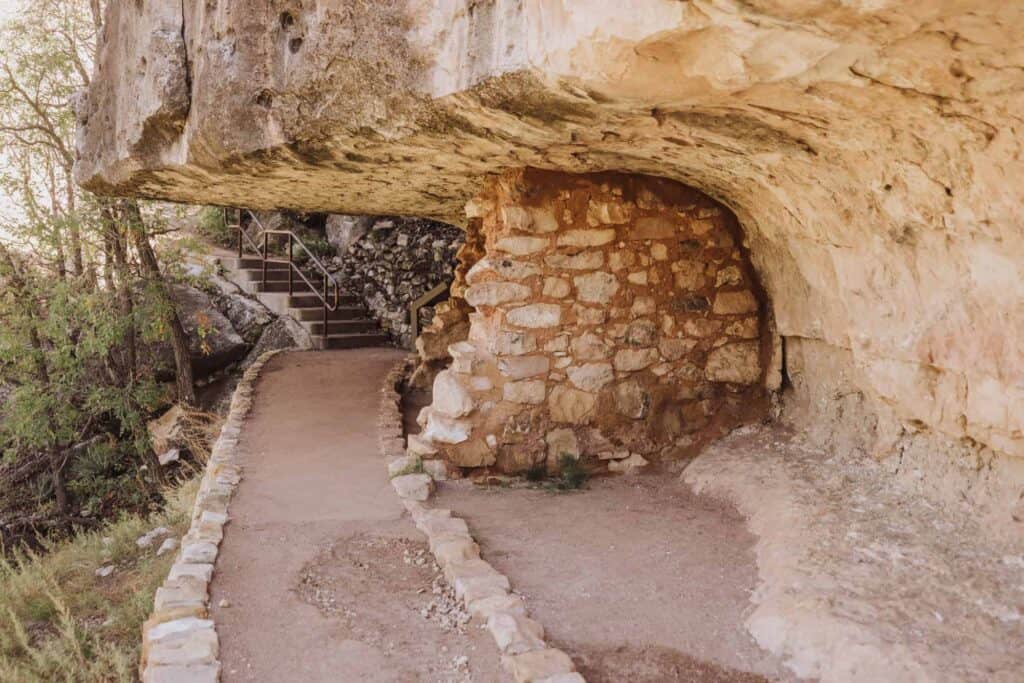
Details on Walnut Canyon
- Location: East of Flagstaff, off I-40
- Best Time to Visit: Cool autumn months; the high elevation makes winter steps icy and treacherous.
- Cost / Permits: National Park Service entry fee is $25 per vehicle (or free with an America the Beautiful pass).
- Cell Service: Good
- Vehicle: Fully paved parking lot.
- Warning: Be prepared for a strenuous climb back up the 240 steps at a high elevation of nearly 7,000 feet.
Book a Tour:
Read More about Walnut Canyon:
19. Cardiac Canyon
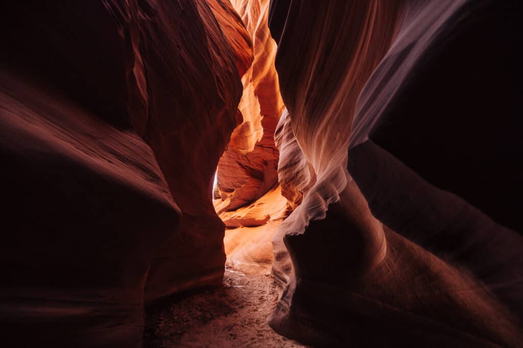
For those looking to escape the extreme crowds at Upper and Lower Antelope Canyon, Cardiac Canyon is a special alternative.
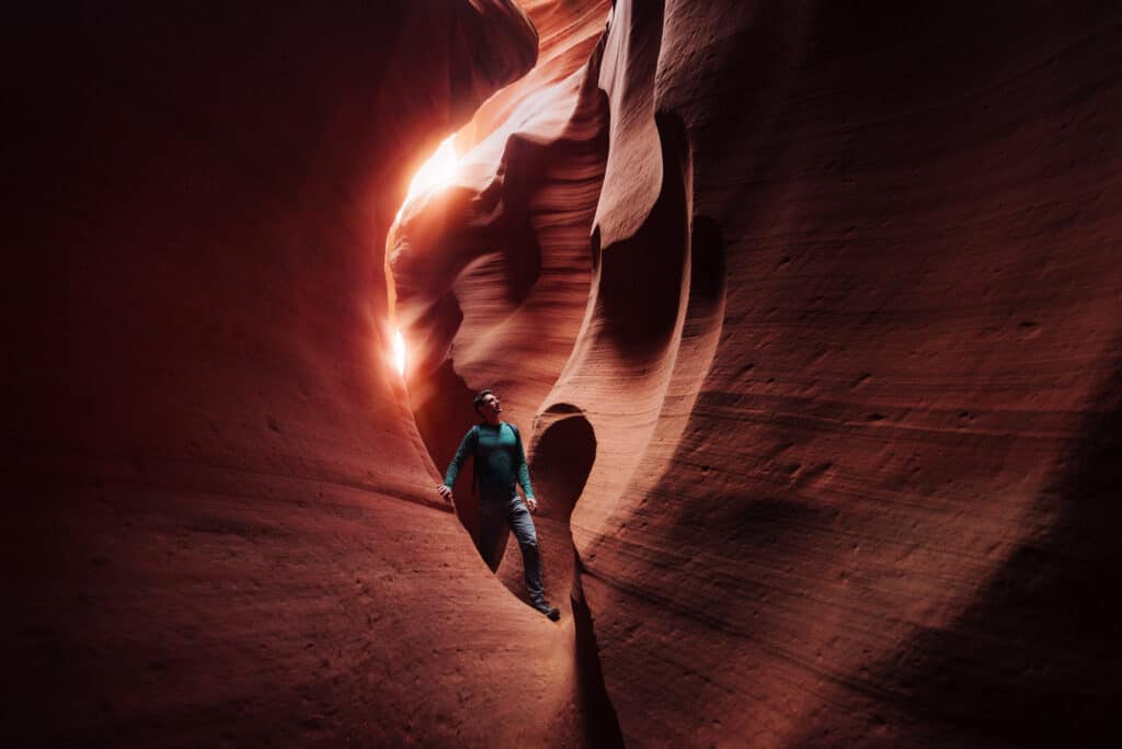
This deep slot canyon features the same fluid, wind-carved sandstone walls but allows only a fraction of the foot traffic… as in a handful of people per day. Plus, you’re given 6 hours to explore, meditate, take photographs, etc.
The entry is physically demanding and involves navigating steep sand slopes and narrow passages.
Details on cardiac Canyon
- Location: Page
- Best Time to Visit: Anytime
- Cost / Permits: Private, authorized Navajo guided tours only; prices are premium for this unique tour, starting at $200
- Gear & Vehicle: Paved road to the Taadidiin Tours entrance. Bring anything you’d like: photography equipment, books, a yoga mat, etc.
Book a Tour:
Read More about Cardiac:
20. Wire Pass (Buckskin Gulch)
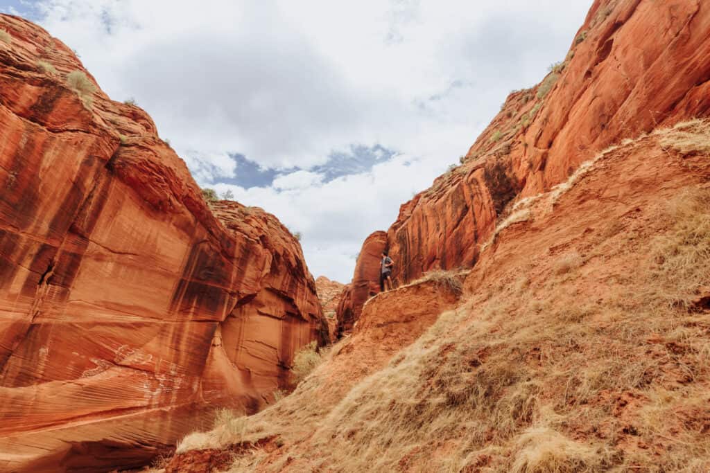
This is a great family-friendly option near Page… as long as there are no storms in the forecast. Wire Pass is known for flash flooding during the summer monsoon storms.
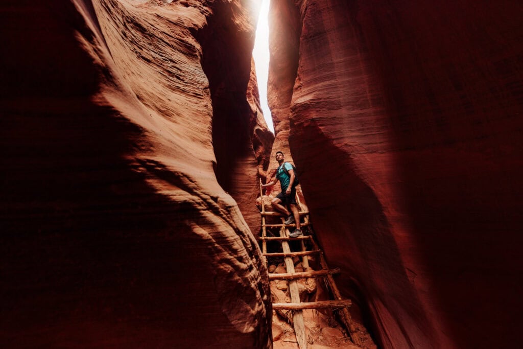
You’ll pass through the tight, colorful Wire Pass slot first, then pop out into Buckskin’s towering 200-foot narrows.
Details on Wire Pass
- Location: Off Highway 89, between Kanab, UT, and Page, AZ
- Parking: Down House Rock Valley Road (can be rough) to the Wire Pass lot.
- Best Time to Visit: Anytime, unless it rains
- AVOID… if rain is in the forecast. Flash floods can be deadly here.
- Cost/Permits: A $6 day-use permit is required for everyone entering via Wire Pass.
- Vehicle: House Rock Valley Road is a graded dirt road, passable by most cars in dry weather but rough and prone to washouts. High clearance is safer.
Book a Tour:
Click to Book: Wire Pass to Buckskin Gulch Tour
21. Kartchner Caverns
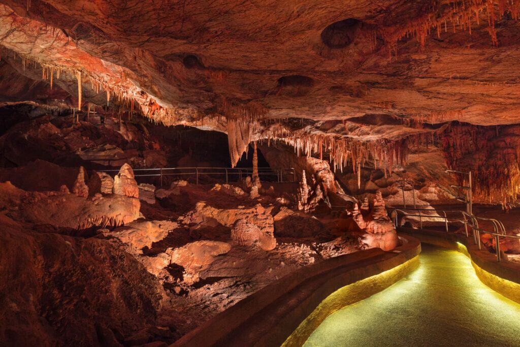
Kartchner Caverns is a massive underground hidden gem in Southern Arizona.
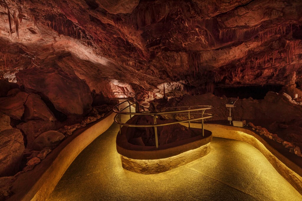
This massive limestone cave system features a “living” environment, meaning the stalactites and stalagmites are still actively growing.
Discovered in 1974, it was kept a total secret for decades to preserve its pristine state before transitioning into a carefully managed state park.
Details on Kartchner Caverns
- Location: Benson
- Best Time to Visit: Year-round; the interior temperature remains a constant, humid 72°F.
- Cost / Permits: Cave tour reservations are mandatory and cost $23–$30 per adult.
- Cell Service: Good.
- Vehicle: Paved parking.
- BUT: You are strictly prohibited from bringing bags, cameras, or phones into the cave to protect the fragile subterranean ecosystem.
Read More About Kartchner:
22. Lava River Cave
Formed by a volcanic eruption nearly 700,000 years ago, this mile-long underground lava tube is a completely wild experience in the Coconino National Forest.
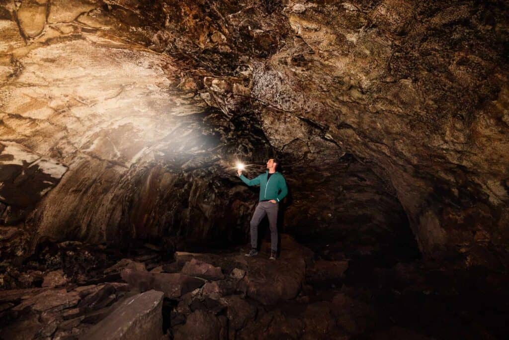
There are no handrails, lights, or paved paths here.
You will scramble over cold, loose basalt rocks in pitch darkness where the cave ceiling drops down to under four feet in certain sections.
Don’t forget a flashlight or headlamp! There’s zero light once you descend into the rocks.
Details on the Lava Caves
- Location: West of Flagstaff
- Best Time to Visit: Summer months, as the cave interior drops to a freezing 42°F even when the Arizona surface is scorching.
- Cost / Permits: Free; managed by the US Forest Service with no permits required.
- Gear: Sturdy hiking boots, a flashlight, and a headlamp
- Vehicle: You’ll be on USFS roads, which get muddy
Read More about the Lava Cave:
More Iconic Desert Destinations
23. Saguaro National Park
Saguaro National Park is split into two portions (on either side of Tucson). For first-timers looking to gawk at the giant saguaros, go to the west side.
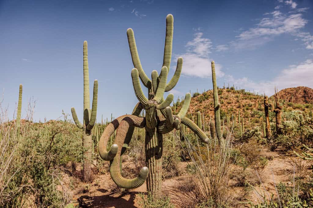
The Valley View Overlook trail is tops on my list here!
Careful of the extreme summer heat, monsoon storms, and snakes.
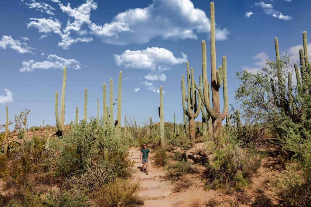
Details on Saguaro National Park
- Location: Tucson
- Best Time to Visit: Anytime
- Cost: $25 per car (or free with an “America the Beautiful” pass)
Read More About Saguaro NP:
24. Picacho Peak State Park
Picacho Peak is a prominent, cone-shaped volcanic landmark rising dramatically out of the desert flatlands off I-10 between Phoenix and Tucson.
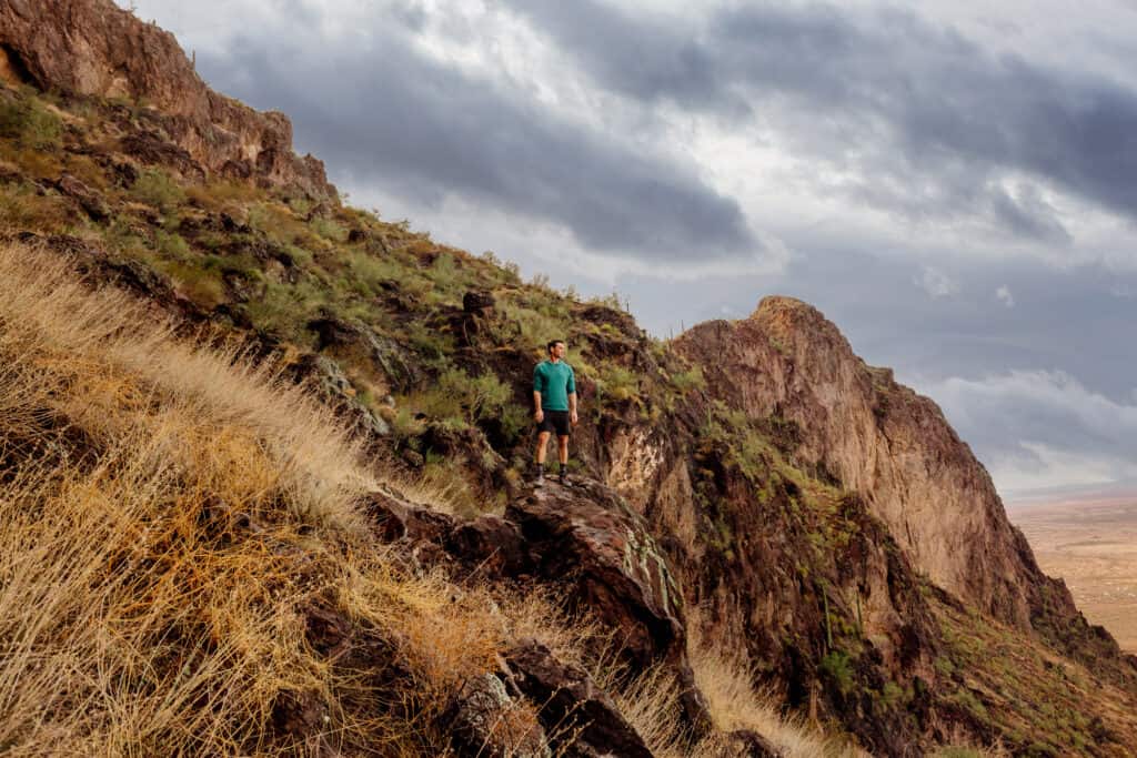
The hike to the top via the Hunter Trail is notorious for its steep parts, where you’ll use steel cables bolted into the rock to hoist yourself up.
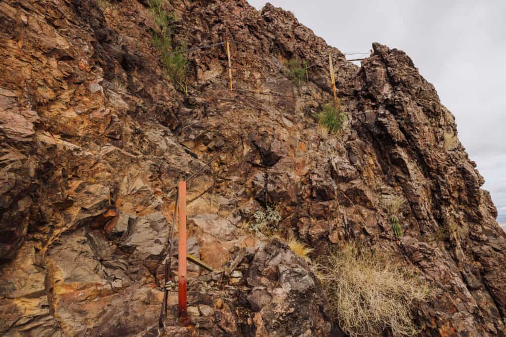
With that said, it’s very manageable for most hikers.
Details on Picacho Peak
- Location: North of Tucson
- Best Time to Visit: Late winter/early spring when the desert wildflowers carpet the lower slopes.
- Cost / Permits: State Park entrance fee is $7 per vehicle.
- Cell Service: Good.
- Gear & Vehicle: Any car can access the trailheads. Consider hiking gloves to help you grip the cables.
Read More About Picacho:
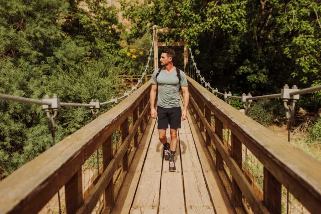
25. Boyce Thompson Arboretum
Located an hour’s drive east of Phoenix, this is the oldest public botanical institution in Arizona and the largest arboretum in the Southwest.
It features over 4,000 species of desert plants collected from across the globe, all framed by towering volcanic cliffs.
Details on Boyce Thompson
- Location: Superior
- Best Time to Visit: Anytime.
- Cost / Permits: Adult admission is $15–$19.
- Cell Service: Good
- Gear & Vehicle: Fully paved access off Highway 60. Bring comfortable walking shoes to explore the main 1.5-mile trail loop.
26. Rune Wines
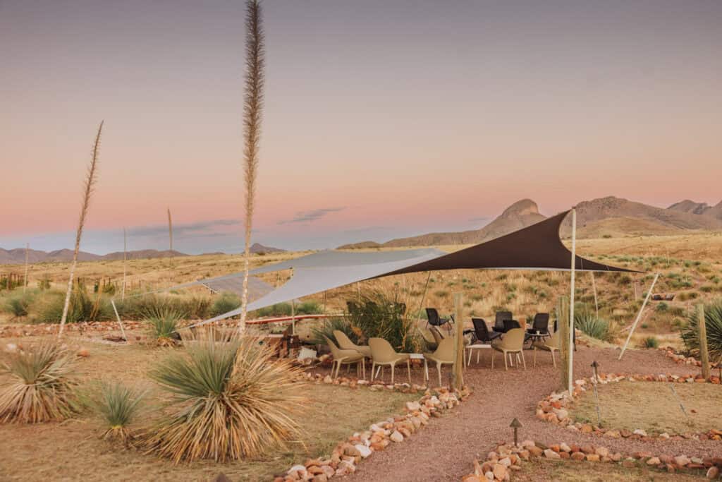
Arizona is home to a few thriving wine regions, but Rune Wines stands out as the state’s only completely off-the-grid winery.
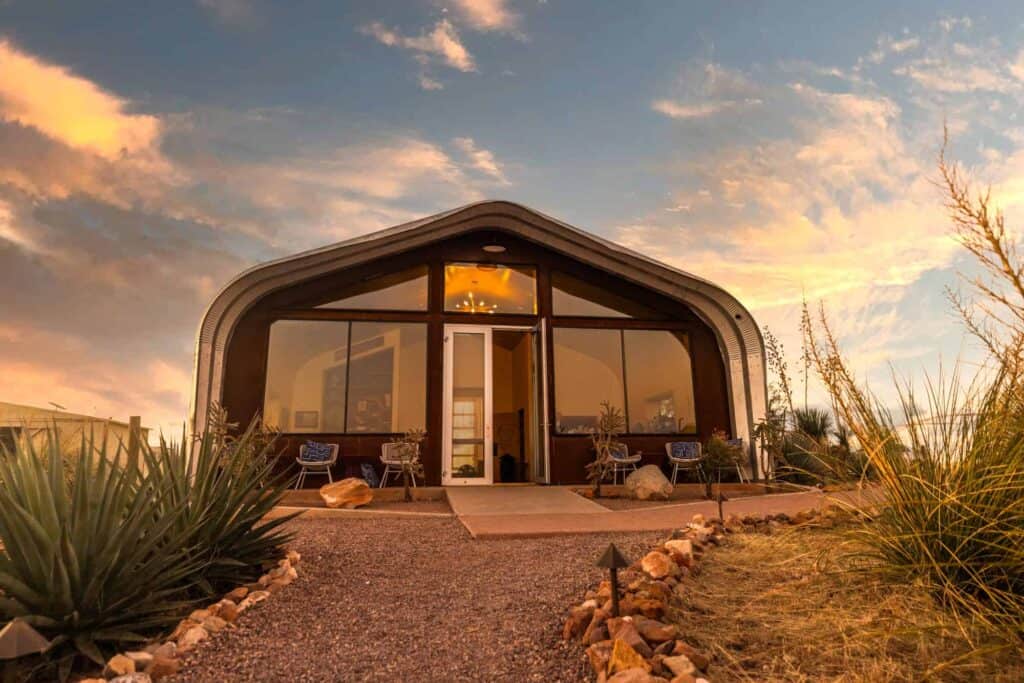
The property operates entirely on solar power and sustainable practices amidst the high-altitude rolling hills of Sonoita.
It is the perfect, quiet outpost to enjoy a glass of local Syrah while watching the sun drop below the distant mountain peaks.
Details on Rune Wine
- Location: Sonoita
- Best Time to Visit: Sunset
- Cost / Permits: Open to the public for tastings; no advance permits needed for small groups.
- Cell Service: Good.
- Gear & Vehicle: Paved, off Highway 82
Read More About Rune:
- Click for more on visiting Rune Wines.
- Click for more on visiting other wineries in the Sonoita/Elgin region.
Ready to Visit Arizona ??
Arizona rewards the people willing to leave the interstate behind. The state’s real magic isn’t in the places everyone’s already seen on Instagram.
Bring extra water, download your maps before you lose signal, and respect every tribal and wilderness boundary along the way.
Do that, and Arizona will hand you views most visitors never even know exist.